Inner City (Klagenfurt am Wörthersee)
| 1st - 4th Inner City district of Klagenfurt |
|
| surface | 68 ha |
| Geographical location | 46 ° 37 ′ N , 14 ° 18 ′ E |
| height |
445 m above sea level A. (New place) |
| Residents | 2627 (January 1, 2020) 3863 inhabitants per km² |
| Post Code | 9020, 9010, 9013 |
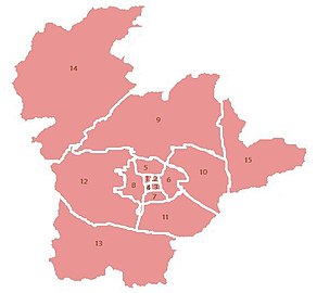
| Map of the districts of Klagenfurt | |
|---|---|
The Inner City is the historic city center of the Carinthian capital Klagenfurt am Wörthersee within the former city wall . Today it is divided into districts 1 to 4.
location
The district is the center of the city of Klagenfurt. Today it is bounded by the Ringstrasse, consisting of St. Veiter Ring, Völkermarkter Ring, Viktringer Ring and Villacher Ring. The exact border runs along the outside of the Ringstrasse (only on the Völkermarkter Ring on the inside) and also encloses the small, elongated triangle around Viktringer Ring-Viktringer Strasse-Rosentaler Strasse.
history
Until the time of Napoleon , the inner city was provided with city fortifications , which ran somewhat within the present-day ring roads. Remains of the city wall are mainly in the area of the Villacher Ring (city moat, Schiller Park). Likewise on the Völkermarkterring, the Kardinalschütt and the Geyerschütt and in the area of the Kaufmanngasse on the Viktringer Ring. There are no more remains on St. Veiter Ring. Parts of the fill in the area of Villacherstraße (Heiligengeistschütt) also formerly consisted of the excavation of the Lendhafen , which barely reaches the Villacher Ring.
City gates
St. Veiter Tor, also known as Karlstor (in the north)
On the south-east edge of the Heuplatz, where the Wiener Gasse begins, stood the old St. Veiter Gate from the founding of the city in 1240 until its expansion in the 16th century. From this gate, the defenders dared to attack the Turks on September 27, 1473 , who marched past the city with great booty. 90 people from Klagenfurt were cut off and slain in the field between the city and Glan .
The coat of arms of the Karls- or St. Veiter Gate from 1584 has been freely accessible since 2008. The detailed stone is dedicated to Archduke Charles II (1540 to 1590) of Inner Austria . It was placed over the archway, as revealed by an engraving by Valvasor .
The coats of arms carved out of the stone are those of House Austria, House Habsburg , Burgundy, Tyrol, Old Hungary, Castile , Leon , Granada , Bohemia , Aragon , Sicily , Styria, Carinthia, Görz , Cilli, Carniola , Windische Mark, Burgau, Pfirt , Swabia , Alsace , Kyburg, Austria above and Austria below the Enns .
Völkermarkter Tor (in the east)
St. Viktringer Tor (in the south)
Villacher Tor (in the west)
Administrative division
The already small inner city of Klagenfurt is subdivided into four further square districts, which is historically justified and has little administrative importance today, for example parking permits for residents of the inner city are only granted district by district.
| district | surface | Inhabitants (January 1, 2020) |
|---|---|---|
| 1. | 0.19 km² | 480 |
| 2. | 0.16 km² | 713 |
| 3. | 0.21 km² | 830 |
| 4th | 0.12 km² | 604 |
The four districts of the inner city together with the four suburbs ( St. Veiter Vorstadt , Völkermarkter Vorstadt , Viktringer Vorstadt , Villacher Vorstadt ) form the cadastral community of Klagenfurt.
population
The inner city comprises the most populous districts of Klagenfurt. Only 480 people live in the 1st district, this is 39.3%
also at the same time the district with the highest proportion of foreigners (City of Klagenfurt: 9.4%). Together, the four inner districts have a population of 2627 (as of January 1, 2020), i.e. only 2.6% of Klagenfurt residents live in the city center.
Parishes and Churches
Two Catholic parishes are responsible for the inner city: Districts I and II belong to the parish of St. Egid, districts III and IV to the cathedral parish.
- Parish of St. Egid
- City parish church St. Egid
- Capuchin Church
- Holy Spirit Church with Ursuline Convent
The parish of St. Egid also includes the southern part of the St. Veiter Vorstadt district and the northern part of the Villacher Vorstadt.
- Cathedral parish
The Viktringer Vorstadt district and the southern part of Villacher Vorstadt also belong to the cathedral parish.
More Attractions
- Alter Platz with the Old Town Hall and Trinity Column
- Neuer Platz with the New Town Hall and Lindwurmbrunnen
- Benedictine market with the stone fisherman
- Country house Klagenfurt
- Landesmuseum , Konzerthaus, Stadthaus, Stadtgalerie, Künstlerhaus, Europahaus, House of Architecture
- Museum of Modern Art (former State Gallery)
- City Theater Klagenfurt
- The coat of arms of the Karlstore on Heuplatz / Wiener Gasse
Public facilities
- State government
- Regional Court, Public Prosecutor and Prison
- City Hall and Magistrate Directorate
- Main Post Office and Telecommunication Office
- Regional Financial Directorate
- City Building Office
- KELAG
- Chamber of Agriculture
- Dorotheum
- Urban burial
schools
- Benedictine school
- Hasner School
- Ursuline high school
- Europagymnasium Klagenfurt
literature
- Reinhold Gasper: Klagenfurt history and stories - Volume 1 , Mohorjeva Hermagoras Verlag, Klagenfurt 2006; ISBN 978-3-7086-0116-8
- Reinhold Gasper: Klagenfurt History and Stories - Volume 2 , Mohorjeva Hermagoras Verlag, Klagenfurt 2006; ISBN 978-3-7086-0276-9
- Anton Kreuzer: Klagenfurt am Wörthersee , Klagenfurt 2009, Kreuzer Buch, Einigkeitsstraße No. 3, 9020 Klagenfurt


