Cologne Path
The Cologne Path is a 171 km long circular hiking trail around Cologne that was opened in 2008 and is divided into stages .
General
The course of the Cologne Path was determined in 2007, and the trail markings were completed in summer 2008. Wanderzeichen is a white circle on a black background, the symbol for circular hiking trails around places in North Rhine-Westphalia. In some places you can find the Kölnpfad logo designed by the Cologne Eifelverein (KEV), a rectangular marking in the Cologne colors of red and white with the black cathedral towers in the red field. This marking is not an official symbol of the German hiking trail network, and it is not consistently attached to the route. The hiking trail circles the city in eleven stages from 9 to 22 km in length. With two exceptions, the route runs within Cologne's city limits. In the south on the right bank of the Rhine, it leads a few kilometers across the Niederkassel area, and in the north-east on the right bank of the Rhine, a detour runs through the Bergisch Gladbach city area. Here you reach the highest point of the hiking trail at the district of Breite. From there you can see the whole of Cologne and thus the entire Cologne Path when the visibility is good. The starting and ending points of each stage can be reached by public transport.
The route was mainly worked out by Fritz Hoepfner, hiking guide of the Cologne Eifel Association. Ingrid Mölders, deputy chairwoman of the Cologne Eifelverein, played another important role in the creation of the Cologne Path. She took up the original idea of the former association chairman (1996–2002) Theodor Schinscholl (1933–2011) and implemented it. She also encouraged the Cologne dialect poet Hans Knipp to write a text for a Kölnpfad song, which was then set to music by Bömmel Lückerath (member of the Cologne music group " Bläck Fööss "). This is how the Cologne Path anthem "Eimol öm Kölle roman" was born.
intention
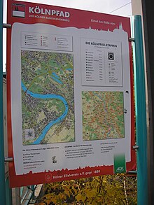
The path should not only invite you to go hiking in nature, it should also make known special cultural aspects, backgrounds of the city's history and interesting details on the edge of the city. That is why boards point out relevant institutions, facilities and sights, but also to quiet areas, playgrounds and refreshment stops along the way or in its vicinity. Eleven billboards were set up by September 27, 2008, the day of the official inauguration. Interesting aspects of the eleven stages and important information were summarized in a hiking book specially written for the Cologne Trail. As a supplement to the book, there is a hiking map on a scale of 1: 25,000 that shows the entire Cologne Trail. The start and finish points of the stages are also marked here, rest stops are listed and many other interesting waymarks are listed.
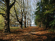
Another aspect of the Kölnpfad concept aims to give hikers an insight into as many different, publicly accessible areas of a large city as possible. It's about showing that a city is shaped by very different areas. The path was deliberately laid not only through idyllic forest areas, parks and open, open fields. The Kölnpfad follows what makes Cologne so special, in both a positive and a negative sense. Industrial facilities are opened up, large traffic routes and traffic facilities are not only crossed or crossed, but are part of the Cologne Path. So he crosses the Rhine with the Rodenkirchen motorway bridge. Motorways and railway tracks do not correspond to the usual picture of idyllic hiking romance, but they are indispensable for the functioning of a big city. The quietest places on the circular route, the nature reserves, are often in the immediate vicinity of these noisy sections of the path. Of course, the path meets the Rhine again and again, because the river has undoubtedly always been of great importance for the city.
This makes the Cologne Path a very varied and interesting hiking trail. It does not get its charm from grandiose views or spectacular panoramas, not even from loneliness and seclusion, but from the constant change from natural areas with residential areas, industrial plants, agricultural areas, commercial forests, parks, traffic routes and all the cultural, historical or even curious phenomena in the course and along the way.
A shorter circular route of around 65 km, which is limited to the Outer Green Belt on both sides of the Rhine, but which is largely identical to the route along the Cologne Path, was developed and signposted by the Cologne Green Foundation in 2014 . A free hiking map is available from the foundation against return postage.
course
The original planning of the Cologne Path envisaged a total length of 155 km. This plan could not be adhered to because, among other things, nature reserves were not allowed to be crossed, private property had to be bypassed or the planning on paper was so confusing in reality that the route had to be changed. After all necessary changes have been made and the route has been officially laid down, the Cologne Trail now has a total length of 171 km. The start and finish points of all stages are easily accessible by public transport. Each stage can be shortened because bus and train stops are always on the way or very close to it. This also opens up the possibility of entering the middle of a stage and ending the path at any point in the following stage.
The Cologne Eifelverein has made use of the opportunity to get on and off the Kölnpfad at almost any point. He offers guided hikes on 15 sections. Some sections have been broken down into subsections. For organizational, content-related and thematic reasons (e.g. short hikes for children or themed hikes), neither the length nor the start and finish points match the official stages. But they exactly follow the course of the Cologne Path. The beginning and end of these short stages can also be easily reached by public transport .
The stages
- Stage 1: from the Rodenkirchener Rheinbrücke through the Weißer Rheinbogen, from there back to the Forest Botanical Garden and through the outer green belt to Klettenberg (approx. 22 km)
- Stage 2: from Klettenberg along the Geißbockheim to the Decksteiner Weiher and through the city forest via Müngersdorf to Bocklemünd (approx. 18 km)
- Stage 3: from Bocklemünd via Pesch and Esch to Roggendorf / Thenhoven (approx. 16 km)
- Stage 4: from Roggendorf / Thenhoven through the Worringer Bruch to the Rhine, via Langel , Rheinkassel and Kasselberg to Merkenich (approx. 11 km)
- Stage 5: from Merkenich along the Fühlinger See , parallel to the Neusser Landstrasse to Longerich and via Niehl back to the Rhine. From there over the Molenkopf ( Niehler Hafen ) and the Mülheimer Bridge to Mülheim to Wiener Platz (approx. 13 km)
- Stage 6: from Mülheim along the banks of the Rhine via Stammheim to Flittard , from there through meadows and fields to thin forest (approx. 14 km)
- Stage 7: from thin forest through the forest to Thielenbruch (approx. 12 km)
- Stage 8: from Thielenbruch via Gierath, along the Saalermühle up to Breite and through the Hardt to Bensberg (approx. 18 km)
- Stage 9: from Bensberg through the Königsforst and the Wahner Heide via Grengel to Wahn (approx. 18 km)
- Stage 10: from Wahn via Libur , past Lülsdorf to the Rhine, downstream via Langel and the leisure island Groov to Zündorf (approx. 20 km)
- Stage 11: from Zündorf down the Rhine via Porz and Westhoven to the Rodenkirchener Rheinbrücke (approx. 9 km)
The cuts
- Section 1: The Cologne Path begins at the Rodenkirchener Rheinbrücke (Heinrich-Lübke-Ufer stop on line 16) in the immediate vicinity of the Cologne Fortress Museum in the Cologne Fortress Ring (on the military ring between Heinrich-Lübke-Ufer and Konrad-Adenauer-Straße), then leads to Along the Rhine to the Weißer Rheinbogen and from there in an arc back to the Siegstrasse stop on line 16. (approx. 12 km)
- Section 2: From the Siegstraße stop (line 16) to the Friedenswäldchen at the Forstbotanischer Garten (there also by bus 132) in the outer Cologne green belt past the Kalscheurer Weiher to Luxemburger Straße to the Klettenbergpark stop . (approx. 9 km)
- Section 3: From the Klettenbergpark stop (line 18) along the green belt with information on many old razed or rededicated fortifications such as the clubhouse of 1. FC Köln , around the Decksteiner Weiher with the restaurant Haus am See past Fort VI and the Adenauer - Weiher (refreshment stops) to the Rheinenergiestadion in Cologne-Müngersdorf (line 1). (approx. 9.5 km)
- Section 4: The route continues from the Line 1 stop at the Rheinenergiestadion in Müngersdorf through the Belvedere Landscape Park via the former Fort IV and the Nüssenberger Busch to Bocklemünd (Old Jewish Cemetery Bocklemünd ) (Lines 3, 4) to the Ollenhauerring stop (end of the line 3, bus 127) in Mengenich . (approx. 7.5 km) From there, a detour to the Butzweilerhof (aviation museum) is possible.
- Section 5: From the terminus of line 3 in Mengenich to the Pescher Seen to Esch (bus 126), then via the Weiler waterworks to Thenhoven . (Stop S 11, Worringen) (approx. 13.5 km)
- Section 6: From Thenhoven through the Worringer Bruch near Worringen to Cologne-Langel , Cologne-Kasselberg to the terminus of line 12 in Merkenich . (approx. 10 km)
- Section 7: From the terminus of line 12 in Merkenich through the Fühlinger Seeen area , past Cologne-Niehl , then along the Rhine on the Rhine dike to the Slabystraße stop (lines 13 and 18) in front of the Mülheimer Brücke . The industrial area with the port and the Ford works are bypassed. (approx. 12.5 km)
- Section 8: From Slabystraße over the Mülheimer Brücke to the Schäl Sick then along the Rhine via Flittard to the level of Stammheim . (Stop S 6) (approx. 8 km, an additional 1 km to the stop)
- Section 9: From Stammheim past Scheuerhof through fields and woods to the terminus of line 4 on Nittumer Weg before Schlebusch . (approx. 6 km)
- Section 10: From Schlebusch on through the Dünnwald forest , the recreation area of Dünnwald with the Dünnwald forest pool and the game reserve, and through the Thurner Forest ( Thurner Hof ) past Hardt, Mutzbach, hand to the terminus of Thielenbruch station on lines 3 and 18 with the Thielenbruch Tram Museum . (approx. 10.5 km)
- Section 11: The next section leads from there to the Saaler Mühle and on the edge of Kippekausen ( Bergisch Gladbach ) to the Bensberger See (near line 1). (approx. 4.5 km, an additional 1 km to the bus stop)
- Section 12: From Lake Bensberger See it goes south of Bergisch Gladbach through forest and meadows past Lerbach Castle up to the height in front of Herkenrath , then through the forest to the Milchborntal and to Bensberg Castle . (Final stop of line 1) (approx. 11.5 km)
- Section 13: From Bensberg it goes on the Wolfsweg through the Königsforst with Cologne's highest mountain, the 118 m high Monte Troodelöh to the terminus of line 9 (approx. 8 km, additional approx. 2 km to the Königsforst stop)
- Section 14: From the Heumarer Mauspfad it goes over the Giesbach into the Wahner Heide to the Mauspfad in Grengel to Wahn (approx. 9.5 km, additionally approx. 2 km from the Königsforst stop).
- Section 15: From Wahn it goes via Cologne-Libur to the Rhine near Lülsdorf (approx. 11 km) (bus 501/164 to the last stop for line 7).
- Section 16: From Lülsdorf past Schneppenhof and Fronhof to Zündorf (approx. 8 km). From Porzer Groov you can take the ferry to Weiß in summer or continue at 17:
- Section 17: From Zündorf along the Rhine, past Porz and Ensen to the Poller Wiesen and Rodenkirchener Bridge, close the circle (approx. 8 km).
history
The circular route was an idea of the long-time chairman of the Cologne Eifelverein eV, founded in 1888 , Theodor Schinscholl. Considerations for such a circular hiking trail arose before the year 2000. Route explorations were carried out, agreements were made with the local groups of the Eifelverein responsible for Cologne on the left bank of the Rhine and finally a project application was submitted to the responsible authority. Approval took place on February 1, 2006. The association and its active members were then given responsibility for setting up and maintaining the entire stretch (including the one on the left bank of the Rhine). The former Lord Mayor Fritz Schramma took over the patronage of the project, which he continues to exercise. After approval by the district government , the marking and the exact route definition could begin on April 1, 2006. The official opening took place with the club's anniversary on September 27, 2008 in Cologne-Thielenbruch.
Course sponsors and sponsors
The paths are maintained by voluntary members and hiking guides of the association. Since the association continues to look after its routes in and in the Eifel, sponsors were sought, especially for the left-bank part of the circular route, who wanted to support the association and take care of a stage.
A prominent godfather, the hiking book author and editor Manuel Andrack , who lived in Cologne until 2008, took over the sponsorship of the 16 km long 3rd stage from Bocklemünd to Roggendorf / Thenhoven, which he and his family did with brush and paint in spring 2007 and has marked stickers. He will continue to look after his stage even after he has moved.
In addition, the KÖLNPFAD is equipped with elaborate, vandalism- resistant information boards. Above all, they are intended to draw attention to interesting features along the way, but also to ensure that the bus and train stops near the Cologne Trail can be found safely - and vice versa. Each hiking board costs around € 2000. The Cologne Eifelverein provided this financial means with the support of sponsors .
Guided walks
The Cologne Eifelverein offers guided hikes along the entire Cologne Trail. The often very long stages were divided into sections, on the one hand to appeal to the largest possible group of interested parties, on the other hand to have the opportunity to offer themed, morning or short hikes for children and inexperienced people. All guided part-section hikes are published on the association's website.
promotion
Bömmel Lückerath von den Bläck Fööss wrote the music for the song by Hans Knipp , Eimol öm Kölle roman . He recorded the piece together with Hartmut Priess, Peter Schütten and Andreas Wegener from the Bläck Föös and the children's choir from the Großer Greeksmarkt secondary school. It was included on CD in the earlier editions of the book on Kölnpfad. Thus, the Cologne Path is a piece of Cologne's cultural asset.
Ultra marathon
On August 15, 2009, the first ultramarathon of the German Ultramarathon Association was held on the Kölnpfad . 17 extreme athletes, including 4 women, started on the 171 km long route. The winner completed the run in 18 hours and 33 minutes.
literature
- Steffi Machnik: Kölnpfad - Der Kölner Rundwanderweg , with a contribution by Manuel Andrack 11 hikes between 9 and 22 kilometers, 240 pages: Kölnpfadlied, 220 colored images and 12 maps, Cologne, JP Bachem Verlag , 22/09/2008, ISBN 978- 3-7616-2190-5 , € 12.95
- Hiking map: Kölnpfad - The Cologne circular hiking trail , scale 1: 25,000, 22/09/2008 ISBN 978-3-7616-2280-3 , € 6.95
Web links
- http://www.koelner-eifelverein.de with current information on the KÖLNPFAD and hiking offers
- Hiking recommendations for children / families (short stages) from the SK-Stiftung Kultur http://www.koelsch-ags.de/de/1.html
- GPS tracks of the individual sections: 1st section - 2nd section - 3rd section - 4th section - 5th section - 6th section - 7th section - 8th section - 9th section - 10th section - 11th section - 12 section - 13 section - 14 section - 15 section - 16 section - 17 section
- further GPS tracks from parts of the Cologne Path: 7th stage / 10th Section - stages 7 to 9 partially 10
Coordinates: 50 ° 54 ′ 1.2 " N , 6 ° 59 ′ 4.8" E


