Canton of Saint-Agrève
| Former canton of Saint-Agrève |
|
|---|---|
| region | Rhône-Alpes |
| Department | Ardèche |
| Arrondissement | Tournon-sur-Rhône |
| main place | Saint-Agrève |
| Dissolution date | March 29, 2015 |
| Residents | 3,930 (Jan 1, 2012) |
| Population density | 23 inhabitants / km² |
| surface | 173.52 km² |
| Communities | 7th |
| INSEE code | 0715 |
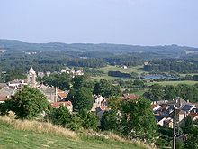
The District of Saint-Agrève was 2015 a French canton in the Arrondissement Tournon-sur-Rhone , in the department of Ardèche and the region Rhône-Alpes ; its main town (French: chef-lieu ) was Saint-Agrève . The nationwide changes in the composition of the cantons resulted in its dissolution in March 2015.
The canton of Saint-Agrève was 17,352 hectares (173.52 km²) and last (2012) had 3930 inhabitants, which corresponded to a population density of 23 inhabitants per km². It was on average at 980 m , between 473 m in Labatie-d'Andaure and 1112 m in Devesset .
Communities
The canton consisted of seven municipalities:
| local community | Population (as of 2017) |
Code postal | Code Insee |
|---|---|---|---|
| Devesset | 295 | 07320 | 07080 |
| Labatie-d'Andaure | 206 | 07570 | 07114 |
| Mars | 264 | 07320 | 07151 |
| Rochepaule | 259 | 07320 | 07192 |
| Saint-Agrève | 2353 | 07320 | 07204 |
| Saint-André-en-Vivarais | 213 | 07690 | 07212 |
| Saint-Jeure-d'Andaure | 102 | 07320 | 07249 |
Coordinates: 45 ° 1 ' N , 4 ° 24' E

