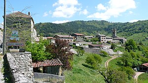
Labatie-d'Andaure
| Labatie-d'Andaure | ||
|---|---|---|
|
|
||
| region | Auvergne-Rhône-Alpes | |
| Department | Ardèche | |
| Arrondissement | Tournon-sur-Rhône | |
| Canton | Skin vivarais | |
| Community association | Pays de Lamastre | |
| Coordinates | 45 ° 2 ′ N , 4 ° 30 ′ E | |
| height | 473-1,003 m | |
| surface | 9.93 km 2 | |
| Residents | 206 (January 1, 2017) | |
| Population density | 21 inhabitants / km 2 | |
| Post Code | 07570 | |
| INSEE code | 07114 | |
 Labatie-d'Andaure |
||
Labatie-d'Andaure a village in the eastern foothills of the Massif Central and a French commune in Ardèche, in the region of Auvergne Rhône-Alpes . It is bordered by Saint-Jeure-d'Andaure to the northwest , Lafarre (point of contact) to the north, Nozières to the northeast and east and Désaignes to the south and southwest .

There are hall crosses at various locations in Labatie-d'Andaure .
Population development
| year | 1962 | 1968 | 1975 | 1982 | 1990 | 1999 | 2008 | 2014 |
|---|---|---|---|---|---|---|---|---|
| Residents | 614 | 382 | 307 | 256 | 203 | 204 | 197 | 217 |
Web links
Commons : Labatie-d'Andaure - collection of images, videos and audio files
