Knörschhügel
| Knörschhügel | ||
|---|---|---|
|
View from Wirtschaftsweg Schleichweg ( R9 ) northeast of Kolmbach west southwest to Knörschhügel: Krehberg (left), with Knörschhügel Götzischberg (center left) and Knodener head (center right); in the center of the picture Kolmbach ; to the right below the Knörschhügel you can see the village of Breitenwiesen |
||
| height | 536 m above sea level NHN | |
| location | at knots ; Bergstrasse District , Hesse ( Germany ) | |
| Mountains | Odenwald | |
| Dominance | 0.94 km → Krehberg | |
| Notch height | 47 m ↓ Kreisstraße 55 between Götzischberg and Schannenbach | |
| Coordinates | 49 ° 41 '42 " N , 8 ° 43' 26" E | |
| Topo map | LAGIS Hessen | |
|
|
||
| particularities | formerly with Ernst-Ludwig-Turm ( AT ) | |
The Knörschhügel between Schannenbach and Breitenwiesen in the Bergstrasse district in southern Hesse is 536 m above sea level. NHN high and densely forested mountain in the Odenwald . From 1886 to 1922 the 20 m high observation tower Ernst Ludwig Tower stood on the summit .
geography
location
The Knörschhügel is located in the Vorderen Odenwald and forms part of the ridge that connects the Krehberg in the south with the Neunkircher Höhe in the east. It is located in the western part of the Bergstrasse-Odenwald Nature Park in the Knoden district of the Lautertal community . Its summit is 2.9 km (as the crow flies ) southeast of Reichenbach in the Lauter valley , the core town of the Lautertal municipality, between the Lautertal villages of Breitenwiesen in the northeast, Schannenbach in the south and Knoden in the west and the Lindenfels district of Glattbach in the east.
The Vorbach rises north-northeast of the Knörschhügel and the Reichenbach rises to the west-northwest ; both are small tributaries of the Lauter . The source of the Seidenbucher Bach, a tributary of the Schlierbach , lies on the eastern flank , and the river at the Rehklingen , a tributary of the Meerbach, rises on the western slope .
There are rocky cliffs on the north flank of the mountain and a cemetery on its south side.
Natural allocation
The Knörschhügel belongs to the natural spatial main unit group Odenwald, Spessart and Südrhön (No. 14), in the main unit Vorderer Odenwald (145) to the subunit Krehberg-Odenwald (145.5).
Ernst Ludwig Tower

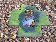
On the summit of the Knörschhügel there are historical remains of the foundations, which were embedded in the ground in 1886 for the construction of the Ernst Ludwig Tower , including a granite stone labeled Granit u. Syenitwerke Bensheim . The 20 m high iron observation tower , which was built by a factory in Dresden on the initiative of the Bensheim Odenwald Club , was inaugurated on August 26, 1886 and was climbed by 5,500 people within a year. In 1922, however, it was dismantled and scrapped due to a lack of funds to cover the maintenance costs.
Traffic and walking
Coming from the north-east in the Lautertal valley from Gadernheim on the county road 55 ( Krehbergstraße ) past Breitenwiesen to Knoden , where the road curves in an arc around the Knörschhügel to the east and continues as Knodener Straße to Seidenbuch . At the cemetery (southern flank) of the mountain, Krehbergstraße branches off as K 56 in a southerly direction to Schannenbach .
The Knoden hikers' car park is located about 500 m west of the Knörsch hill in the village of Knoden . Three main hiking trails run by the Odenwald Club and a cycle path lead past the mountain to the west :
- of the 130 km long predicate Trail HW 72 Nibelungensteig of Zwingenberg on the mountain road up to Freudenberg am Main,
- the 84 km long HW 13 from Ober-Ramstadt to Wiesenbach ,
- the 62 km long HW 20 from Bensheim to Miltenberg and
- the 70 km long Hessian long- distance cycle route R9 from Worms to Obernburg am Main .
Web links
References and comments
- ↑ a b Photo of an orientation table on the Kaiserturm (Lautertal) with an altitude of 536 m for the Knörschhügel, the former location of the Knoden Tower (Ernst-Ludwig-Turm), on commons.wikimedia.org
- ↑ Hessian Land Surveying Office / geodata online: topographic map TK25 Lindenfels, ID 6318 , M = 1: 25,000
- ↑ Otto Klausing: Geographical land survey: The natural space units on sheet 151 Darmstadt. Federal Institute for Regional Studies, Bad Godesberg 1967. → Online map (PDF; 4.3 MB)
- ↑ Hessian land survey office / geodata online / real estate cadastre / cadastral issues / parcel records: district Knoden (Lautertal (Odenwald)) No. 3013, corridor 3, parcel 72/1
- ↑ Knoden's experience with towers ( memento of November 2, 2014 in the Internet Archive ), on archive.org, published on September 25, 2014 in fact - The local magazine , from fact-in-deutschland.de
- ↑ Hessian Land Surveying Office: Topographische Freizeitkarte Nördlicher Odenwald West , M = 1: 50,000, 2009


