Knooppunt Zurich
| Knooppunt Zurich | |
|---|---|
|
|
|
| map | |
| location | |
| Country: | Netherlands |
| Provinces : | Friesland Province |
| Coordinates: | 53 ° 5 '49 " N , 5 ° 22' 56" E |
| Height: | 0 m above sea level NN |
| Basic data | |
| Design type: | Triangle , half Maltese cross |
| Bridges: | 3 (motorway) / 2 (other) |
| Construction year: | 1976 |
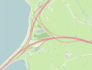
The Knooppunt Zurich is a highway junction in the Dutch province of Friesland south of the town Zurich at the eastern end of the Afsluitdijk . It connects Rijksweg 7 (A7: Zaandam - Den Oever - Heerenveen - Groningen ) with Rijksweg 31 (N31: Zurich - Leeuwarden - Drachten ).
The node is named after the 170-inhabitant village of Zurich , about 8 kilometers south of Harlingen , which is 1.4 kilometers north of the triangle.
history
On September 25, 1933, a road was opened in the area of today's A7 on the final dike and in the area of today's junction as far as Zurich. In February 1938, the single-lane section to the east of today's triangle was released to Harkezijl . In mid-1975 the road was expanded to two lanes in each direction and was given its current name. On December 3, 1975, the N31 between the Knooppunt Zurich and Zurich and thus the triangle was opened to traffic. Although the node was already fully operational at the time, it was not officially opened as Knooppunt Kop Afsluitdijk until 1976 .
By the end of 2005, the N31 section between Zurich and Harlingen had been expanded to four lanes.
Design
The motorway triangle is mainly built in the so-called triangular shape , which is also known as the half Maltese cross. In contrast to most of the motorway triangles of this type, the triangle is very spacious, which is evident from the fact that the eastern connecting ramps from Sneek to Harlingen and vice versa are almost 2 kilometers long. The connection ramp from Den Helder towards Harlingen is two-lane, the connection from Harlingen towards Den Helder is two-lane until just before the junction with the A7, but then becomes a single-lane. The other connecting ramps are all single-track.
In the triangle there is also the Zurich exit, in and from both directions of the A7 and from and to the north of the N31. The service area with gas station and the bus stop in the junction can be reached via the exits.
The A7 and the N31 are each expanded to four lanes in the area of the motorway triangle. Immediately to the west of the triangle is the North Sea , but it is not visible from the roads in the node because it is covered by the high coastal dikes . The final dike begins at the western end of the triangle .

