La Unión (Nariño)
| La Unión | ||
|---|---|---|
|
Coordinates: 1 ° 36 ′ N , 77 ° 8 ′ W La Unión on the map of Colombia
|
||
|
Location of the municipality of La Unión on the map of Nariño
|
||
| Basic data | ||
| Country | Colombia | |
| Department | Nariño | |
| City foundation | 1847 | |
| Residents | 25,270 (2019) | |
| City insignia | ||
| Detailed data | ||
| surface | 43 km 2 | |
| Population density | 588 inhabitants / km 2 | |
| height | 1650 m | |
| Time zone | UTC -5 | |
| City Presidency | Floriberto Suárez (2016-2019) | |
| Website | ||
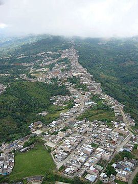
| La Unión from above | ||
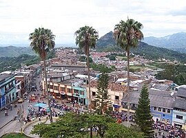
| Parque Cuevas Leyva | ||
La Unión is a municipality ( municipio ) in the department of Nariño in Colombia .
geography
La Unión is located in the northeast of Nariño in the province of Juanambú at an altitude of 1650 m above sea level. NN , 90 km from Pasto . The municipality borders in the north on Mercaderes in the Departamento del Cauca , in the south on San Pedro de Cartago , in the east on Belén , Colón and San Pablo and in the west on San Lorenzo .
population
The municipality of La Unión has 25,270 inhabitants, of which 10,864 live in the urban part (cabecera municipal) of the municipality (as of 2019).
economy
The main industry in La Unión is the cultivation and distribution of coffee . There is also cattle production and fruit and citrus crops are grown.
Personalities
- Aurelio Arturo (1906–1974), poet
Web links
Commons : La Unión - collection of images, videos and audio files
- Página Oficial del Municipio de La Unión. Alcaldía del Municipio de La Unión - Nariño, accessed on April 3, 2019 (Spanish, website of the municipality).
Individual evidence
- ↑ a b Nuestro municipio. Alcaldía del Municipio de La Unión - Nariño, accessed on April 3, 2019 (Spanish, information on the municipality).
- ↑ ESTIMACIONES DE POBLACIÓN 1985 - 2005 Y PROYECCIONES DE POBLACIÓN 2005 - 2020 TOTAL DEPARTAMENTAL POR ÁREA. (Excel; 1.72 MB) DANE, May 11, 2011, accessed on April 3, 2019 (Spanish, extrapolation of the population of Colombia).


