
Hohenstein-Ernstthal district
| Basic data (as of 1994) | |
|---|---|
| Existing period: | 1990-1994 |
| State : | Saxony |
| Administrative region : | Chemnitz |
| Administrative headquarters : | Hohenstein-Ernstthal |
| Residents: | ? (1994) |
| License plate : | HOT |
| Circle key : | 14 0 33 |
| Circle structure: | 17 municipalities |
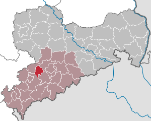
| Location of the district of Hohenstein-Ernstthal in Saxony | |
  |
|
The district of Hohenstein-Ernstthal was a district in the Free State of Saxony . His area is now in the Zwickau district in Saxony. The seat of the district administration was in Hohenstein-Ernstthal .
geography
location
The district of Hohenstein-Ernstthal was between Chemnitz and Zwickau .
Neighboring areas
The district of Hohenstein-Ernstthal bordered in a clockwise direction in the northwest on the districts of Glauchau , Chemnitz , Stollberg , Zwickauer Land , Werdau and Schmölln .
history
On May 17, 1990, the district was renamed the Hohenstein-Ernstthal district.
Until its dissolution in August 1994, the district experienced only a few changes in the municipality:
- January 1, 1994 Falken, Langenberg and Langenchursdorf merge to form Chursbachtal
- January 1, 1994 incorporation of Hermsdorf into Bernsdorf
- January 1st, 1994 incorporation of Rödlitz into the city of Lichtenstein
- March 1, 1994 Reichenbach incorporated into Callenberg
During the first Saxon district reform the county Hohenstein-Ernstthal was on August 1, 1994 with the district Glauchau and parts of the district Chemnitz to district Chemnitzer Land pooled.
traffic
The district was connected to the motorway network via the BAB 4 . The national road traffic also served the B 173 from Zwickau via Hohenstein-Ernstthal to Chemnitz and the B 180 from Altenburg via Hohenstein-Ernstthal to Stollberg .
The district area was opened up by the Zwickau – Hohenstein-Ernstthal – Dresden , St. Egidien – Stollberg and Wüstenbrand – Neuoelsnitz railway lines, and the Hohenstein-Ernstthal – Oelsnitz tram ran through the district until 1960 .
Population data
Population overview of all 17 municipalities in the district that came to Saxony in 1990.
| AGS | local community | Residents | Area (ha) | |
| 10/03/1990 | December 31, 1990 | |||
| 14033010 | Bernsdorf | 1,660 | 1,656 | 1,121 |
| 14033020 | Callenberg | 1,886 | 1,888 | 1,092 |
| 14033030 | Hawks | 669 | 660 | 430 |
| 14033040 | Gersdorf | 4,742 | 4,736 | 970 |
| 14033060 | Heinrichsort | 1,180 | 1,183 | 72 |
| 14033070 | Hermsdorf | 814 | 809 | 386 |
| 14033080 | Hohenstein-Ernstthal, city | 16,263 | 16,210 | 814 |
| 14033090 | Cow snappers | 532 | 523 | 1,143 |
| 14033100 | Langenberg | 924 | 919 | 833 |
| 14033110 | Langenchursdorf | 1,371 | 1,363 | 1,290 |
| 14033120 | Lichtenstein / Sa., City | 12,166 | 12,165 | 1,067 |
| 14033130 | Lobsdorf | 338 | 336 | 368 |
| 14033150 | Oberlungwitz, city | 7,882 | 7,800 | 1,501 |
| 14033160 | Reichenbach | 651 | 654 | 334 |
| 14033170 | Rödlitz | 1,811 | 1,815 | 403 |
| 14033180 | St. Egidien | 2,693 | 2,683 | 1,159 |
| 14033190 | Desert fire | 2,385 | 2,380 | 447 |
| 14033 | Hohenstein-Ernstthal district | 57,967 | 57,780 | 13,429 |
License Plate
On January 1, 1991, the district received the distinctive sign HOT . It was valid until July 31, 1994 and has been issued again in the Zwickau district since November 9, 2012 due to the license plate liberalization .