Cow snappers
|
Cow snappers
St. Egidien parish
Coordinates: 50 ° 48 ′ 26 " N , 12 ° 38 ′ 41" E
|
||
|---|---|---|
| Height : | 325 m | |
| Area : | 6.23 km² | |
| Incorporation : | April 1, 1996 | |
| Postal code : | 09356 | |
| Area code : | 03723 | |
|
Location of Kuhschnappel in Saxony |
||
Kuhschnappel is a district of the municipality of St. Egidien in the district of Zwickau in Saxony . The municipality of Kuhschnappel with its district of Tirschheim was incorporated into St. Egidien on April 1, 1996.
geography
Geographical location and traffic
Kuhschnappel is located in the Erzgebirge foothills of the Zwickau district . The Kuhschnappelbach flowing through the village drains over the Lungwitzbach into the Zwickauer Mulde . Can be reached via the Kuhschnappel Motorway Hohenstein-Ernstthal of A 4 and on the motorway Hartenstein of A 72 from the direction of Lichtenstein . The place can also be reached via the B 180 and S 255 .
Neighboring places
| Lobsdorf | Tirschheim | |

|
Hohenstein | |
| St. Egidien | Rüsdorf | Hermsdorf |
history
The forest hoof village Kuhschnappel was mentioned in 1460 as "Consnapel (e)". The place name goes back to the Sorbian "Kóńc na pólje" and means "The end of the field". In contrast to Tirschheim , which is directly to the north , Kuhschnappel was not parish and trained to Grumbach , but to Lobsdorf.
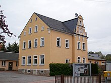
With regard to the manorial rule , the district village Kuhschnappel belonged to the Rüsdorf court , which was initially part of the Schönburg rule of Waldenburg , then to the Schönburg rule of Lichtenstein from 1702 to the Schönburg rule of Stein and from 1813 after the separation of the Rüsdorf court back to the Lichtenstein rule. After an administrative reform was carried out in the area of the Schönburg recession in 1878, Kuhschnappel came to the newly founded Saxon governorate of Glauchau in 1880 . The first school in Kuhschnappel was opened in 1845. Since 1889, the now existing municipal office has been used as a school. It initially had one room, and since 1928 a second room.
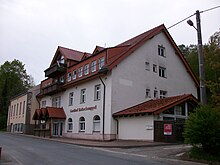
In 1913, the Saxon King Friedrich August III visited. the village of Kuhschnappel. In 1915 the town of Hohenstein-Ernstthal acquired the part of the Hüttengrund that had previously belonged to Kuhschnappel. ⊙ This parcel also the restaurant "Heiterer views" came ⊙ and in 1891 opened "Bethlehemstift" ⊙ at today's B180 and 1829/30 opened mineral bath with the 1765 discovered Hohenstein source (roads "in the district" and "Am Sachsenring") ⊙ to the city of Hohenstein-Ernstthal. Since then, today's B180, i.e. H. the old route of the Sachsenring , opened in 1927 , the eastern boundary of Kuhschnappel. The Waldenburger Oberwald manor district was assigned to the Kuhschnappel community around 1922. The village pond of Kuhschnappel has been used as a community pool since 1938. It continued to serve as a water supply point for the fire brigade.
On July 1, 1950, Tirschheim was incorporated , which seamlessly connects to Kuhschnappel in the north. In the same year, a cemetery and chapel were built in the village. As a result of the second district reform in the GDR , the municipality of Kuhschnappel with Tirschheim became part of Hohenstein-Ernstthal in the Chemnitz district in 1952 (renamed the Karl-Marx-Stadt district in 1953 ). After 1945 the two-class elementary school was converted into a four-class elementary school. From 1959 all 7th and 8th grade students were taught in St. Egidien. After the closure of the Kuhschnappel school, all pupils were taught in the polytechnic high school in St. Egidien from 1970 . Between 1959/60 and 1990 the industrial railway of the St. Egidien nickel smelter was in operation, which connected the St. Egidien nickel smelter with the nickel opencast mines in the Callenberg area. Its route, which can still be recognized today, ran west of Kuhschnappel in several arcs.
From 1990 the municipality of Kuhschnappel belonged to the Saxon district of Hohenstein-Ernstthal , which was added to the district of Chemnitzer Land in 1994 and in 2008 to the Zwickau district. As early as 1991, the municipality of Kuhschnappel offered voluntary incorporation as part of a fundamental decision by the city of Hohenstein-Ernstthal in order to be able to develop common industrial areas. However, this was not taken into account by the city of Hohenstein-Ernstthal. As part of the Saxon municipal reform in 1994, Kuhschnappel favored incorporation into Lichtenstein , which, however , was not approved by the Saxon State Ministry of the Interior due to the lack of municipal boundaries . So the only decision left for the municipality was to be incorporated into St. Egidien or Bernsdorf , since both places are also part of the administrative community around the Auersberg and have common district boundaries with Kuhschnappel. On April 1, 1996, Kuhschnappel and its district of Tirschheim were incorporated into St. Egidien.
politics
mayor
- Emil Türschmann
- Walter Lahl
- Erich Leistner
- Moritz Sunday
- Kurt Kornig
- Walter Krebaum
- Herta Roenitz
- Gerhard Geipel
- Erwin Boseniak
- Marianne Schmidt
- Bernd Mehlhorn
- Irmhild Klein
In the course of an administrative reform in 1994, Kuhschnappel lost its political independence and has had a mayor since then .
Mayor
- Ingrid Bock
- André Bock
Attractions
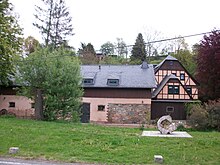
- Kunze mill (first mentioned in 1707)
- Christmas house Kuhschnappel
Trivia
The novel Siebenkäs by the writer Jean Paul (1763-1825) is set to a large extent in the fictional Reichsmarktflecken Kuhschnappel.
Web links
- Kuhschnappel in the Digital Historical Directory of Saxony
- Homepage of the place
Individual evidence
- ^ Statement by the Leipzig name researcher Gabriele Rodriguez in the DRadio Wissen editorial conference on May 19, 2014; available at: http://dradiowissen.de/beitrag/namenforschung-was-hinter-vor-und-nachnamen-steckt ( page no longer available , search in web archives ) Info: The link was automatically marked as defective. Please check the link according to the instructions and then remove this notice. (49th minute)
- ^ The Rüsdorf manor at www.sachsens-schlösser.de
- ↑ Handbook of Geography, p. 527
- ↑ Handbook of Geography, pp. 511f.
- ↑ Kuhschnappel in the book "Geography for all Stands", p. 901
- ^ Karlheinz Blaschke , Uwe Ulrich Jäschke : Kursächsischer Ämteratlas. Leipzig 2009, ISBN 978-3-937386-14-0 ; P. 92 f.
- ↑ Handbook of Geography, p. 527
- ↑ The Glauchau administrative authority in the municipal register 1900
- ↑ Historical table sheet from 1909
- ↑ File on the incorporation of the Oberwald manor district into Kuhschnappel in the State Archives of the Free State of Saxony
- ↑ Tirscheim on hov.genealogy.net
- ↑ Kuhschnappel on gov.genealogy.net
- ^ StBA: Changes in the municipalities in Germany, see 1996


