
Hohenstein-Ernstthal
| coat of arms | Germany map | |
|---|---|---|

|
Coordinates: 50 ° 48 ' N , 12 ° 43' E |
|
| Basic data | ||
| State : | Saxony | |
| County : | Zwickau | |
| Height : | 355 m above sea level NHN | |
| Area : | 18.58 km 2 | |
| Residents: | 14,527 (Dec. 31, 2019) | |
| Population density : | 782 inhabitants per km 2 | |
| Postal code : | 09337 | |
| Area code : | 03723 | |
| License plate : | Z, GC, HOT, WDA | |
| Community key : | 14 5 24 120 | |
| LOCODE : | HOI | |
City administration address : |
Altmarkt 41 09337 Hohenstein-Ernstthal |
|
| Website : | ||
| Lord Mayor : | Lars Kluge ( CDU ) | |
| Location of the city of Hohenstein-Ernstthal in the district of Zwickau | ||
  |
||


The large district town of Hohenstein-Ernstthal is in the east of the district of Zwickau . The city is particularly known as the birthplace of the writer Karl May and for the Sachsenring , where the German motorcycle world championship is held.
geography
Geographical location
The former district town of Glauchau is approx. 15 km west and the city of Chemnitz approx. 20 km east of the city. Hohenstein-Ernstthal lies on the transition from the northern edge of the Ore Mountains Basin and the southern edge of the central Saxon loess loam hill country , which reaches here in the heights of the Pfaffenberg ( 479 m above sea level ). Since a large part of the city center is on the south side of the Pfaffenberg, you can see large parts of the Ore Mountains from here . To the north of the city are the Oberwald reservoir and the Oberwald serpentinite quarry . They belong to the “Pfaffenberg – Oberwald” nature reserve. The Goldbach rises in the Ernstthal district and drains over the Lungwitzbach into the Zwickauer Mulde . The highest point of desert fire is Heidelberg ( 450 m above sea level ) with its observation tower.
City structure
Hohenstein-Ernstthal is divided into the districts of Hohenstein , Ernstthal , Wüstenbrand and Waldenburger Oberwald . Wüstenbrand has the status of a district .
history
Under the Schönburg counts Ernst I (1480–89) and Ernst II († 1534) both urbanism and mining were promoted; the mining towns of Hohenstein , Scheibenberg and Oberwiesenthal are their founding. Hohenstein was created after silver ore was discovered here in the 15th century . According to legend, the first settlers should have shouted "uff dem hoch Stein" when they saw what is now Pfaffenberg for the first time. Hohenstein was founded in 1510. Hohenstein belonged to the Schönburg rule of Glauchau. In the 16th century, the residents of Hohenstein were exempt from forced labor. In 1616 there was no court of its own in Hohenstein, the Glauchau office apparently allows court to be held here if necessary or court days.
In 1679, some Hohensteiners settled in the nearby forest because the plague was rampant in Hohenstein . The new settlement was named Ernstthal in honor of Christian Ernst von Schönburg (1655–1718) and August Ernst von Schönburg (1666–1729) . In 1687 Ernstthal received city rights.
The two cities of Hohenstein and Ernstthal belonged largely to the Schönburg rule of Glauchau , from which they were territorially separated. Hohenstein belonged to the office of Fordglauchau , Ernstthal to the office of Hinterglauchau . Only seven houses from Hohenstein and one house from Ernstthal belonged to the Schönburg lordship of Waldenburg .
After linen weaving and bleaching, and later also stocking knitting, spread in Hohenstein and the surrounding area in the first half of the 16th century, from the 17th century onwards it was not mining that dominated, but weaving. The textile industry as in many places of the region's most important source of income.
The famous writer Karl May was born in Ernstthal on February 25, 1842 . In 1880 he married his wife Emma Pollmer in the Hohenstein Church of St. Christophori. Numerous memorial plaques and the Karl May House in the house where he was born remind of Karl May's work in Hohenstein and Ernstthal .
With the opening of the Chemnitz - Zwickau section of the Dresden – Werdau railway line, Hohenstein-Ernstthal station was opened to traffic on November 15, 1858 . Initially, however, the station belonged neither to Hohenstein nor to Ernstthal, but to Oberlungwitz Abbey . The station property was later bought by the city of Hohenstein.
After an administrative reform was carried out in the area of the Schönburg recession in 1878, Hohenstein and Ernstthal came to the newly founded Saxon authorities in Glauchau in 1880 .
At the beginning of 1898 the two cities merged to form today's Hohenstein-Ernstthal. The Hohenstein town hall now became the administrative building of the new city, which also received a new city coat of arms.
After in 1910 in the “St. Lampertus ”was the last shift, the mining era in Hohenstein ended. Except for the Huthaus built in 1846, all buildings were demolished. The hut has been used as a club house since 1998 by the "Freundeskreis Geologie und Bergbau Hohenstein-Ernstthal eV", founded in 1996.
In 1911, the Erzgebirgsverein built the mountain inn on the Pfaffenberg . The first mountain festival also took place this year.
In 1913 the Hohenstein-Ernstthal-Oelsnitz tram , which was operated until 1960, opened , which began at Hohenstein-Ernstthal station and then ran along Goldbachstrasse. The Hohenstein-Ernstthal , Hohenstein-Ernstthal freight station , August-Bebel-Strasse (until 1945: Schönburgstrasse ) and depot station were located in the Hohenstein corridor .
In an area exchange between Oberlungwitz and Hohenstein-Ernstthal, the city of Hohenstein-Ernstthal received the Windberg (northeast of Ernstthal) and Neuoberlungwitz (south of Ernstthal, corridor of today's new development area Sonnenstraße) as well as the part of the Hüttengrund with the Klaus that previously belonged to Oberlungwitz -Mühle and the Hüttenmühle (west of Hohenstein), which was demolished in 2012. Through a further exchange of territory with the municipality of Kuhschnappel in 1915, the part of the Hüttengrund that had previously belonged to Kuhschnappel came to Hohenstein-Ernstthal. With this plot of land, the restaurant "Heiterer Blick", the "Bethlehemstift" opened in 1891 at today's B 180 and the Hohenstein mineral bath opened in 1829/30 with the Hohensteiner Quelle discovered in 1765 came to the city of Hohenstein-Ernstthal.
In 1927, the Badberg Viereckrennen was held for the first time on the old route of the Sachsenring race track . The 8.71 km long road course ran counterclockwise through Hohenstein-Ernstthal to the north, and then in a westerly direction parallel to today's A4 Chemnitz - Gera . On today's federal highway 180 , it went south, then merged into the home straight in the Queckenberg curve. The autobahn north of Hohenstein-Ernstthal, now known as the A4, was built in 1937.
During the Second World War from December 10, 1944 to mid-April 1945, a satellite camp of the Flossenbürg concentration camp was set up in the village , in which 444 concentration camp prisoners had to do forced labor in the local armaments industry and in neighboring Siegmar-Schönau . There were also prisoners of war and forced laborers from the countries occupied by Germany.
With the second district reform in the GDR in 1952, Hohenstein-Ernstthal became the district town of the Hohenstein-Ernstthal district in the Chemnitz district (renamed the Karl-Marx-Stadt district in 1953 ), which was continued as the Saxon Hohenstein-Ernstthal district in 1990 .
In the years after the fall of the Wall , the city had to struggle with high levels of emigration due to structural change . In recent years the city has benefited from major developments in the automotive and mechanical engineering industries. This has improved the economic situation. Due to the loss of the district seat in 1994, the city of Hohenstein-Ernstthal was awarded the title of Large District Town . She came to the Chemnitzer Land district in 1994 , which was added to the Zwickau district in 2008. In 1995 the new Sachsenring circuit was put into operation.
On January 1, 1999, Wüstenbrand and parts of Oberlungwitz (with 92 inhabitants) and St. Egidien (with 47 inhabitants from Kuhschnappel ( Waldenburger Oberwald )) were incorporated. In the week of June 4 to 12, 2005, the Ernstthal district celebrated its 325th anniversary. The highlight of the festival week was an 810 meter long parade on June 12th. On August 8, 2012 there were talks between Hohenstein-Ernstthal and Callenberg about a cooperation. The then Hohenstein-Ernstthal mayor Erich Homilius made specific suggestions about a possible merging of the two places.
Kirchberg and Gecksdorf deserted areas
In today's town hall of Hohenstein-Ernstthal were the villages of Kirchberg and Gecksdorf, which fell desolate in the Middle Ages . They were probably given up in the 15th century or before, because in 1493 a Schoenburg inheritance book of the Glauchau rule names numerous desolate estates on the Hohenstein . Presumably Gecksdorf and Kirchberg were meant. It is unclear whether it was a question of rural settlements or mining settlements. Probably the former.
Population development
On October 3rd, 1990 Hohenstein-Ernstthal had 18,790 inhabitants. The following population figures refer to December 31 of the previous year:
|
|
|
|
Source: State Statistical Office of the Free State of Saxony

Memorials
- Monument from 1965 (inauguration on May 8, 1965) at the intersection "Dresdner Straße / Anton-Günther-Weg" (Pfaffenbergauffahrt) in memory of 465 citizens of the former Hohenstein-Ernstthal district persecuted during the Nazi era fell victim to Nazi terror. The following inscription can be found on the monument: “Disappeared, but not forgotten. Bludgeoned but not refuted. Brecht ”.
- Graves and memorial stones at the St. Christophori cemetery and in a grove of honor on the former “Sachsenring” race track not far from the “Heiterer Blick” mountain inn for 96 Soviet victims or 299 named Soviet and 138 named Italian military internees as well as victims from other countries. The following inscription can be found on the entrance gate: "The dead admonish us" and on the obelisk: "In memory of those tormented to death in fascist captivity". Historical facts about the Ehrenhain: During the Second World War , the Bethlehem Abbey next to it served as a hospital for prisoners of war and foreign workers. In 1946 her grave was redesigned into the present grove of honor.
- Memorial plaque on the forest sports ground , which bore his name in the GDR era, for the communist worker sportsman Kurt Ritter , who was murdered in Brandenburg-Görden in 1944
- Memorial to the citizens of the city who died in World War I on the Pfaffenberg
- Karl-May-Gedenkstein, moved from the former “Karl-May-Hain” in Fuchsgrund to the beginning of Karl-May-Straße
- Anton Günther memorial stone at the intersection of “Dresdner Straße / Anton-Günther-Weg” (Pfaffenberg ramp) in memory of the Ore Mountains folk poet and native singer Anton Günther
.jpg)
politics
City council
Since the election on May 26, 2019, the 22 seats in the city council have been distributed among the individual parties and groups of voters as follows:
| Political party | Share of votes | Seats |
| CDU | 30.3% | 7th |
| AfD | 20.5% | 5 |
| The left | 15.4% | 3 |
| FWV | 11.6% | 3 |
| Alliance 90 / The Greens | 8.4% | 2 |
| SPD | 7.7% | 1 |
| PRO HOT | 6.2% | 1 |
Local council desert fire
Since the election on May 26, 2019, the 8 seats in the local council have been distributed among the individual parties and groups of voters as follows:
| Political party | Share of votes | Seats |
| CDU | 54.5% | 5 |
| SPD | 45.5% | 3 |
Lord Mayor
Erich Homilius was Lord Mayor from August 1994 to November 2012. When he took office in 1994 he was a member of the Bündnis 90 / Die Grünen party , from which he left in 1999. He was confirmed in office as a candidate of the Free Voters' Association on June 10, 2001 with 81.8% and on June 8, 2008 with 82.1%. The turnout was 43.4%. In the district council election that took place at the same time , he was elected to the district council of the Zwickau district for the CDU .
Lars Kluge ( CDU ) has been Lord Mayor since November 1, 2012, and Erich Homilius was an alderman from 2008 to 2012. He was elected to this office on September 9, 2012 with a result of 91.9%.
At the election of the Lord Mayor on September 1, 2019, Lars Kluge was confirmed in office with 63.8% of the votes.
coat of arms
Blazon : " Square , in one in gold one made of a blue wave shield foot, in it two silver wave threads, growing a left-turned silver-imitated man in natural colors, gold-belted blue robe with red cloak, with his right hand on a green stick in natural colors, on which On the left shoulder the natural-colored, silver-embellished Christ Child with a silver orb in his left hand, a green fir tree in red between two receding silver stepped rocks, in three in black a golden mallet and iron and in four in silver two bars growing out of the field edge, crossed , red-sleeved hands in natural colors, everything covered with a label, divided three times diagonally by red and silver. "
The city of Hohenstein-Ernstthal uses the colors red and silver as the flag. Other versions of the coat of arms show a looking saint, e.g. Partly with a golden nimbus, the sleeve color black.
The city coat of arms was created after the unification of the two cities of Hohenstein and Ernstthal around 1898. The diminished man is St. Christopher and refers to the Lutheran Church of St. Christopheri, the "mallet and iron" is to be seen as a symbol of the former mining industry, the fir tree reminds of the former forest on the Ernstthaler corridors and the interlocking hands symbolize the Cohesion of the Ernstthal citizens, both of the latter from the former Ernstthal coat of arms. The lords of Schönburg were the former feudal landlords of both places, whose coat of arms is shown in the heart shield.
Town twinning
Sister cities of Hohenstein-Ernstthal are
- Burghausen ( Bavaria ), since September 13, 2002
- Hockenheim ( Baden-Württemberg ), since October 3, 1990
- Rheinberg ( North Rhine-Westphalia ), since October 3, 1990
The city of Dugny ( France ) was a twin town of the former district town of Hohenstein-Ernstthal in the GDR times from 1969.
Culture and sights

Museums, galleries and art collections

- Karl May House - the birthplace of the writer Karl May
- Karl May meeting place with changing special exhibitions
- Textile and racing museum
- Museum "Buntes Holz"
- Small gallery
- Hut house "St. Lampertus "
- Gallery "Art in the Ruin"
- Staircase of the Hohenstein-Ernstthal town hall with changing exhibitions
Water features
The city has the following water features:
- Market fountain ( Kalte Hedwig )
- Mining fountain, on the old market
- Stadtrechtsbrunnen, in the textile and racing museum
- Kugelbrunnen, on the Zillplatz
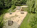
- Artesian well, in the city garden
- Ball fountain, in desert fire
Regular events

- Grand Prix of Germany for motorcycles as part of the motorcycle world championship at the Sachsenring
- Mountain festival on the Pfaffenberg
- Heidelberg Festival
- Voice of Art Festival on the Pfaffenberg (since 1997)
- Karl May Festival on the Neumarkt in Ernstthal
- Pub crawl
- Hohenstein-Ernstthal annual market
- Vernissages and changing exhibitions in the small gallery
- Town hall concerts
- Vernissages and changing exhibitions in the Hohenstein town hall
- Christmas concert by the choirs of the G.-E.-Lessing-Gymnasium
societies


- Art and culture association
- “Silberbüchse” - Förderverein Karl-May-Haus e. V.
- Tourist office Hohenstein-Ernstthal e. V.
- STOP e. V. - Counseling center for social affairs
- Women's center of the Democratic Women's Association
- Youth center "Off Is"
- DRK KV e. V.
- Wichtelgarten e. V.
- Western ranch e. V.
- VfL 05 Hohenstein-Ernstthal e. V.
- SV Sachsenring Hohenstein-Ernstthal e. V.
- Wüstenbrander Sportverein 1862 e. V.
- Youth Brass Orchestra Hohenstein-Ernstthal e. V.
- KSV Sachsenring-Siegmar
Economy and Infrastructure
economy
retail trade
The city center of Hohenstein-Ernstthaler has many small shops, so there are branches of Barth Optik, Rossmann , Vodafone or Ernstings family near the center . In addition, there are a large number of food retail stores in Hohenstein-Ernstthal.

Weinkellerstrasse
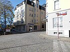
Travel agency in Weinkellerstraße


Local businesses
- Meyer Burger (Germany) GmbH - TecDAX -notiertes engineering company in the photovoltaic region
- ThyssenKrupp System Engineering GmbH
education
- Lessing high school
- Sachsenring-Oberschule (formerly Hüttengrund-Grundschule and before that Clara-Zetkin-Oberschule)
- Karl May Elementary School (formerly: Wilhelm Pieck Oberschule and Herder Middle School)
- Diesterweg primary school Wüstenbrand
- Learning support school "Am Sachsenring"
traffic
Road traffic
Through the urban area which leads A 4 . This can be reached via the Hohenstein-Ernstthal and Wüstenbrand junctions . The B 173 and B 180 also pass nearby.
Rail transport

The Hohenstein-Ernstthal station is located on Dresden-Werdau railway in Transport Association Central Saxony . Both the hourly regional express trains on the RE3 Dresden – Freiberg – Chemnitz – Zwickau – Plauen – Hof line and the regional trains on the RB30 Dresden – Freiberg – Chemnitz – Zwickau line stop at all en-route stations, the hourly intervals of which are sometimes reduced to half an hour . The commissioning of the Central Saxony electrical network in June 2016 went hand in hand with improvements in the timetable and the use of new, affiliated Alstom Coradia Continental railcars . Since then, the operator has been the Mitteldeutsche Regiobahn .
The regional express RE1 Chemnitz - Erfurt - Göttingen stopped until December 2011 and has since ended in Glauchau. A withdrawal of the reduction depends on whether the Free State of Saxony will in future pass on the regionalization funds from the federal government in full to the special-purpose associations responsible for ordering local transport . Until 2012 the station was also the stop of the private long-distance line Vogtland-Express Plauen-Chemnitz-Berlin.
Local public transport
There are two city bus lines in the city , line 1 serves the area from the train station / bus station in the direction of Hüttengrund, Sonnenstraße and Wüstenbrand. And line 2 serves the E-Thälmann-Siedlung and F-Heckert-Siedlung area. There are still a large number of overland lines in the direction of Lichtenstein, Oberlungwitz, Limbach-Oberfrohna, Lugau, Langenchursdorf, Oelsnitz, Waldenburg and Chemnitz. From 1913 to 1960 the station forecourt in Hohenstein-Ernstthal was the starting point for an intercity tram, the Hohenstein-Ernstthal-Oelsnitz tram .

Bus station

Island platform

Station 2003

Waiting hall 2007

Tram depot Hohenstein-Ernstthal
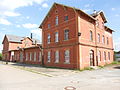
Desert fire station building


Green areas and playgrounds
Hohenstein-Ernstthal offers various green areas, parks and playgrounds for residents and visitors.
Pfaffenberg
Hohenstein-Ernstthal is located on the southern slope of the Paffenberg, which is 480 m high. In good weather conditions, the view of the highest mountain in Saxony, the Fichtelberg, is tremendous. The large area offers a variety of opportunities for walkers and hikers. In the center of the area is the mountain inn, which is unfortunately currently closed.
There is also a dendrological nature trail, a large variety of rhododendrons, and an open-air stage with seating for concerts or events in the area. The Pfaffenberg also offers two playgrounds for children.
Rosa Luxemburg Park
The Rosa-Luxemburg-Park, located in the Hohenstein district, offers a small park for strollers and a playground for children of all ages.
Heidelberg
The Heidelberg Tower is at the center of the Heidelberg green space in Wüstenbrand . This is a lookout tower, which was built in 1991 on the highest point of the place.
More parks
- Hermann-Ende-Park (Röhrensteig)
- Police park
- Park Talstrasse
- former Talstraße dye works
- former outdoor pool
- Wilhelm-Stein green space
- City garden
- city Park
- Jahnpark
- Fuchsgrund
- Pond place
- Green development area between Ernsthaler Friedhof and Schülergässchen
- Volkshausteich
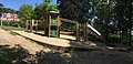
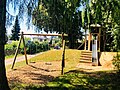
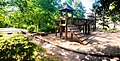
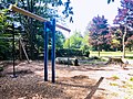
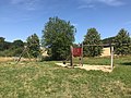
playgrounds
In Hohenstein-Ernstthal and the Wüstenbrand district there are currently 15 playgrounds close to home. The playgrounds listed below are open to the public and freely accessible. The majority is managed by the city of Hohenstein-Ernstthal, a few by the municipal housing association or housing association.

Fritz-Heckert-Siedlung playground
Fritz-Heckert-Siedlung playground
Jahnpark playground
Lindenhofweg OT Wüstenbrand playground

Ringstrasse playground

Rosa Luxemburg Park playground
Sonnenstrasse playground
Pfaffenberg stage playground
Playground at the Heroldteiche

Fuchsgrund playground in Hohenstein-Ernstthal

.jpg)


Personalities
literature
- Wolfgang Hallmann: Hohenstein-Ernstthal, Saxony, in the old days. Geiger-Verlag, Horb am Neckar 1991, ISBN 3-89264-615-5 .
- Wolfgang Hallmann: Hohenstein-Ernstthal in the 50s and 60s . Geiger-Verlag, Horb am Neckar 2005, ISBN 3-86595-075-2 .
- District management Hohenstein-Ernstthal (ed.): Memorial and memorial sites of the workers' movement in the Hohenstein-Ernstthal district . Hohenstein-Ernstthal 1978.
- Council of the City of Hohenstein-Ernstthal: Karl-May sites in Hohenstein-Ernstthal . Hohenstein-Ernstthal 1985.
- Regina Röhner : Hohenstein-Ernstthal . Klis'sche Verlags-Buchhandlung, Hohenstein-Ernstthal 2008, ISBN 978-3-937654-31-7 .
- City administration Hohenstein-Ernstthal (ed.): Hohenstein-Ernstthal - 100 years united . Hohenstein-Ernstthal 1998.
- Richard Steche : Ernstthal. In: Descriptive representation of the older architectural and art monuments of the Kingdom of Saxony. 13. Issue: Glauchau District Authority . CC Meinhold, Dresden 1890, p. 6.
- Richard Steche : Hohenstein. In: Descriptive representation of the older architectural and art monuments of the Kingdom of Saxony. 13. Issue: Glauchau District Authority . CC Meinhold, Dresden 1890, p. 15.
- Otto Sebastian: Origin and development of the mountain town Hohenstein. Hohenstein-Ernstthal, 2nd edition 1927.
- Engraver: History of the city of Hohenstein, In: Schönburgische Geschichtsblätter 5, 1898/1899, pp. 27–50 u. 77-90.
Web links
- Hohenstein-Ernstthal in the Digital Historical Directory of Saxony
- Information on the mining history of Hohenstein-Ernstthal
- Hohenstein-Ernstthal in words and pictures
Individual evidence
- ↑ Population of the Free State of Saxony by municipalities on December 31, 2019 ( help on this ).
- ^ The "Pfaffenberg – Oberwald" nature reserve on the Zwickau district website
- ^ Walter Schlesinger , edited by Thomas Lang: Contributions to the history of the city of Glauchau. Edited by Enno Bünz. Thelem Verlag, Dresden 2010, p. 94 u. 97.
- ↑ Historical reviews from the city archive ( Memento from May 15, 2013 in the web archive archive.today )
- ↑ The Glauchau administrative authority in the municipal register 1900
- ^ Website of the St. Lampertus visitor mine in Hohenstein-Ernstthal
- ^ Website of the mining friends of Saxony
- ^ Website of the Flossenbürg Concentration Camp Memorial Accessed July 6, 2016
- ↑ StBA: Changes in the municipalities in Germany, see 1999
- ↑ Hohenstein-Ernstthal makes concrete marriage proposal
- ^ Walter Schlesinger , edited by Thomas Lang: Contributions to the history of the city of Glauchau. Edited by Enno Bünz. Thelem Verlag, Dresden 2010, p. 88.
- ^ Election results for the Free State of Saxony - municipal council election 2019 .
- ↑ Communication and Public Relations Department: Election Results - sachsen.de. Retrieved August 19, 2019 .
- ^ Website of the city
- ^ Erzgebirgische Volkskunstsammlung Museum Buntes Holz 09337 Hohenstein-Ernstthal Friedrich-Engels-Strasse 1. In: http://www.fair-hotels.de/ . Retrieved November 24, 2017 .
- ↑ Wood brought to life. In: https://www.sachsen-fernsehen.de/ . Retrieved November 24, 2017 .
- ↑ hpk: At Easter the fountains splash again . In: Free Press . April 9, 2020 ( freiepresse.de ).
- ↑ HOTWeb.de: company database. Retrieved August 22, 2017 .