
Hartmannsdorf near Kirchberg
| coat of arms | Germany map | |
|---|---|---|

|
Coordinates: 50 ° 36 ' N , 12 ° 33' E |
|
| Basic data | ||
| State : | Saxony | |
| County : | Zwickau | |
| Management Community : | Kirchberg | |
| Height : | 413 m above sea level NHN | |
| Area : | 27.17 km 2 | |
| Residents: | 1373 (Dec. 31, 2019) | |
| Population density : | 51 inhabitants per km 2 | |
| Postal code : | 08107 | |
| Area code : | 037602 | |
| License plate : | Z, GC, HOT, WDA | |
| Community key : | 14 5 24 100 | |
| Community structure: | 2 districts | |
| Address of the municipal administration: |
Badstrasse 1 08107 Hartmannsdorf |
|
| Website : | ||
| Mayoress : | Kerstin Nicolaus ( CDU ) | |
| Location of the municipality of Hartmannsdorf near Kirchberg in the district of Zwickau | ||
  |
||

Hartmannsdorf bei Kirchberg (formerly also: Hartmannsdorf bei Saupersdorf ) is a municipality in the southern part of the western Saxon district of Zwickau . It has been part of the Kirchberg administrative community since 1999 .
geography
Geographical location
Schneeberg is 6 km east, Zwickau 17 km north and Reichenbach 18 km west. The Hirschenstein (Saxony) in the Hartmannsdorfer Forest is at 610.4 m the highest elevation in the municipality and the district of Zwickau.
Neighboring places
| Leutersbach | Saupersdorf | Burkersdorf |
| Lauterhofen |
.svg)
|
Lindenau |
| Obercrinitz | Bear forest | Neustädtel |
Community structure
The Hartmannsdorf district is located in the Rödelbach valley on the western edge of the Hartmannsdorfer Forest , where peat was cut for a long time . On the road in the peat cut of the Jahnsgrün raised bog there are two houses that belong to the formerly larger Jahnsgrün settlement . The district of Giegengrün lies further west in the valley of the Giegengrüner Bach.
Incorporations
1996 Giegengrün was incorporated.
history

Hartmannsdorf was first mentioned in a document in 1316. The settlement of the region began as part of the flourishing mining industry in the Hohen Forst .
Around 1318 Kirchberg became an independent parish, to which the Hartmannsdorf field chapel also belonged from the beginning.
Hartmannsdorf belonged to the Zwickau office in 1606 and from 1764 to the Wiesenburg office , which was renamed "Kirchberg office" in 1843. In 1836 the New Alphabetical Directory of Places of the Kingdom of Saxony reported on Hartmannsdorf, 1024 inhabitants lived in 138 residential buildings. Due to the forestry office for the administration of the manorial Wiesenburg forest , the place had a special position in the rule Wiesenburg. In 1856 the place came to the Kirchberg judicial office and since 1875 it belonged to the Zwickau administration , the successor of which was the Zwickau district. To distinguish it from Hartmannsdorf near Werdau , the place was then called Hartmannsdorf near Saupersdorf . In 1996 Giegengrün, which had previously belonged to Leutersbach, came to Hartmannsdorf. Hartmannsdorf is the birthplace of Christoph Graupner .
Religious communities
The villages of Hartmannsdorf with Jahnsgrün and Giegengrün belong to the Evangelical Lutheran parish of Hartmannsdorf. The sister church is the parish in Bärenwalde . There is also a parish of the regional church community and the Evangelical Methodist Church in the village .
politics
Municipal council
Since the municipal council election on May 26, 2019 , the 12 seats of the municipal council have been distributed among the individual groups as follows:
Mayoress
Kerstin Nicolaus (CDU), member of the state parliament, was mayor from 1990 to November 2007 . After being convicted of fraud, she was suspended by the Chemnitz Regional Council. In the local elections in June 2008, Nicolaus, who had not officially re-run for office, was re-elected mayor with more than 70% of the votes. In 2015 she was re-elected after the end of her term of office.
Memorials
In the local cemetery there is a grave and a memorial stone for the Nazi opponents Ernst Georg Enderlein and Max Emil Haufe , who were attacked, mistreated and slain by SA men in March 1933 .
Culture and sights
church

The Protestant parish church of Hartmannsdorf was previously referred to with the addition "to Johannis Beheading". This addition is not in use today; it was used to express that she was consecrated to John the Baptist.
There are various references to the time when the first church was built: It is variously described as being in the 15th or 16th century. In Dehio's art guide it says in the volume Saxony II that the hall church has probably existed since the middle of the 13th century. This can be regarded as certain: the first church was already there in 1529. During the first church visitation in Saxony after the beginning of the Reformation in January / February 1529, it was found that Hartmannsdorf did not yet have its own pastor and belonged to Kirchberg, but a church had already been built.
The older part of the church was built in the late Gothic style. The altar from 1969 houses old sculptures, namely altar figures by Peter Breuer . They are dated to 1511/1512: in the predella the birth of Christ, in the shrine a crescent moon Madonna with Saint Barbara and Saint Margaret and in the wings Anna Selbdritt and Katharina. Dehio attributes the wall paintings on the north side to the second half of the 15th century. The roof-high extension to the south was built in 1750. It enlarged the interior of the church and, in particular, changed the south side significantly, but had become necessary due to the increased population. The church has no tower. The roof turret with hood and lantern is designed like a tower and is very concise.
Due to necessary construction work, the church cannot be used for a long time. Church events take place in the Bärenwalder Church. Emergency backup, decontamination and preliminary examinations for the renovation and construction work have been completed as of February 2018. 92,000 euros were spent on this. The main reason for the church being closed is an infestation with dry rot. As early as Christmas 2017, no more services could be held in the church. The complete renovation of the church has not yet been completed in spring 2019.
Natural monuments
In Hartmannsdorfer forest , many animal and plant species were preserved in their original form. The Jahnsgrün raised bog is a specialty due to its geographical location in the lower elevations of the Western Ore Mountains . Comparable raised bogs can only be found in the ridge areas in the Ore Mountains . The area around the high moor has been under nature protection since 1995 and was integrated into the “ Heide und Moorwald am Filzteich ” nature reserve in 2010 , which also includes the headwaters of the Filzbach and the Hartmannsdorf side of the Filzteich.
sport and freetime

In Hartmannsdorf there are many different options for recreational activities and sporting activities. The Hartmannsdorfer Forest is a recreational area with hiking and cycling trails, where the Nordic Walking fun run takes place once a year . In the center of the village there is a sports and leisure center, which includes an artificial turf field with social building and fitness studio as well as a football field. These are operated by FV Blau-Weiß Hartmannsdorf eV . They are in the immediate vicinity of the Hartmannsdorfer outdoor pool, which was built in 1972 and was extensively renovated and modernized in 1994 and 2017. At the northern entrance to the village there is a gym that is used by the sports club and the primary school.
Hartmannsdorf has a diverse club life:
- FV Blau-Weiß Hartmannsdorf eV (sports)
- Fire Brigade Association eV
- FireAbend eV (events in the former Oberhartmannsdorf train station, children's clothing bazaar)
- Heimatfreunde Hartmannsdorf eV (maintaining tradition)
- DRK local association Hartmannsdorf
- Rassegeflügelverein Hartmannsdorf eV
- Folk choir "Liederkranz" eV (founded 1864)
- EC Jugendbund Hartmannsdorf (Protestant Youth Association)
- Rural riding and driving association "Am Sonnenberg" eV (Jahnsgrün, Reiterhof Weiser)
- Erzgebirge cultural association "Glück auf! Hartmannsdorf" eV
Ore Mountains mining region
The mining landscape of Hoher Forst and the felt pond in Hartmannsdorfer Forst are part of the Ore Mountains / Krušnohoří mining region , which has been a UNESCO World Heritage Site since 2019 .
Economy and Infrastructure

In 1460 a hammer forge was established that used the iron ore there . This hammer was converted into a paper mill around 1600. In 1659, the owner Gärtner built another hammer mill, it was mostly referred to as the Wolfsthaler Hammer . In 1667, Wolf Gerber, or Gärtner, owned the hammer, for which a privilege had been granted in 1664. The heyday of ore mining in Hartmannsdorf was between 1600 and 1700. The system was operated as a Schar- or Zainhammer in 1748, in 1783 Johann Gottlieb Viehweg was the owner, his family also owned the Zeller Hammer in Aue (Saxony) . After the ore mining in Hartmannsdorf and the Kirchberg area declined in 1830, the hammer mill became a sheep's wool spinning mill with 300 spindles, which burned down in 1875. Since 1887, the water power was used again - for a cotton wool factory, from which a woolen mill and finally a quilt factory emerged. A hunt set up in front of the former hammer tavern reminds of ore mining . The board on the side informs: “1310 copper and silver finds in the Hohenforst, 1420 iron ore mining in the local area, 1540 water wheels drive the hammer mill and mills. 1948 Unsuccessful search of the bismuth for uranium ore ”.
At the end of the 20th and the beginning of the 21st century, the economy in Hartmannsdorf is characterized by craft, trade and services. Civil engineering and building construction companies, roofers, natural stone works, carpenters, interior fittings, turners, interior decorators are part of the construction and craft sector. A forestry company, a brushwood factory and a shipping company, supplemented by an auto parts dealer, are available. Companies for measurement technology, control technology, metal construction and the repair of fittings as well as the trade in school supplies, gifts and a photo studio complete the offer. Restaurants, hotels, guest houses, riding stables and trading in equestrian accessories make holidays in Hartmannsdorf and Giegengrün possible.
education
There is a primary school in Hartmannsdorf. Secondary schools are located in neighboring Kirchberg.
railroad
From 1893 to 1970, the oldest and longest narrow-gauge line in Saxony, the Wilkau-Haßlau-Carlsfeld narrow-gauge railway, ran through Hartmannsdorf . In the village there were the stops Hartmannsdorf b Saupersdorf and Oberhartmannsdorf (Sachs) . While only the foundations are left of the Hartmannsdorf station, there is still the wooden waiting hall at the Oberhartmannsdorf station, which is already in Bärenwalde.
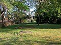
Hartmannsdorf stop (near Saupersdorf), foundations of the waiting hall and exit (2016)

Hartmannsdorf stop (b Saupersdorf) (2016)

Hartmannsdorf stop (b Saupersdorf) (2016)

Oberhartmannsdorf (Sachs) stop (2011)
_(1).jpg)
_(2).jpg)
_(3).jpg)

literature
- Erich Hunger: Chronicle of the Hartmannsdorf community near Kirchberg , published by the Hartmannsdorf community council, 75 pages, 1954
- Richard Steche : Hartmannsdorf. In: Descriptive representation of the older architectural and art monuments of the Kingdom of Saxony. 12. Issue: Zwickau Official Authority . CC Meinhold, Dresden 1889, p. 28.
Web links
- Site of the Hartmannsdorf sports club
- Site of the Hartmannsdorf community
- Hartmannsdorf near Kirchberg in the Digital Historical Directory of Saxony
Individual evidence
- ↑ Population of the Free State of Saxony by municipalities on December 31, 2019 ( help on this ).
- ^ New alphabetical index of places of the Kingdom of Saxony. Compiled according to official reports by the Central Committee of the statistical association for the Kingdom of Saxony. With the most gracious privilege granted . Verlag der Waltherschen Hofbuchhandlung. First division A.–L. Dresden 1836, p. 104 digitized version , accessed on February 18, 2015
- ↑ Results of the 2019 municipal council elections
- ↑ State Statistical Office
- ↑ State Statistical Office
- ^ Georg Dehio: Handbook of German Art Monuments, Saxony II, administrative districts of Leipzig and Chemnitz , edited by Barbara Becker, Wiebke Fastenrath, Heinrich Magirius et al., Munich 1998, page 388
- ^ Karl August Hugo Burkhardt: History of the Saxon Church and School Visitations from 1524 to 1529 , reprint of the Leipzig edition 1879, Scientia-Verlag, Aalen 1981, p. 24f.
- ^ Georg Dehio: Handbook of German Art Monuments, Saxony II, administrative districts of Leipzig and Chemnitz , edited by Barbara Becker, Wiebke Fastenrath, Heinrich Magirius et al., Munich 1998, page 389
- ↑ Report on the website "Church in Hartmannsdorf"
- ↑ Report on the website “Kirche in Hartmannsdorf” in the News section , accessed on March 20, 2018
- ^ Report from TV Westsachsen from December 28, 2017 on Youtube , accessed on March 20, 2018
- ↑ Irmela Henning: Why an altar is being restored in secret in Stützengrün , report on the restoration of the altar figures in the Hartmannsdorf Church, in: Freie Presse - Regional Edition Aue -, March 21, 2019, p. 9
- ^ Website of the FV Blau-Weiß Hartmannsdorf eV , accessed on September 19, 2018
- ↑ Information from the Hartmannsdorf community on the renovation of the outdoor swimming pool , accessed on September 19, 2018
- ↑ a b c d Carl Schiffner : Old Hütten und Hämmer in Sachsen , edited by Werner Gräbner, in the series Freiberger Forschungshefte Kultur und Technik D14, Akademie-Verlag, Berlin 1959, p. 204
- ↑ Website of the municipality, accessed on March 23, 2013 (PDF; 49 kB)
- ^ Siegfried Sieber: Studies on the industrial history of the Erzgebirge , Cologne 1967, p. 6