
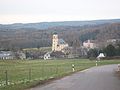
Langenweißbach
| coat of arms | Germany map | |
|---|---|---|

|
Coordinates: 50 ° 38 ' N , 12 ° 36' E |
|
| Basic data | ||
| State : | Saxony | |
| County : | Zwickau | |
| Height : | 447 m above sea level NHN | |
| Area : | 22.62 km 2 | |
| Residents: | 2473 (Dec. 31, 2019) | |
| Population density : | 109 inhabitants per km 2 | |
| Postal code : | 08134 | |
| Area code : | 037603 | |
| License plate : | Z, GC, HOT, WDA | |
| Community key : | 14 5 24 150 | |
| Community structure: | 3 districts | |
| Address of the municipal administration: |
Hauptstrasse 52 08134 Langenweißbach |
|
| Website : | ||
| Mayor : | Jens Wächtler ( UWG ) | |
| Location of the community of Langenweißbach in the district of Zwickau | ||
  |
||

The community Langenweißbach consists of the three districts Langenbach, Weißbach and Grünau. It was founded on July 1, 1996 as part of the municipal reform from the places Langenbach with the districts Grünau and Weißbach.
geography
Geographical location
The community is located in the district of Zwickau , on the Zwickauer Mulde and on the railway line from Zwickau to Johanngeorgenstadt , as well as on the federal highway 93 - southeast of Zwickau behind Wilkau-Haßlau and Wildenfels , in the lower Western Ore Mountains . In Weißbach it extends to the Hohen Forst ( Hartmannsdorfer Forst ). The altitude in the community ranges from 300 m on the Zwickauer Mulde to 580 m on the Hohen Forst. Grünau is located in the intermediate mountains of Wildenfels .
Neighboring places
| Wilkau-Haßlau | Wildenfels | Hartenstein |
| Kirchberg |
.svg)
|
Aue-Bad Schlema |
| Hartmannsdorf near Kirchberg | Schneeberg |
Community structure
- Weißbach with Hermannsdorf
- Langenbach with Lerchenberg and ferry bridge
- Grünau
- Neudörfel (Langenweißbach)
politics
Municipal council
Since the municipal council election on May 25, 2014 , the 15 seats of the municipal council have been distributed among the individual groups as follows:
- Independent community of voters Langenweißbach (UWG): 8 seats
- CDU : 7 seats
Local partnerships
Langenweißbach has had a partnership with Otzberg in Hesse since 1990 .
history
In the 11th and 12th centuries there were frequent armed conflicts between Germans and Sorbs in this region. The conquered land was made arable and the people ate what was hunted and caught. During this time, attempts were made in many places to consolidate German rule by building castles, later monasteries and churches. So the Lords of Wiese built a knight's seat on the Mulde, today's Wiesenburg Castle . Weissbach got its name Veitsbach from the founder and builder Ritter Veit. In the 11th century, a trade route was built from Zwickau over the mountain ridge to Bohemia. This traffic artery, still called Silberstraße today, enabled the development of silver mining in Schneeberg around 1466 . In the 16th and 17th centuries, people's lives were mainly characterized by forest work. Langenbach, Weißbach and Grünau later developed into farming villages. In the 16th century the late Gothic hall church was built in Weißbach and in 1755 the Langenbach church was built as a baroque building. In Grünau, which was previously called Kalkgrün, an electoral marble quarry was operated. In 1858 the Zwickau – Schwarzenberg railway was built . The Fährbrücke railway station thus created made it possible for the paper and chemical factories to settle in Langenbach later. Workers moved in and increased housing construction began. Limestone quarries were created in the Grünau district. A workers' community developed from the farming villages of Langenbach and Grünau. In Weissbach, on the other hand, agriculture played a major role. The Weißbach farmers used the Silberstraße and later the rail connection via Wiesenburg to market their vegetable and animal products. Before the First World War, Weißbach had become known far beyond the region for its brisk butter trade.
Weißbach and the Hermannsdorf corridor connected to it (united with Weißbach from 1791) originally belonged to the Wiesenburg rule . After a feud they came to the Wildenfels rule around 1253 and after their unification belonged to the Zwickau office around 1706 to 1856 and then to the Wildenfels court office . Since 1875 they have belonged to the Zwickau administration , the successor of which is the Zwickau district .
Langenbach and the settlements of Lerchenberg and Fährbrücke belonged to the Schönburg office of Stein . Since 1885 it has also belonged to the Zwickau district administration , whose successor is the Zwickau district .
The Fährbrücke settlement, which belongs to Langenbach , was created in the 19th century through the settlement of various factories on the banks of the Zwickauer Mulde . Favored by its location on the railway line to Zwickau, a wood pulp factory was built in 1882 (closed in 1939) and in 1881 the Fährbrücke Spezialpapiere GmbH , which existed until 2013. The chemical factory founded in 1891 existed until 2011 under the name CCF Chemische Fabrik Fährbrücke GmbH . Later Loser Chemie GmbH and now Ecolochem GmbH continued the tradition of chemical production at the site.
The place Neudörfel (Langenweißbach) was divided between Langenbach and Weißbach. Thus the place was divided between the offices of Zwickau and Stein until 1885.
Grünau belonged to the more distant Grünhain office , which emerged from the lands of the Grünhain monastery . In 1843 Grünau came to the Kirchberg office and in 1856 to the Wildenfels court office . From 1875, like Weißbach, it belonged to the Zwickau district administration , whose successor is the Zwickau district . In 1952 Grünau was incorporated into Langenbach.
Religions
The ev.-luth. Parish Langenbach formed a parish with the parish Wildbach until 2005 . Since 2006 it has belonged with the parish of Weißbach to the newly founded parish of Langenweißbach in the parish of Zwickau. Thus the parish was released from its centuries-old historical ties and the newer political boundaries were taken into account. Since then, Wildbach has been part of the Bad Schlema parish in the church district of Aue.
Grünau belongs to the ev.-luth. Parish in Schönau .
The ev.-meth. Parish Weißbach belongs to the parish of Schneeberg.
Incorporations
| Former parish | date | annotation |
|---|---|---|
| Grünau | January 1, 1952 | Incorporation to Langenbach |
| Hermannsdorf | before 1880 | Incorporation to Weißbach |
| Langenbach | July 1, 1996 | Merger with Weißbach to Langenweißbach |
| Lerchenberg | before 1880 | Incorporation to Langenbach |
| Neudörfel | before 1880 | Incorporation to Langenbach |
| Weissbach | July 1, 1996 | Merger with Langenbach to Langenweißbach |
Culture and sights

Langenbach Church

Weissbach


- The late Gothic Salvator Church in the Weißbach district is richly furnished. It was built in 1515/16 and was rebuilt in 1694. The late Gothic winged altar by Peter Breuer dates from 1518/20. The ceiling and galleries are painted. The pulpit is from 1693, the crucifix from 1695. The church also has life-size woodcuts by the reformers Luther and Melanchthon from the 16th century.
- The church of Langenbach is a baroque building from the years 1754/55.
- In the district of Grünau the only ruin stands a lime kiln type Kalkringbrennofen in Saxony.
- The club mine ( show mine ) Engländerstolln (1944) with cut medieval old mine of the Martin-Römer pit (s) is located in the district of Weißbach on the edge of the Hohenforest . It can be visited regularly.
Leisure and Tourism
- There is a forest pool in the Langenbach district.
- The Mulderadweg runs through the village from Zwickau to Aue.
- On a hiking trail through the Oelbachgrund in the direction of Griesbach you get to Hermannsgrab.
Sports
Several recreational sports clubs are located in Langenweißbach. These include the SV Rotation Langenbach e. V. (soccer, table tennis and athletics) as well as SV Weißbach 1864 e. V. Both in Weißbach and in Langenbach, youth football teams could be established despite the comparatively low population. The table tennis section from SV Rotation Langenbach has been an important part of the extracurricular activities of young people in the community for years.
traffic
The federal road 93 from Zwickau to Schneeberg runs through the upper district of Weißbach . With the ferry bridge stop , the place has a station on the Zwickau – Schwarzenberg railway line .

Fährbrücke station with Erzgebirgsbahn (2016)

Former Reception building of the Fährbrücke station (2016)

.JPG)
Public facilities
The Langenweißbach municipal administration is located in the Langenweißbach district. There is a branch in the primary school in Weißbach.
education
The common primary school for all districts is located in the Weißbach district.
Personalities
- Friedrich Wilhelm Meyer (born March 1, 1797 in Weißbach; † June 6, 1879 in Zwickau), lawyer and mayor of Zwickau
literature
- Jörg Richter (Hrsg.): Langenweißbach: History of the unified community and its districts Grünau, Langenbach and Weißbach. Beier & Beran: Langenweißbach 2006, ISBN 3-937517-33-2 .
- Horst Herbert Schulz: First register volume on the parish registers of the Salvator Church in Weißbach in the Erzgebirge 1583–1644. Copy of the family cards . Hamburg 1978, p. 525 (650 families, according to the inventory, part IV of the German Central Office for Genealogy ).
- Hans-Georg Türke: Saxon hiking guide. Volume 5. Western Ore Mountains and Zwickauer Land. 1st edition. Chemnitzer Verlag, 2011, ISBN 978-3-937025-60-5 , p. 20 f.
Web links
- Official website of the municipality
- Langenweißbach in the Digital Historical Directory of Saxony
- Weißbach in the Digital Historical Directory of Saxony
- Hermannsdorf in the Digital Historical Directory of Saxony
- Langenbach in the Digital Historical Directory of Saxony
- Ferry bridge in the Digital Historical Directory of Saxony
- Lerchenberg in the Digital Historical Directory of Saxony
- Neudörfel in the Digital Historical Directory of Saxony
- Grünau in the Digital Historical Directory of Saxony
Individual evidence
- ↑ Population of the Free State of Saxony by municipalities on December 31, 2019 ( help on this ).
- ↑ Results of the 2014 municipal council elections. In: statistik.sachsen.de, accessed on January 6, 2018.
- ^ Salzweg to Weißbach ( Memento from September 20, 2013 in the Internet Archive ). In: kirchberger-bergbrueder.de, accessed on January 8, 2018.
- ↑ Federal Statistical Office (Ed.): Municipalities 1994 and their changes since 01.01.1948 in the new federal states. Metzler-Poeschel publishing house, Stuttgart 1995, ISBN 3-8246-0321-7 .
- ↑ Ministry of the Interior of Saxony (ed.): Lists of the municipalities incorporated since May 1945 and evidence of the subdivision of the independent manor districts and state forest districts. Dresden 1952, OCLC 314156849 .
- ↑ a b c The Book of Saxony. Municipal publishing house Saxony, Dresden 1943.
- ↑ a b State Statistical Office of the Free State of Saxony: Area changes. In: statistik.sachsen.de, accessed on January 8, 2018.