
List of architectural monuments in Aub

The monuments of the Lower Franconian town of Aub are compiled on this page . This table is a partial list of the list of architectural monuments in Bavaria . The basis is the Bavarian Monument List , which was first drawn up on the basis of the Bavarian Monument Protection Act of October 1, 1973 and has since been managed by the Bavarian State Office for Monument Preservation . The following information does not replace the legally binding information from the monument protection authority. This list reflects the update status from April 16, 2020 and contains 126 architectural monuments.
Ensembles
Ensemble old town Aub
The ensemble encompasses the medieval city within its wall ring from the 15th century including the moat area and the walled castle garden in the south in front of the fortification. The original cell of the settlement first mentioned in 1136 is likely to have been a Benedictine provost in the place of today's parish church . Following the Hohenlohe castle , the town was expanded into the 13th and 14th centuries , although it was not granted town charter until 1404 . Century. Aub is on the southern slope above the Gollach . The hillside location requires a structure that is largely oriented parallel to the contour lines, in which the routing of the highways is not integrated: the stretched, rectangular, walled urban area following the course of the river appears to be determined in the longitudinal axis by a sequence of two square streets, which separates the free-standing town hall from each other (market square, Harbachstrasse); this main line, which occupies roughly the middle of the slope, has parallel streets to the north, lower down (Mühlstrasse), and to the south, in an elevated position (Johann-Böhm-Strasse, Hoffahrtstrasse). Steep cross streets mediate between these three parallel streets. The main street does not coincide with the thoroughfare, the city has no gates on its narrow sides; Gollachuferstrasse runs past the city on the other side of the river; the highway that runs through the city is cross-directional, it climbs the slope out of the valley to the southeast; from the former hospital gate it climbs steeply past the parish church, which is elevated above a retaining wall, to the western end of the market square as the main street; here she turns into the market square, which she crosses as a resting place, so to speak; In front of the town hall she takes the cross direction again and reaches the Obere Tor via the steep Etzelstrasse. The main market square, Harbachstrasse has a closed row of gabled houses with some stately buildings from the 16th to 18th centuries, especially on the market square . Century. Due to their width and hillside location, both square streets are built on two levels: Harbachstraße is divided along its entire length by a central retaining wall; on the market square, the central area with the fountain and statue of the Virgin Mary forms a raised platform. The side street on the river side (Mühlstraße) has smaller buildings, also in a closed row of gables; As the street name suggests, there were craftsmen here; the side street on the mountain side was Scheunengasse until a fire in 1841; its current development goes back in part to the reconstruction of the mid-19th century. Monumental focal points are the parish church, which lies roughly in the middle of the city on terraced foundations and is separated from the market square by a row of houses; the administrative castle in Würzburg, which has been in Würzburg since 1521 and which dominates the southern corner and at the same time the highest point of the urban area; the hospital at the Gollach crossing and the town hall that closes off the market square to the east . Boundaries: Waldmannshöfer Strasse - tree avenue south of the castle - path along the gardens in front of the western city wall - the course of the Gollach - path along the southeastern city wall - Hemmersheimer Strasse. File number: E-6-79-114-1.
Places of particular importance
Marketplace
The marketplace from the 13th / 14th Century is located on an irregular floor plan. The square expands like a hose from the width of the street in the west to spaciousness in the east. The uniform, southern wall of the square is answered in the north by a curved row of houses that shields the church square, then, after an opening to the church square, a straight line of houses. In the east, the town hall closes off the square with a narrow side. Due to the hillside location, the square is arranged on two levels. The development consists of a closed row of partly stately gabled houses from the 16th to 18th centuries. Century. A fountain and a statue of the Virgin Mary denote the middle. Boundary: Marktplatz 1–25, 27, Etzelstraße 1, Hauptstraße 7,9, Mangsteig 2.
City fortifications Aub
The city fortifications Aub has a nearly preserved closed wall ring made of quarry stone masonry, which was built between 1404 and 1436. In the north the Gollach represents a natural defensive moat. The city is most strongly fortified on the western flank in the area of the castle. There was a kennel there, which was secured by a second wall and of which only a few tower stumps have survived. The former wall height was 11 m with a thickness of 1.50 m. Of the former 15 towers, 11 including the keep at the castle and some half-shell towers are still preserved. The towers mostly had half-timbered upper floors, which were mostly laid in the 19th century. Most of the towers were designed as round towers. The few rectangular towers mostly had simultaneous residential and thus guard use. File number D-6-79-114-2. Starting at Mühlstraße, the following parts of the city fortifications have been preserved in a clockwise direction:
- City wall, built into the houses on the north side of Mühlstrasse 1, 3, 5, 7 ( location )
- City wall, built into the houses on the north side of Mühlstrasse 9, 11, 13, 15 ( location )
- City wall, built into the house on the north side of Mühlstrasse 17 ( location )
- City wall, built into the house on the north side of Mühlstraße 19 ( location )
- Stasdtturm, round tower, north-east of Mühlstraße 19, quarry stone masonry, with municipal lease pig stable ( location )
- City wall, on the north side of Mühlstrasse 21, 23, 25, 27, 29, 31, partly built into houses ( location )
- City wall, built into the house on the north side of Mühlstrasse 33 ( location )
- City wall, built into the house on the north side of Mühlstraße 35 ( location )
- City tower, so-called shepherd's tower or bath tower, square quarry stone masonry building with half-timbered upper floor and gable roof, Mühlstraße 35 ( location )
- City tower, so-called Rimpach tower, round tower made of quarry stone masonry, near Harbachstraße ( location )
- City wall, north of Harbachstrasse, on the eastern property boundary of No. 23 ( location )
- City tower, Geyerschlossturm, round tower, former torture and prison tower, made of rubble stones, 15./16. Century ( location )
- City wall, south of Harbachstrasse, on the eastern property boundary of No. 20 ( location )
- City wall, north of Harbachstrasse, on the southern property boundary of No. 18, 16 ( location )
- City tower, round tower made of quarry stone masonry, on the eastern property boundary of Harbachstraße 12 ( location )
- City wall, north of Harbachstrasse, on the southern property boundary of No. 8, 6, 4 ( location )
- City tower, round tower made of quarry stone masonry, modern built, on the northern property boundary of Hammersheimer Straße 1 ( location )
- City wall, Hoffahrtgasse 2, on the southern property boundary ( location )
- City wall, Etzelstraße 17, on the southern property boundary ( location )

City wall, north side of Mühlstrasse 3, 5, 7
City wall, north side of Mühlstrasse 15

City wall, north side of Mühlstrasse 29

City wall, north side of Mühlstrasse 31

Shepherd's Tower, Mühlstrasse 35

Rimbach Tower

City wall, Harbachstraße 23

Geyerschlossturm

City tower at Hoffahrtgasse 12


| location | object | description | File no. | image |
|---|---|---|---|---|
| Etzelstraße 19 ( location ) |
Gate tower, formerly known as the upper tower or center tower | Rectangular solid building made of quarry stone with corner blocks, rebuilt around 1613, formerly with a baroque lantern hood, after a partial collapse in 1841 with a crenellated top and eastern, two-storey extension with pilaster strips and half hipped roof, rebuilt in 1852 | D-6-79-114-14 |
 more pictures |
- City wall, Etzelstraße 8, on the southern property boundary ( location )
- City wall, Johannes-Böhm-Straße 3, 5, on the southern property boundary ( location )
- Half-shell tower, Johannes-Böhm-Straße 7, on the southern property boundary ( location )
- City wall, Hauptstrasse 1, integrated into the palace complex ( location )
- City tower, round tower ( location )
- City tower, half-round tower, built in with the former castle, plastered quarry stone wall ( location )
- City wall, Hauptstrasse 3, 7, 9, 11, on the western property boundary ( location )
- Remains of a shell tower, near Judengasse ( location )
- City wall, western wall extension near Neutorgasse ( location )
- City tower, round tower, northwestern watchtower ( location )
- City wall, Hauptstrasse 31 ( location )

City wall at Johannes-Böhm-Straße 2

City wall at the castle

Round tower at the castle

Half-round tower at the castle

City wall at Hauptstraße 3

northwest round tower

City wall Hauptstrasse 31


Architectural monuments according to districts
Aub
| location | object | description | File no. | image |
|---|---|---|---|---|
| Bahnhofstrasse 1 ( location ) |
Former customs house | Two-storey hipped roof building with half-timbered upper storey, north side with Brandenburg coat of arms, 17th century | D-6-79-114-3 |

|
| Bahnhofstrasse 2 ( location ) |
Inn, so-called White Swan | Two-storey solid construction with a mansard hipped roof and drilled window walls, 18th century | D-6-79-114-4 |
|
| Bahnhofstrasse 12 ( location ) |
Wayside shrine | Rectangular top with triangular gable and cross crown, as well as a relief with the Flight into Egypt , on a short pedestal, sandstone, 19th century | D-6-79-114-5 |
|
| Etzelstrasse 1 ( location ) |
Residential buildings | Two-storey, plastered solid building with a hipped roof in a corner position, with profiled window frames, 18th century | D-6-79-114-6 |
 more pictures |
| Etzelstraße 2 ( location ) |
Residential buildings | Two-storey, plastered saddle roof building with half-timbered upper storey, 17th century | D-6-79-114-7 |
|
| Etzelstrasse 3 ( location ) |
Residential buildings | Two-story, plastered hipped roof building with half-timbered upper floor, 18th century | D-6-79-114-8 |
 more pictures |
| Etzelstrasse 4 ( location ) |
Residential buildings | Three-story, plastered saddle roof building with half-timbered upper floors, 17th century | D-6-79-114-9 |
|
| Etzelstrasse 8 ( location ) |
Residential buildings | Two-storey brick masonry building with a half-hipped roof, limestone, mid-19th century | D-6-79-114-10 |
|
| Etzelstraße 11 ( location ) |
Residential buildings | Two-storey, eaves gable roof building with plastered, cantilevered half-timbered upper storey, 17th century | D-6-79-114-11 |
 more pictures |
| Etzelstraße 13 ( location ) |
Residential buildings | Two-storey, eaves gable roof building with plastered, cantilevered half-timbered upper storey, 17th century | D-6-79-114-12 |
 more pictures |
| Galgenberg, in Pfahlheimer Grund ( ) |
Stone cross | not re-qualified, not mapped in the Bavarian Monument Atlas | D-6-79-114-79 |
|
| Gelchsheimer Weg ( location ) |
Wayside shrine | Relief attachment with a cross crowning and depicting fourteen helpers in need , reverse with Our Lady, on octagonal shaft above pedestal, 19th century | D-6-79-114-80 |
|
| Near Gollach ( location ) |
St. Nepomuk statue | Figure of St. John Nepomuk , sandstone, 18th century | D-6-79-114-35 |
|
| Harbachstrasse 11 ( location ) |
Residential buildings | Two-storey saddle roof building, upper floor plastered half-timbering, gable half-timbered, 17th century | D-6-79-114-15 |
 more pictures |
| Harbachstraße 14, Hoffahrtgasse 14 ( location ) |
Residential buildings | Gabled house with half hip, upper floor plastered half-timbering, early 19th century | D-6-79-114-17 |
 more pictures |
| Harbachstraße 19 ( location ) |
Residential buildings | Two-story saddle roof building, with half-timbered upper floor and house coat of arms above the door, corner post marked "1619" | D-6-79-114-19 |
 more pictures |
| Hauptstrasse 1 ( location ) |
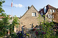
Former castle of the Truchsesses in Baldersheim, then the prince-bishop's palace and office building | The oldest part of the central, three- story stepped gable building with a gable roof , 1456–1474, connected by a shield wall to the round keep, so-called witch's tower, made of quarry stone masonry, this before 1430, the former castle under Julius Echter expanded to include the north and east wings, these as two-story Solid buildings with renaissance tail gables , north wing with high plinth, 1595–1626, remains of the former office building adjoining the keep to the south, two-storey quarry stone building with hipped roof, from 1624; with equipment | D-6-79-114-22 |
 more pictures |
| Hauptstraße 1, outside the city fortifications ( location ) |
Walled castle garden | First quarter of the 17th century | D-6-79-114-22 |
|
| Hauptstrasse 2 a ( location ) |
Courtyard gate of the former tithe courtyard belonging to the castle, the so-called cattle yard | Arched gate with a slight profile, in the core 17th century, modern overformed | D-6-79-114-24 |
|
| Hauptstrasse 9 ( location ) |
Former official seat of the Rosenberg, later of the Teutonic Knight Order, then the Goldener Löwe inn | Two-storey, plastered solid building with a gable roof, inscribed "1568", building largely renovated after war damage, 1948 | D-6-79-114-25 |
 more pictures |
| Hauptstrasse 9 ( location ) |
Pieta figure | Probably the second half of the 18th century | D-6-79-114-25 |
 more pictures |
| Hauptstrasse 17 ( location ) |
Residential buildings | Three-storey, plastered saddle roof building with half-timbered upper storey, first quarter of the 19th century | D-6-79-114-29 |
 more pictures |
| Hauptstrasse 19 ( location ) |
Residential buildings | Two-storey saddle roof building with half-timbered upper storey, marked "1677" | D-6-79-114-28 |
 more pictures |
| Hauptstrasse 21 ( location ) |
Residential building, in the core a former synagogue | Two-storey, plastered hipped roof building with half-timbered upper storey, in the core before 1745, end of the 18th century | D-6-79-114-30 |
 more pictures |
| Hauptstrasse 25 ( location ) |
Residential buildings | Two-storey, plastered saddle roof building with half-timbered upper storey, 17th century | D-6-79-114-32 |
 more pictures |
| Hauptstrasse 27 ( location ) |
Former rectory of the hospital | Two-storey, plastered gable roof building with profiled window frames, second half of the 19th century | D-6-79-114-33 | |
| Hauptstrasse 29 ( location ) |
Former porter's house of the hospital | Single-storey quarry stone masonry building with a gable roof and sandstone structure, 1863/64 | D-6-79-114-154 |
|
| Hauptstrasse 31 ( location ) |
Former Holy Spirit Hospital | Founding of Gottfried II von Hohenlohe-Brauneck, 1355, elongated building group probably grown together from formerly separate buildings, hospital building adjoining the church to the west, two-storey, massive saddle roof building with an irregular floor plan, with a two-storey hipped roof extension, in the core 14th century, profound under Julius Echter renewed, inscribed "1595"; with equipment | D-6-79-114-34 |
 more pictures |
| Hauptstrasse 31 ( location ) |
Former Holy Spirit Hospital, former barn | Sandstone block construction with a gable roof, 16./17. century | D-6-79-114-34 |
 more pictures |
| Hauptstrasse 33 ( location ) |
Hospital Church | Founding of Gottfried II von Hohenlohe-Brauneck, 1355, elongated building group probably grown together from formerly separate buildings, with the eastern hospital church of the Holy Spirit, hall building with retracted choir and roof turret, choir in the core medieval, profound nave conversion or new construction under Julius Echter, around 1595–1604, renewed reconstruction in 1862–1864 | D-6-79-114-34 |
 more pictures |
| Johannes-Böhm-Straße 2 ( location ) |
Residential buildings | Two-storey solid building made of limestone with house stone integration and crooked hip, in a corner, mid-19th century | D-6-79-114-39 |
 more pictures |
| Johannes-Böhm-Straße 7 ( location ) |
Former tithe house, now a residential building | Two-storey, plastered saddle roof building with half-timbered upper storey, 17th century | D-6-79-114-41 |
|
| Kirchplatz 2 ( location ) |
Catholic parish church of the Assumption, until 1464 Benedictine provostry of St. Burkard in Würzburg | Three-aisled hall church with western porch, retracted choir and choir flank tower with pyramid roof, the western building around 1275–1280, the rest of the building in 1615, the nave initially redesigned in 1752 as a three-aisled hall after being destroyed in the war in 1951; with equipment | D-6-79-114-42 |
 more pictures |
| Kirchsteige 1 ( location ) |
Residential buildings | Two-storey, eaves gable roof building with half-timbered upper storey, labeled "1597" | D-6-79-114-43 |
|
| Kirchsteige 2 ( location ) |
Rectory | L-shaped, two-story solid building with saddle roofs, north wing over a high base, mid-17th century | D-6-79-114-44 |
 more pictures |
| Kirchsteige 2 ( location ) |
Garden fence with yard gate | Quarry stone masonry, marked "1665" | D-6-79-114-44 |
|
| Kirchsteige 3 ( location ) |
Former customs house, then Latin school, today residential building | Two-storey hipped roof building with half-timbered upper storey, 18th century | D-6-79-114-26 |
 more pictures |
| Marketplace ( location ) |
Market fountain | Octagonal, profiled well basin with a central well column with spherical crown, sandstone, 1737 | D-6-79-114-59 |
 more pictures |
| Marketplace ( location ) |
Marian column | Figure of Our Lady with Child Jesus (copy), on a pillar above a table base, original sculpture in the town hall, sandstone, by Leopold Kurzhammer, 1732 | D-6-79-114-60 |
 more pictures |
| Marketplace 1 ( location ) |
town hall | Three-storey solid building with half-timbered upper storey and renewed flight of stairs, eastern part two-storey with half-timbered gable, with gable roofs and western ridge turrets with bell roof, late Gothic core, 1482–1489, extended before 1671 and extensively renewed, further changes, 19th century | D-6-79-114-45 |
 more pictures |
| Marketplace 2 ( location ) |
White Horse Inn | Two-storey, plastered half-hipped roof building with wrought-iron pub cantilever, second quarter of the 19th century | D-6-79-114-46 |
|
| Marketplace 3 ( location ) |
Gasthaus Zum Hirschen | Two-storey, plastered hipped roof building with half-timbered upper storey, end of the 18th century | D-6-79-114-47 |
 more pictures |
| Marketplace 5 ( location ) |
Residential buildings | Two-storey, plastered gable roof building, upper storey with drilled window frames, the core of the 18th century | D-6-79-114-48 |
 more pictures |
| Marktplatz 6 ( location ) |
Goldenes Lamm inn | Two-storey, plastered mansard hipped roof building, archway marked "1493", 17th century core, remodeled around 1800, former steep gable roof replaced by mansard hipped roof in the 20th century | D-6-79-114-49 |
 more pictures |
| Marktplatz 8 ( location ) |
Former residential building, pharmacy since the 18th century, so-called swan pharmacy | Two-storey, gable-independent saddle roof building with half-timbered upper storey, labeled "1568" | D-6-79-114-50 |
 more pictures |
| Marktplatz 11 ( location ) |
Residential buildings | Two-storey saddle roof building with half-timbered upper storey, with the coat of arms of the Truchsess von Baldersheim of the previous building, this is labeled "1569", 16./17. century | D-6-79-114-51 |
 more pictures |
| Marktplatz 12 ( location ) |
Residential buildings | Two-storey half-hipped roof building with half-timbered upper floor, with Rosenberger coat of arms, inscribed "1568" | D-6-79-114-52 |
 more pictures |
| Marktplatz 15 ( location ) |
Residential buildings | Two-storey, plastered saddle roof building, upper storey with drilled window frames, house Madonna of the 17th century, this was only added in 1948, and the coat of arms stone inscribed "17 ..", first half of the 18th century | D-6-79-114-53 |
 more pictures |
| Marktplatz 18 ( location ) |
Residential buildings | Two-storey, gable-independent saddle roof building with half-timbered upper storey, 18th century | D-6-79-114-54 |
 more pictures |
| Marktplatz 19 ( location ) |
Residential buildings | Two-storey solid construction, probably half-timbered upper storey, with a saddle roof and rich volute gable as well as with a profiled portal with coat of arms stone, Renaissance, inscribed "1616", in the core 16th century | D-6-79-114-55 |
 more pictures |
| Marktplatz 20 ( location ) |
Residential buildings | Two-storey, gable-independent saddle roof building with half-timbered upper storey, 18th century | D-6-79-114-56 |
 more pictures |
| Marktplatz 22 ( location ) |
Residential building | Two-storey, gable-independent saddle roof building with a western, eaves extension, with half-timbered upper storeys and drilled window frames, 18th century | D-6-79-114-57 |
 more pictures |
| Marktplatz 25 ( location ) |
Residential buildings | Two-storey limestone building with a saddle roof and sandstone structure, with an outside staircase, mid-19th century | D-6-79-114-58 |
 more pictures |
| Mühlstrasse 16 ( location ) |
Residential buildings | Two-storey hipped roof building in a corner, with a half-timbered upper storey and profiled sandstone walls on the ground floor, as well as with the coat of arms of Prince-Bishop Johann Philipp von Greiffenclau zu Vollrath , inscribed "1581", ground floor overformed in the 18th century | D-6-79-114-62 |
 more pictures |
| Mühlstrasse 19 ( location ) |
Residential buildings | Two-storey saddle roof building with plastered half-timbered upper floor, gable half-timbered, 17th / 18th century. century | D-6-79-114-64 |
 more pictures |
| Mühlstrasse 33 ( location ) |
Residential buildings | Two-storey, plastered half-hipped roof building with half-timbered upper storey, early 19th century, northern part changed after 1826 | D-6-79-114-66 |
 more pictures |
| Neuertgasse 10 ( location ) |
Residential buildings | Two-storey, plastered tailcoat roof with half-hips and half-timbered upper floor, 17th / 18th centuries century | D-6-79-114-67 |
 more pictures |
| Neuertgasse 12 ( location ) |
Former synagogue, now a residential building | Two-storey, plastered gable roof building with half-timbered upper storey, 1744, damaged in 1938, then converted into a residential building | D-6-79-114-141 |
 more pictures |
| Ochsenfurter Straße 1 ( location ) |
Residential buildings | Two-storey solid limestone building with hipped roof and outside staircase, mid-19th century | D-6-79-114-68 |
|
| Ochsenfurter Straße 1 ( location ) |
Wayside shrine | Cast, relief essay with crucifixion group and donor family, on pillar above pedestal, cast stone, inscribed "1628", 20th century | D-6-79-114-69 |
|
| Ochsenfurter Straße 14 ( location ) |
Wayside shrine | Cast of a no longer preserved wayside shrine from 1727, relief attachment depicting the Assumption of Mary , on a pillar, 20th century | D-6-79-114-70 |
|
| Near Uffenheimer Straße ( location ) |
War memorial for the fallen from 1870/71 | Tuff stone pylon with iron cross relief and helmet attachment, around 1900 | D-6-79-114-73 |
 more pictures |
| Uffenheimer Strasse ( location ) |
Wayside shrine | Relief attachment with crucifixion group and crowning of the cross, including a block of inscriptions, on a pillar above a renewed base, inscribed "1616" | D-6-79-114-74 |
 more pictures |
| Uffenheimer Straße 2 ( location ) |
graveyard | Walled complex in the northern core area around 1805, with southern cemetery expansion, second half of the 19th century, with preserved grave monuments from the late 19th and early 20th centuries | D-6-79-114-72 |
|
| Uffenheimer Straße 2 ( location ) |
Cemetery cross | Crucifix on pedestal, cross and base renewed, sandstone, 18th century | D-6-79-114-72 |
 more pictures |
| Uffenheimer Straße 2 ( location ) |
Cemetery chapel | Small hall building with gable roof and bell ridge, late 19th century | D-6-79-114-72 |
|
| Vordere Oellinger Straße ( location ) |
Field chapel | Simple masonry or quarry stone masonry construction with a gable roof, 19./20. Century, therein Pietà, wood, 18th century | D-6-79-114-81 |
|
| Waldmannshöfer Straße 2 ( location ) |
Evangelical-Lutheran parish church, so-called Dreifaltigkeitskirche | Choir tower church, hall building with retracted choir and northern choir tower with onion dome, in Baroque style, by Otto Schulz, 1922–26; Enclosure, at the same time | D-6-79-114-75 |
 more pictures |
| Am Galgenberg ( location ) |
Wayside shrine | Rectangular niche top with relief of Our Lady of Sorrows and crowning of the cross, on a sandstone pedestal, inscribed "1900" | D-6-79-114-78 | |
| Am Judengraben ( location ) |
New Jewish cemetery | Walled complex, built after the old Jewish cemetery was fully occupied, which has existed in the immediate vicinity since around 1630 and was leveled in the 1920s, with translocated tombs of the old cemetery in the western wall, some of which go back to the 17th century, as well as tombs 19th and early 20th century and a war memorial for the fallen Jewish citizens in World War I, around 1920, new construction probably first half of the 19th century | D-6-79-114-76 |
 more pictures |
| Am Judengraben ( location ) |
New Jewish cemetery, enclosing wall | Quarry stone masonry, 1923 | D-6-79-114-76 |
more pictures |
| Near Lamm-Gottes-Weg ( location ) |
Processional altar | Altar-like structure with a relief of the Lamb of God flanked by putti, and a relief with the heart of Jesus as crowning, on a broad table base, sandstone, inscribed "1729" | D-6-79-114-77 | |
| Rothenburger Straße 1 ( location ) |
Wayside shrine | Canopy-crowned relief attachment with crucifixion scene, on octagonal pillar above pedestal, sandstone, 17th century | D-6-79-114-71 |
Baldersheim
| location | object | description | File no. | image |
|---|---|---|---|---|
| on the old road ( ) |
Wayside shrine | Crowned by a cross; not re-qualified, not mapped in the Bavarian Monument Atlas | D-6-79-114-106 | |
| Badstrasse 1 ( location ) |
Coat of arms stones | Three sandstone coats of arms of Johann Philipp von Schönborn , Prince-Bishop of Würzburg and Archbishop of Mainz, translocated from the broken gate to the tithe barn, inscribed "1670" | D-6-79-114-82 | |
| Badstrasse 4 ( location ) |
House figure | Madonna, 18th century | D-6-79-114-83 | |
| Broad Ried ( location ) |
Wayside shrine | Relief attachment with bust of the Madonna, back with fourteen helpers in need, as well as crowning of the cross, on pillars with reliefs of saints above base, neo-Gothic, sandstone, inscribed "1897" | D-6-79-114-113 | |
| Burgerrother Straße ( ) |
Wayside shrine | With Trinity and Pietà, sandstone, ducal crown, 18th century; not re-qualified, not mapped in the Bavarian Monument Atlas | D-6-79-114-136 | |
| Closely; on Gelchsheimer Strasse ( location ) |
Wayside shrine | Relief attachment with portrait of the Madonna and gable-like roofing, on a pillar above a table base, artificial stone, 1947 | D-6-79-114-111 | |
| Gaubahn cycle path, on Auber Strasse near Lieblein ( ) |
Wayside shrine | With round-arched niche over square pillars; not re-qualified, not mapped in the Bavarian Monument Atlas | D-6-79-114-105 | |
| Gollachweg ( location ) |
Wayside shrine | Relief attachment with crucifixion, on the direction finder with inscription, sandstone, inscribed "1604" | D-6-79-114-98 | |
| Gollachweg, at the level crossing ( location ) |
Wayside shrine | Shaft with relief of a prayer, crucifixion relief, inscribed "1483" | D-6-79-114-117 | |
| Kappelstrasse 9 ( location ) |
Catholic cemetery chapel of St. Laurentius | Simple hall construction with a gable roof and ridge turret, new building from the 18th century using components from the late Gothic predecessor building from the 14th century; with equipment | D-6-79-114-84 | |
| Kappelstrasse; Near Kappelstrasse ( location ) |
Wayside shrine | Relief attachment with a crucifixion group, on a round column above a table base, sandstone, 18th century | D-6-79-114-85 | |
| Kirchgasse 2 ( location ) |
Cross tug | Figure of the cross-bearing Savior with a thief, above a bulged pedestal with a chalice relief, on a table base with an inscription cartouche, sandstone, by Georg Dettelbacher, inscribed "1706" | D-6-79-114-87 | |
| Kirchgasse 2 ( location ) |
Former municipal administration | Two-storey saddle roof building with a northern half hip, with a half-timbered upper storey and a solid south gable as well as an outside staircase, late 18th / early 19th century | D-6-79-114-86 | |
| Kirchgasse 2 ( location ) |
Remnants of the enclosure | Simultaneously | D-6-79-114-86 | |
| Kirchgasse 3 ( location ) |
Rectory | Two-storey, massive half-hipped roof over a high base with corner pilaster strips, early 19th century | D-6-79-114-88 | |
| Kirchgasse 3 ( location ) |
enclosure | Simultaneously | D-6-79-114-88 | |
| Kirchgasse 4 ( location ) |
Catholic parish church of St. George | Choir tower church, hall structure with retracted choir and choir tower with pointed helmet, 1609–16, tower marked “1609”, nave redesign, 1901; with equipment | D-6-79-114-89 |
 more pictures |
| Kirchgasse 4 ( location ) |
Churchyard wall | On the north side still reinforced with loopholes, quarry stone masonry, medieval, with younger pillar portal, probably 17th / 18th. century | D-6-79-114-89 | |
| Kirchgasse 4 ( location ) |
Mount of Olives Chapel | With a group of sandstone figures around 1500, in a neo-Gothic case, 1901 | D-6-79-114-89 | |
| Kirchgasse 4 ( location ) |
Ossuary | Small solid building with a gable roof, after 1825, with a walled-in wayside shrine with the five wounds of Christ , sandstone, probably 17th century | D-6-79-114-89 | |
| Kornmarkt 5 b ( location ) |
Tithe barn | Remains preserved, quarry stone masonry with a gable roof, early 17th century | D-6-79-114-90 | |
| Kornmarkt 5 b ( location ) |
House figure | Maria Immaculata, wood, 18th century | D-6-79-114-90 | |
| District road WÜ 43 ( location ) |
Wayside shrine | Canopy-crowned relief attachment with Trinity and Pietà, on a renewed shaft, sandstone, first half of the 18th century | D-6-79-114-115 | |
| District road WÜ 43, under two poplars on the road to Burgerroth, approx. 200 m before the village on the left ( location ) |
Wayside shrine | Relief attachment with crucifixion and crowning of the cross, on pillar, sandstone, inscribed "1621" | D-6-79-114-114 | |
| Near district road WÜ 43 ( location ) |
Wayside shrine | Gable-roofed relief attachment with brother Konrad and crowning of the cross, on a pillar, artificial stone, 1946, over a bulged sandstone pedestal, probably 18th century | D-6-79-114-112 | |
| Lindenberg ( location ) |
Wayside shrine | Relief attachment with fourteen helpers and a canopy-like crown, on a pillar above a pedestal with inscriptions, sandstone, inscribed "1804" | D-6-79-114-97 | |
| Ölacker, on Auber Straße ( me ) |
Wayside shrine | not re-qualified, not mapped in the Bavarian Monument Atlas | D-6-79-114-103 | |
| State road 2269, on the road to Aufstetten, approx. 300 m before the village on the right ( me ) |
Wayside shrine | Pietà, inscribed "1879"; not re-qualified, not mapped in the Bavarian Monument Atlas | D-6-79-114-116 | |
| St.-Georg-Strasse ( location ) |
Wayside shrine | Relief attachment with crucifixion scene , on a renewed artificial stone pillar, above a bulged pedestal, sandstone, 18th century, renovated and partially renewed, inscribed "1946" | D-6-79-114-108 | |
| St.-Georg-Straße, exit to Aub ( location ) |
Wayside shrine | Relief attachment with blood miracle to Walldürn and Pietà , as well as with a cross crown, on a chamfered square shaft over a table base, neo-Gothic, sandstone, inscribed "1875" | D-6-79-114-104 | |
| St.-Georg-Straße 4 ( location ) |
House figure | Sacred Heart statue in a neo-Gothic wall niche, mid-19th century | D-6-79-114-137 | |
| Torgartenweg 1 ( location ) |
Wayside shrine | Pointed-gable relief attachment with savior and saint in mandorla , on round column above pedestal, neo-Gothic, sandstone, second half of the 19th century | D-6-79-114-91 | |
| Truchseßstrasse 5 ( location ) |
St. Nepomuk statue | Figure of St. John Nepomuk on a pedestal with an inscription cartouche over a renewed base, on the courtyard wall, sandstone, inscribed "1767" | D-6-79-114-92 | |
| Truchseßstrasse 6 ( location ) |
House figure | Baroque Trinity group, wood, 18th century | D-6-79-114-93 | |
| Truchseßstrasse 7 ( location ) |
Cross tug | Figure of the Savior carrying the cross on a high pedestal set into the wall with an inscription field, sandstone, by Johann Georg Auwera, inscribed "1792" | D-6-79-114-94 |
 more pictures |
| Truchseßstraße 8, on the wall ( ) |
Pietà in niche | Second half of the 18th century
not re-qualified, not mapped in the Bavarian Monument Atlas |
D-6-79-114-95 | |
| Truchseßstraße 12 ( location ) |
House figure | Seated Madonna figure on base with inscription cartouche, wood, 18th / 19th century century | D-6-79-114-96 | |
| Truchseßstraße 21 ( location ) |
Tavern boom | Late 18th century | D-6-79-114-99 | |
| Truchseßstraße 35 ( location ) |
Wayside shrine | Round-arched relief essay with the Holy Family with Trinity , on a pillar above a pedestal with an inscription, historicistic, sandstone, inscribed "1911" | D-6-79-114-1 | |
| Turmweg ( location ) |
Former watch tower | Round tower, quarry stone masonry, 15th century | D-6-79-114-107 | |
| Turmweg ( location ) |
Wayside shrine | Canopy-crowned relief piece with the Holy Family, on a pillar with reliefs of saints above a base, sandstone, inscribed "1817" | D-6-79-114-102 | |
| Turmweg ( location ) |
Wayside shrine | Gable-roofed relief attachment with St. Theresa and crowning the cross, on a pillar above a base, artificial stone, first half of the 20th century | D-6-79-114-110 | |
| Turmweg ( location ) |
Madonna | Figure of Our Lady on a high sandstone pedestal with an inscription field, second half of the 19th century | D-6-79-114-109 | |
| Watch tower ( location ) |
Wayside shrine | Relief attachment depicting the crucifixion, on a renewed pillar with foundation inscription, above a diamond-coated base, sandstone, inscribed "1727", renewed in 1904 | D-6-79-114-101 |
Burgerroth
| location | object | description | File no. | image |
|---|---|---|---|---|
| Old mountain ( location ) |
Catholic Chapel of St. Kunigund | Small hall with retracted choir and oriel apse, as well as roof turrets, Romanesque layout, around 1200; with equipment | D-6-79-114-120 |
 more pictures |
| Old mountain ( location ) |
Cemetery wall | With arched gate, stone masonry, probably at the same time | D-6-79-114-120 | |
| Old mountain ( location ) |
Cemetery wall with arched gate | House masonry, probably at the same time | D-6-79-114-120 | |
| Old mountain ( location ) |
former cemetery cross | Crucifix on table base, metal body and sandstone, inscribed "1843" and "1893" | D-6-79-114-120 | |
| Old mountain ( location ) |
Funerary monuments | Around 1900 | D-6-79-114-120 | |
| On the cattle path, on the road to Bieberehren ( ) |
Wayside shrine | not re-qualified, not mapped in the Bavarian Monument Atlas | D-6-79-114-130 | |
| On the cattle path, on the road to Bieberehren, approx. 1 km from the outskirts ( ) |
Wayside shrine | Jesus as Good Shepherd, 1776; not re-qualified, not mapped in the Bavarian Monument Atlas | D-6-79-114-131 | |
| Bieberehrener Straße 1 ( location ) |
Wayside shrine | Relief attachment with crucifixion relief and crowning of the cross, on pillar above base, sandstone, inscribed "1752" | D-6-79-114-129 | |
| Bieberehrener Straße 1 ( location ) |
farm | Residential building, two-storey, plastered saddle roof building with half-timbered gable, the core of the 18th century | D-6-79-114-122 | |
| Bieberehrener Straße 1 ( location ) |
farm | Economy building, cellar arch marked "1830" | D-6-79-114-122 | |
| Dorfplatz 6, at the gable ( ) |
House figure | Madonna, 18th century; not re-qualified, not mapped in the Bavarian Monument Atlas | D-6-79-114-121 | |
| Dorfplatz 9 ( location ) |
Farmhouse with a tailcoat roof | Half-timbered plastered, 18th century | D-6-79-114-138 | |
| Dorfplatz 14, at the end of the village square ( location ) |
Wayside shrine | Relief attachment with a cross crown and a modern bronze Pietà relief, on a pillar, sandstone, inscribed "1763" | D-6-79-114-125 | |
| Großer Wasen, on the south side of the village square ( location ) |
Wayside shrine | Relief attachment with the Trinity on a pillar with reliefs of saints over a bulged base, sandstone, second half of the 18th century | D-6-79-114-127 | |
| Güterwald, exit towards Baldersheim, side path, in front of the grove ( us ) |
Wayside shrine | not re-qualified, not mapped in the Bavarian Monument Atlas | D-6-79-114-126 | |
| Kirchäcker ( location ) |
Wayside shrine | Crowned relief piece with Saint George, on a pillar with reliefs of saints over a bulged base, sandstone, second half of the 18th century | D-6-79-114-132 | |
| Oberer Tannenbergweg, on the way to the Kunigunden Chapel, left ( location ) |
Wayside shrine | Relief attachment with Saint Joseph and the crowning of the cross, on a pillar above a base, limestone, around 1800 | D-6-79-114-133 | |
| St.-Andreas-Straße 4 ( location ) |
Former school | Single-storey saddle roof building, with half-timbered gable, plastered, door lintel marked "1791" | D-6-79-114-123 | |
| St.-Andreas-Straße 5 ( location ) |
Catholic parish church of St. Andrew | Hall building with gable roof and east tower with bell roof, classicistic, 1824; with equipment | D-6-79-114-118 |
 more pictures |
| St.-Andreas-Straße 5 ( location ) |
Cemetery cross | Crucifix on pedestal with inscription field, sandstone, inscribed "1819" | D-6-79-114-119 |
Lamb mill
| location | object | description | File no. | image |
|---|---|---|---|---|
| Gollach ( location ) |
Arch bridge over the Gollach | Quarry stone masonry, around 1800 | D-6-79-114-135 | |
| Lämmermühle 1 ( location ) |
Gabled house with crested hip | Around 1800 | D-6-79-114-134 | |
| Lämmermühle 1 ( location ) |
Outbuildings | Around 1800 | D-6-79-114-134 |
Stilt mill
| location | object | description | File no. | image |
|---|---|---|---|---|
| south of the village over the Gollach ( location ) |
Reichelsburg castle ruins | Castle ruins, predecessor building first mentioned in 1230, in Hohenlohe as a Bamberg fief until 1390, belonging to the diocese of Würzburg from 1390, Würzburg official seat in 1521, destroyed in the Peasants' War in 1525; Regular square complex with a round, eastern keep, quarry stone masonry, the latter 14th century, the rest of the complex 15th and early 16th century | D-6-79-114-100 |
 more pictures |
| South of the village over the Gollach ( location ) |
Reichelsburg castle ruins | Zwinger wall with seven flank towers, quarry stone masonry, probably 15th century | D-6-79-114-100 |
 more pictures |
Former architectural monuments
This section lists objects that were previously entered in the list of monuments.
| location | object | description | File no. | image |
|---|---|---|---|---|
| Aub Badstrasse 1 ( location ) |
House figure | Mary with the child, wood, painted, 1420 | D-6-79-114-82 | |
| Aub Harbachstraße 13 ( ) |
Residential buildings | Two-story, plastered gable roof building with half-timbered upper floor, 1711 ( dendrochronologically dated) | D-6-79-114-16 | |
| Aub Hauptstraße 2 ( ) |
Gate | 17th century | D-6-79-114-23 |
See also
Remarks
- ↑ This list may not correspond to the current status of the official list of monuments. The latter can be viewed on the Internet as a PDF using the link given under web links and is also mapped in the Bavarian Monument Atlas . Even these representations, although they are updated daily by the Bavarian State Office for Monument Preservation , do not always and everywhere reflect the current status. Therefore, the presence or absence of an object in this list or in the Bavarian Monument Atlas does not guarantee that it is currently a registered monument or not. The Bavarian List of Monuments is also an information directory. The property of a monument - and thus the legal protection - is defined in Art. 1 of the Bavarian Monument Protection Act (BayDSchG) and does not depend on the mapping in the Monument Atlas and the entry in the Bavarian Monument List. Objects that are not listed in the Bavarian Monument List can also be monuments if they meet the criteria according to Art. 1 BayDSchG. Early involvement of the Bavarian State Office for Monument Preservation according to Art. 6 BayDSchG is therefore necessary in all projects.
literature
- Denis André Chevalley: Lower Franconia . Ed .: Michael Petzet , Bavarian State Office for the Preservation of Monuments (= Monuments in Bavaria . Volume VI ). Oldenbourg, Munich 1985, ISBN 3-486-52397-X .
Web links
- Bavarian Monument Atlas (cartographic representation of the Bavarian architectural and ground monuments by the BLfD , requires JavaScript)
- List of monuments for Aub (PDF) at the Bavarian State Office for Monument Preservation

Altertheim | Aub | Bergtheim | Bieberehren | Bütthard | Eibelstadt | Eisenheim | Eisingen | Erlabrunn | Estenfeld | Frickenhausen am Main | Gaukönigshofen | Gelchsheim | Gerbrunn | Geroldshausen | Gable City | Greußenheim | Güntersleben | Hausen near Würzburg | Helmstadt | Hettstadt | Höchberg | Wooden churches | Kirchheim | Box | Small cattle field | Kürnach | Leinach | Margetshöchheim | Neubrunn | Oberpleichfeld | Ochsenfurt | Prosselsheim | Randersacker | Reichenberg | Remlingen | Riedenheim | Rimpar | Rottendorf | Röttingen | Sommerhausen | Sonderhofen | Tauberrettersheim | Theilheim | Thüngersheim | Uettingen | Unterpleichfeld | Veitshoechheim | Waldbrunn | Waldbüttelbrunn | Winterhausen | Zell am Main