List of architectural monuments in Springe
The incomplete list of architectural monuments in Springe contains architectural monuments of the Springer core town as well as the districts Alferde , Altenhagen I , Alvesrode , Bennigsen , Boitzum , town of Eldagsen , Gestorf , Springe , Lüdersen , Mittelrode and Völksen .
Alferde
| location | designation | description |
ID |
image |
|---|---|---|---|---|
| Alte Dorfstrasse 6 52 ° 9 ′ 50 ″ N, 9 ° 42 ′ 24 ″ E |
church | The church was probably built around 1200. In the 18th century the church was redesigned. |
 More pictures |
|
| Am Mühlenbach 52 ° 9 ′ 45 ″ N, 9 ° 42 ′ 19 ″ E |
bridge | The Wülfinghauser Mühlbach runs open on the edge of the road. Access to the adjoining courtyard is via this brick bridge, and to younger new buildings via a reinforced concrete slab. |

|
|
| Im Wienhagen 52 ° 9 ′ 49 ″ N, 9 ° 42 ′ 23 ″ E |
cenotaph | The younger of the two Alferder cenotaphs. |

|
Altenhagen I.
| location | designation | description |
ID |
image |
|---|---|---|---|---|
| Alte Landstrasse 1 52 ° 10 ′ 30 ″ N, 9 ° 31 ′ 18 ″ E |
Courtyard | Closed courtyard, the house dates from 1887. |

|
|
| Bundesstrasse 217 / Sedemünder 52 ° 11 ′ 19 ″ N, 9 ° 31 ′ 44 ″ E |
milestone | The milestone on the B 217 near Sedemünder , already mentioned in 1780 as the 3rd mile pillar near Altenhagen , is an all- round milestone in the district of Hanover on the former Hamelner Chaussee. In the 1980s it was on the main road at another point near Steinkrug . |
 More pictures |
|
| Hollow road 5 52 ° 10 ′ 14 ″ N, 9 ° 31 ′ 7 ″ E |
Residential building | Wall stand construction, half-timbered structure on rubble stone base. | ||
| Spiegelberger Strasse 1 52 ° 10 ′ 11 ″ N, 9 ° 31 ′ 3 ″ E |
Residential building | The house on a farm is dated 1756. | ||
| Süntelstrasse 1 52 ° 10 ′ 8 ″ N, 9 ° 30 ′ 55 ″ E |
graveyard | |||
| Zum Nesselberg 52 ° 10 ′ 12 ″ N, 9 ° 31 ′ 5 ″ E |
cenotaph | Memorial on the occasion of the 100th anniversary of the Battle of Nations |

|
|
| Zum Nesselberg 11 52 ° 10 ′ 15 ″ N, 9 ° 30 ′ 55 ″ E |
church | The church was first mentioned in 1510. In the Thirty Years War the church was destroyed and rebuilt. |

|
|
| Zum Nesselberg 12 52 ° 10 ′ 14 ″ N, 9 ° 30 ′ 52 ″ E |
Bakehouse |

|
||
| Zum Nesselberg 14 52 ° 10 ′ 14 ″ N, 9 ° 30 ′ 51 ″ E |
Residential building | The half-timbered house is a four-column house, it is dated 1753. |

|
|
| Zum Nesselberg 16 52 ° 10 ′ 14 ″ N, 9 ° 30 ′ 53 ″ E |
Wrought | It is a single storey building. |

|
|
| Zum Nesselberg 28 52 ° 10 ′ 11 ″ N, 9 ° 31 ′ 6 ″ E |
Rectory | The rectory was built in 1825 and expanded by 6 sections around 1880. |

|
|
| To the Allerhaube 1 52 ° 10 ′ 13 ″ N, 9 ° 30 ′ 52 ″ E |
Courtyard | The house was built around 1900. It's a two-story brick house. |

|
|
| At morning rest 52 ° 10 ′ 6 ″ N, 9 ° 31 ′ 37 ″ E |
cenotaph | The obelisk is dedicated to Altenhagen's fallen in World War I. The boards on the wall are those of WWII |

|
Alvesrode
| location | designation | description |
ID |
image |
|---|---|---|---|---|
| Alte Rodenbeeke 4 52 ° 12 ′ 9 ″ N, 9 ° 36 ′ 11 ″ E |
Courtyard | The house in the courtyard is a two-story wall stud construction with a half-hipped roof. |

|
|
| Hallerstrasse 4 52 ° 12 ′ 7 ″ N, 9 ° 36 ′ 4 ″ E |
Residential building | The house is a two-story half-timbered house. The Mühlenhaller flows at the rear. |

|
|
| At an angle of 14 52 ° 12 ′ 9 ″ N, 9 ° 35 ′ 59 ″ E |
Yard | Ensemble of hall house from the first half of the 18th century, longitudinal barn, outbuildings and the chestnut tree. |

|
|
| In front of height 5 52 ° 12 ′ 6 ″ N, 9 ° 35 ′ 55 ″ E |
Hall house | One of the few unaltered hall houses from around 1800. The inscription on the door beam of the house states the year 1791. |

|
|
| To Saupark 10 52 ° 12 ′ 9 ″ N, 9 ° 36 ′ 7 ″ E |
Residential building | The house belongs to the ensemble around the old chapel. |

|
|
| To Saupark 12 52 ° 12 ′ 8 ″ N, 9 ° 36 ′ 6 ″ E |
chapel | The former chapel dates from 1839. |

|
|
| To Saupark 12a 52 ° 12 ′ 9 ″ N, 9 ° 36 ′ 7 ″ E |
school | Former school. The house is a two-story half-timbered house. |

|
|
| To Saupark 14 52 ° 12 ′ 7 ″ N, 9 ° 36 ′ 6 ″ E |
Cross-deck house | The building in the center of the village was erected around 1840. |

|
Bennigsen
| location | designation | description |
ID |
image |
|---|---|---|---|---|
| At 52 ° 14 ′ 15 ″ N, 9 ° 40 ′ 9 ″ E |
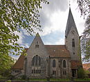
St. Martin Church | The church, which was built by Eduard Wendebourg on the site of the previous one, which burned down after a lightning strike in 1905 and consecrated in 1907, is the third church on this site. The von Bennigsen family exercises patronage . The building is 32.1 m long and the tower is 48.2 m high. |
 More pictures |
|
| Am Gut 6 52 ° 14 ′ 10 ″ N, 9 ° 40 ′ 8 ″ E |
Mansion | The seat of the von Bennigsen family, built as a moated castle in 1311 and supplemented into the 19th century. After 1990 a hall from the 17th century and a barn from the 18th were prepared for concerts. The historic park with rare trees is 4.5 hectares and is under nature protection. | ||
| At Gut 6 52 ° 14 '14 "N, 9 ° 40' 10" E |
Well | Farm yard of the property. First mentioned in 1629, rebuilt after the Thirty Years' War. Gate entrance with arch from the beginning of the 18th century, manor barn 1803. |
 More pictures |
|
| At 11 52 ° 14 ′ 16 ″ N, 9 ° 40 ′ 8 ″ E |
Rectory | Today there is a kindergarten here. |

|
|
| At Gut 12 52 ° 14 ′ 11 ″ N, 9 ° 40 ′ 13 ″ E |
Mill | The water mill was part of the estate. Of the mill mentioned in 1428, only the water wall is made of quarry stone. The remaining parts of the building date from the middle of the 19th century. |

|
|
| At Gut 14 52 ° 14 ′ 11 ″ N, 9 ° 40 ′ 14 ″ E |
Residential building | The house is probably Bennigsen's oldest four-column building. |

|
|
| At 17 52 ° 14 ′ 12 ″ N, 9 ° 40 ′ 10 ″ E |
Residential building |

|
||
| Hauptstrasse / Schusterhöfe 52 ° 14 ′ 20 ″ N, 9 ° 40 ′ 4 ″ E |
cenotaph | An obelisk with a circular surrounding wall erected by the Bennigsen community in 1878 serves as a memorial for those who died and those who participated in the wars of 1866 and 1870/71. The names of the Bennigs who died in the First World War were later added to plaques on the wall. |

|
|
| Hauptstrasse 2 52 ° 14 ′ 23 ″ N, 9 ° 39 ′ 57 ″ E |
Residential building | The house was built around 1900. |

|
|
| Hauptstrasse 5 52 ° 14 ′ 21 ″ N, 9 ° 39 ′ 58 ″ E |
Residential building | The house was built around 1900. |

|
|
| Hauptstrasse 11 52 ° 14 ′ 20 ″ N, 9 ° 40 ′ 9 ″ E |
Residential building | House built around 1900 in a courtyard. Single storey plastered quarry stone building. |

|
|
| Hüpeder Straße 52 ° 14 ′ 27 ″ N, 9 ° 40 ′ 36 ″ E |
graveyard |

|
||
| Meierhofweg 52 ° 14 ′ 11 ″ N, 9 ° 39 ′ 54 ″ E |
monument | War memorial 1866-1949 |

|
|
| Meierhofweg 2 52 ° 14 ′ 11 ″ N, 9 ° 39 ′ 57 ″ E |
Mansion | The new mansion was built between 1863 and 1864. The villa built by Laves in the manor park served Rudolf von Bennigsen as a retirement home. |

|
|
| Schusterhöfe 2 52 ° 14 ′ 20 ″ N, 9 ° 40 ′ 4 ″ E |
Residential building | The house of a former Halbmeierhof was built around 1680, the side wings were added in the first half of the 19th century. Residence of the manor II, which was created by division in 1850. |

|
Boitzum
| location | designation | description |
ID |
image |
|---|---|---|---|---|
| Am Thie 52 ° 8 '59 "N, 9 ° 41' 36" E |
chapel | The chapel was built in 1748. |

|
|
| Am Thie 23 52 ° 9 ′ 0 ″ N, 9 ° 41 ′ 39 ″ E |
Courtyard |

|
City of Eldagsen
| location | designation | description |
ID |
image |
|---|---|---|---|---|
| Am Gehlenbach 14 52 ° 10 ′ 19 ″ N, 9 ° 39 ′ 8 ″ E |
barn | Lengthways barn made of quarry stone masonry. |

|
|
| Am Wöhlbach 1-3 52 ° 10 ′ 13 ″ N, 9 ° 39 ′ 50 ″ E |
Paterhof | One of the three estates in Eldagsen. The Paterhof probably belonged to the Marienrode monastery in Neuhof / Hildesheimer Wald / Marienrode near Hildesheim . The estate was destroyed in the Thirty Years War . The house was built in the first half of the 18th century, the other buildings were built in the 19th century. |

|
|
| Am Wöhlbach 9 52 ° 10 ′ 13 ″ N, 9 ° 39 ′ 41 ″ E |
Former school | The former school was built in 1821. |

|
|
| Am Wöhlbach 13 52 ° 10 ′ 12 ″ N, 9 ° 39 ′ 37 ″ E |
Lower parish | Wall stud construction on a high basement. One of the oldest buildings in Eldagsen. Renovated in 1779. |

|
|
| Brückenstrasse 4 52 ° 10 ′ 19 ″ N, 9 ° 39 ′ 15 ″ E |
Residential building |

|
||
| Kirchhofstrasse 52 ° 10 ′ 7 ″ N, 9 ° 39 ′ 43 ″ E |
graveyard |

|
||
| Knickstrasse 52 ° 10 ′ 19 ″ N, 9 ° 39 ′ 19 ″ E |
Jewish Cemetery | The cemetery was occupied from 1753 to 1937. |

|
|
| State road 422 52 ° 9 ′ 55 ″ N, 9 ° 37 ′ 11 ″ E |
bridge | The natural stone vault bridge over the New Gehlenbach was built in 1837. |

|
|
| Lange Straße 38 52 ° 10 ′ 16 ″ N, 9 ° 39 ′ 24 ″ E |
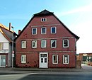
Residential building |
|
||
| Lange Straße 62 52 ° 10 ′ 16 ″ N, 9 ° 39 ′ 34 ″ E |
Residential building |

|
||
| Lange Straße 63 52 ° 10 ′ 17 ″ N, 9 ° 39 ′ 36 ″ E |
cenotaph | The memorial (erected on private property during the Prussian era) commemorates the battle of Langensalza in 1866. |

|
|
| Lange Straße 64 52 ° 10 ′ 16 ″ N, 9 ° 39 ′ 35 ″ E |

|
|||
| Lange Straße 92 52 ° 10 ′ 16 ″ N, 9 ° 39 ′ 50 ″ E |
Residential building |

|
||
| Lange Straße 95 52 ° 10 ′ 16 ″ N, 9 ° 39 ′ 54 ″ E |
City fortifications | Remnants of the city fortifications have been preserved on the stable building. |

|
|
| Lange Straße 96 52 ° 10 ′ 15 ″ N, 9 ° 39 ′ 51 ″ E |
Residential building |

|
||
| Lange Straße 107 52 ° 10 ′ 16 ″ N, 9 ° 39 ′ 59 ″ E |
Yard |

|
||
| Lange Straße 110 52 ° 10 ′ 15 ″ N, 9 ° 39 ′ 57 ″ E |
Residential building |

|
||
| Lange Straße 125 52 ° 10 ′ 17 ″ N, 9 ° 40 ′ 5 ″ E |
Residential building |

|
||
| Lange Straße 142 52 ° 10 ′ 17 ″ N, 9 ° 40 ′ 11 ″ E |
Residential building |

|
||
| Marktplatz 1 52 ° 10 ′ 14 ″ N, 9 ° 39 ′ 38 ″ E |
Rectory | The current rectory was built in 1816 in place of the previous building from 1642. It is a two-story house with seven axes. |

|
|
| Marktplatz 2 52 ° 10 ′ 15 ″ N, 9 ° 39 ′ 36 ″ E |
church | The origin of the church goes back to the year 1180. The church burned down in 1626. The tower was rebuilt from 1663 to 1673. The hall building was built from 1704. |

|
|
| Marktplatz 2 52 ° 10 ′ 15 ″ N, 9 ° 39 ′ 37 ″ E |
cenotaph |

|
||
| Marktstrasse 6 52 ° 10 ′ 14 ″ N, 9 ° 39 ′ 32 ″ E |
Residential building |

|
||
| Nonnenmühle 52 ° 10 ′ 24 "N, 9 ° 40 ′ 49" E |
Nun mill | Watermill with buildings and watercourses on the New Gehlenbach below Eldagsen. | ||
| Obergutstrasse 2 52 ° 10 ′ 21 ″ N, 9 ° 39 ′ 5 ″ E |
Obergut |
 More pictures |
||
| Obergutstrasse 2 52 ° 10 ′ 23 ″ N, 9 ° 39 ′ 11 ″ E |
park | Manor park of the obergut | ||
| Pfarrstrasse 1 52 ° 10 ′ 16 ″ N, 9 ° 39 ′ 48 ″ E |
Wall stand construction | Two-storey wall stud construction built around 1800. Street side with horizontal board cladding. |

|
|
| Pfarrstrasse 15 52 ° 10 ′ 14 ″ N, 9 ° 39 ′ 43 ″ E |
Courtyard | Courtyard from the 2nd half of the 18th century. The farm yard was once surrounded by buildings on all sides. |

|
|
| Schützenplatz 52 ° 10 ′ 15 ″ N, 9 ° 39 ′ 3 ″ E |
cenotaph |

|
Gestorf
| location | designation | description |
ID |
image |
|---|---|---|---|---|
| B 3, kilometer 18.330 52 ° 12 ′ 27 ″ N, 9 ° 44 ′ 48 ″ E |
bridge | Bridge on Bundesstrasse 3 over the Gestorfer Beeke. The keystone is decorated with a royal monogram. |

|
|
| Gograph angle 1 52 ° 12 ′ 51 ″ N, 9 ° 42 ′ 1 ″ E |
Residential building | The house is almost a cubic structure and therefore looks a bit strange in its proportions. |

|
|
| Hannoversche Strasse 32 52 ° 13 ′ 2 ″ N, 9 ° 42 ′ 19 ″ E |
Estate | Farm yard of the estate (Gut I) around the manor house in Neustadtstrasse. |

|
|
| Hannoversche Strasse 42 52 ° 13 ′ 6 ″ N, 9 ° 42 ′ 31 ″ E |
Good III | Gut III was probably created as a merger of several Vollmeierhöfe. Manor house built around 1800, additional storeys in 1860. |

|
|
| Hannoversche Strasse 44 52 ° 13 ′ 6 ″ N, 9 ° 42 ′ 34 ″ E |
Good III | Gut III was probably created as a merger of several Vollmeierhöfe. |

|
|
| Im Baumhof 2 52 ° 12 ′ 52 ″ N, 9 ° 42 ′ 17 ″ E |
Yard | The courtyard with house and barn was built around 1820. |

|
|
| In the monastery 5 52 ° 12 ′ 58 ″ N, 9 ° 41 ′ 58 ″ E |
Residential building | Double house with two entrances on the eaves. |

|
|
| In the shaft 52 ° 12 '54 "N, 9 ° 42' 18" O |
church | The tower of the church was built in the 14th century on the choir of the previous building. In 1772 the church was enlarged. |

|
|
| In the shaft 52 ° 12 '54 "N, 9 ° 42' 17" O |
Memorial stones |

|
||
| In shaft 3 52 ° 12 ′ 52 ″ N, 9 ° 42 ′ 19 ″ O |
Residential building |

|
||
| In shaft 4 52 ° 12 ′ 54 ″ N, 9 ° 42 ′ 19 ″ O |
Rectory |

|
||
| In shaft 5 52 ° 12 ′ 52 ″ N, 9 ° 42 ′ 18 ″ O |
Residential building |

|
||
| In shaft 7 52 ° 12 '53 "N, 9 ° 42' 17" O |
Former school | The design of the house is attributed to Conrad Wilhelm Hase . The school building was built in 1863. |

|
|
| In shaft 8 52 ° 12 ′ 55 ″ N, 9 ° 42 ′ 15 ″ O |
Residential building |

|
||
| In shaft 9 52 ° 12 '54 "N, 9 ° 42' 13" O |
Good II |

|
||
| In shaft 11 52 ° 12 '54 "N, 9 ° 42' 11" O |
Good II |

|
||
| Neustadtstrasse 14 52 ° 12 ′ 58 ″ N, 9 ° 42 ′ 22 ″ E |
Mansion |

|
||
| Neustadtstrasse 31 52 ° 12 ′ 55 ″ N, 9 ° 42 ′ 26 ″ E |
Elementary school | The building of today's Gestorf elementary school was built in 1901 as a primary school building. |

|
|
| Völksener Strasse 52 ° 12 ′ 53 ″ N, 9 ° 41 ′ 29 ″ E |
Jewish Cemetery | The cemetery is outside the village on the road to Völksen. The first occupation of the cemetery took place in 1783. |

|
Holtensen
| location | designation | description |
ID |
image |
|---|---|---|---|---|
| Dorfstrasse 31 52 ° 9 ′ 31 ″ N, 9 ° 40 ′ 27 ″ E |
church | The church was built from 1803 to 1804. |

|
|
| Dorfstrasse 33 52 ° 9 ′ 31 ″ N, 9 ° 40 ′ 29 ″ E |
Rectory | |||
| Freimannstrasse 2 52 ° 9 ′ 29 ″ N, 9 ° 40 ′ 25 ″ E |
Hall house | Main house in a courtyard | ||
| Kohlbergstrasse 8 52 ° 9 ′ 27 ″ N, 9 ° 40 ′ 17 ″ E |
Residential building | The single-storey, elongated wall stud construction was built around 1830. | ||
| District Road 24 52 ° 9 ′ 25 ″ N, 9 ° 40 ′ 11 ″ E |
Ludersen
| location | designation | description |
ID |
image |
|---|---|---|---|---|
| At the defense tower 11 52 ° 15 ′ 12 ″ N, 9 ° 40 ′ 19 ″ E |
Parish church |

|
||
| At the defense tower 14 52 ° 15 ′ 13 ″ N, 9 ° 40 ′ 19 ″ E |
Residential building | The hall house on a sandstone base was built in the middle of the 19th century. |

|
|
| Hainsood 4 52 ° 15 ′ 13 ″ N, 9 ° 40 ′ 19 ″ E |
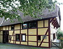
Hall house | Main house of the yard. |
|
|
| Hiddestorfer Strasse 8 52 ° 15 ′ 6 ″ N, 9 ° 40 ′ 29 ″ E |
Courtyard | All buildings in the courtyard behind a brick wall were built from bricks. |

|
|
| Hiddestorfer Strasse 11 52 ° 15 ′ 8 ″ N, 9 ° 40 ′ 26 ″ E |
Courtyard | The four-column main house and longitudinal barn of a courtyard were built around 1800. |

|
|
| At Griesenwinkel 3 52 ° 15 ′ 14 ″ N, 9 ° 40 ′ 28 ″ E |
Hall house | Main house of the yard. The elongated one-story half-timbered building was built in 1780. |

|
Mittelrode
| location | designation | description |
ID |
image |
|---|---|---|---|---|
| 52 ° 12 ′ 3 ″ N, 9 ° 40 ′ 0 ″ E | Good Bockerode | The estate is located southeast of the village. It was first mentioned around 1500. The oldest house today is the mansion from 1736. The mansion is a two-story, six-axle house with a half-hip roof. A new mansion from 1868 still stands on the estate. |

|
|
| Rodelandstrasse 3 52 ° 12 ′ 20 ″ N, 9 ° 39 ′ 2 ″ E |
cenotaph |

|
||
| To Hallermühle 27 52 ° 11 ′ 58 ″ N, 9 ° 38 ′ 50 ″ E |
Hallermühle | The Hallermühle used to belong to the von Jeinsen estate (Gut I) in Gestorf. The year of construction is unknown; the mill is mentioned for the first time in 1766. The current house was built in 1860. |

|
Jump
| location | designation | description |
ID |
image |
|---|---|---|---|---|
| Old surcharge 52 ° 13 ′ 25 ″ N, 9 ° 30 ′ 54 ″ E |
cenotaph | The König-Ernst-August-Jagdstein, off the trail in the Meinsberg natural forest . | ||
| Am Markt 52 ° 12 ′ 31 ″ N, 9 ° 33 ′ 17 ″ E |
Fountain | The fountain was built in 1903. The street Am Markt has been expanded so that a market can be held here. Today the street Am Markt is a pedestrian zone. There is a wrought iron socket on the fountain. |

|
|
| Am Markt 1 52 ° 12 ′ 31 ″ N, 9 ° 33 ′ 18 ″ E |
Agricultural bourgeoisie | The so-called Petersche Haus is on the corner of Burgstrasse. It is one of the few houses that survived the Thirty Years War and the fires of 1713 and 1780. It was probably built in 1616 or 1619. The house is a three-storey half-timbered house with a gorge on the corner of Burgstrasse, the gable faces Am Markt street. The fillers are richly decorated. |

|
|
| Am Markt 3 52 ° 12 ′ 31 ″ N, 9 ° 33 ′ 17 ″ E |
Agricultural bourgeoisie |

|
||
| Am Markt 5 52 ° 12 ′ 31 ″ N, 9 ° 33 ′ 17 ″ E |

|
|||
| Am Markt 9 52 ° 12 ′ 31 ″ N, 9 ° 33 ′ 16 ″ E |
Agricultural bourgeoisie | The half-timbered house with an utlucht was built in 1738. |

|
|
| Am Markt 11 52 ° 12 ′ 30 ″ N, 9 ° 33 ′ 15 ″ E |

|
|||
| Am Markt 13 52 ° 12 ′ 30 ″ N, 9 ° 33 ′ 15 ″ E |

|
|||
| Am Markt 14 52 ° 12 ′ 30 ″ N, 9 ° 33 ′ 13 ″ E |
Agricultural bourgeoisie | The building has a loft on the side facing St.-Andreas-Straße. |

|
|
| Am Markt 15 52 ° 12 ′ 30 ″ N, 9 ° 33 ′ 14 ″ E |

|
|||
| Am Markt 17 52 ° 12 ′ 31 ″ N, 9 ° 33 ′ 14 ″ E |
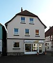
Residential and commercial building |
|
||
| At the church 52 ° 12 ′ 27 ″ N, 9 ° 33 ′ 17 ″ E |
church | St. Andrew's Church was built in the 15th century. It is a three-aisled church with a tower and a detached choir. Parts of the tower date from the 13th century. In 1682 the church was rebuilt in the Baroque style. From 1860 to 1862 the church was expanded. Inside there is a baptismal font from around 1500. |
 More pictures |
|
| At the church 1 52 ° 12 ′ 28 ″ N, 9 ° 33 ′ 16 ″ E |
Rectorate | The house was built in 1780. |

|
|
| At church 4 52 ° 12 ′ 26 ″ N, 9 ° 33 ′ 15 ″ E |
Parish widow house | The building is by the St. Andrew's Church. |

|
|
| In the Burghof 1 52 ° 12 ′ 25 ″ N, 9 ° 33 ′ 26 ″ E |
Amtshof | Courtyard. Former administrative court, since 1884 seat of the district administration Springe, since 1974 city administration Springe. |

|
|
| In the castle courtyard 1A 52 ° 12 ′ 27 ″ N, 9 ° 33 ′ 21 ″ E |
Amtshof | Farm buildings of the later domain in the former courtyard. Today the local museum Springe . |

|
|
|
B 217 52 ° 11 ′ 30 "N, 9 ° 31 ′ 47" E |
cenotaph | Here is a memorial stone for the Sedemünder desert |

|
|
| Bahnhofstrasse 52 ° 12 ′ 36 ″ N, 9 ° 33 ′ 30 ″ E |
cenotaph | Cenotaph of the town of Springe for those who fell in the war against France 1870–71 |

|
|
| Bahnhofstrasse 50 52 ° 12 ′ 53 ″ N, 9 ° 33 ′ 26 ″ E |
Railway station restaurant |

|
||
| Bohnstrasse 3 52 ° 12 ′ 32 ″ N, 9 ° 33 ′ 24 ″ E |
Agricultural bourgeoisie |

|
||
| Bohnstrasse 6 52 ° 12 ′ 31 ″ N, 9 ° 33 ′ 14 ″ E |
Agricultural bourgeoisie |

|
||
| Bohnstrasse 10 52 ° 12 ′ 30 ″ N, 9 ° 33 ′ 25 ″ E |
Agricultural bourgeoisie | The building was erected in 1748. |

|
|
| Bohnstrasse 16 52 ° 12 ′ 29 ″ N, 9 ° 33 ′ 25 ″ E |
Agricultural bourgeoisie |

|
||
| Burgstrasse 1 52 ° 12 ′ 31 ″ N, 9 ° 33 ′ 19 ″ E |
Residential building |

|
||
| Burgstrasse 12 52 ° 12 ′ 28 ″ N, 9 ° 33 ′ 19 ″ E |
Agricultural bourgeoisie | The inscription states the year 1769 |

|
|
| Dammtor 2 52 ° 12 ′ 24 ″ N, 9 ° 33 ′ 19 ″ E |
Agricultural bourgeoisie |

|
||
| Dahle 52 ° 11 ′ 53 ″ N, 9 ° 31 ′ 6 ″ E |
Dahle domain | A building with well-fortified quarry stone walls |

|
|
| Echternstrasse 4 52 ° 12 ′ 27 ″ N, 9 ° 33 ′ 5 ″ E |
Agricultural bourgeoisie |

|
||
| Echternstrasse 16 52 ° 12 ′ 25 ″ N, 9 ° 33 ′ 6 ″ E |
Agricultural bourgeoisie |

|
||
| Echternstrasse 20 52 ° 12 ′ 25 ″ N, 9 ° 33 ′ 7 ″ E |

|
|||
| Echternstrasse 25 52 ° 12 ′ 25 ″ N, 9 ° 33 ′ 11 ″ E |
Residential building |

|
||
| Echternstrasse 29 52 ° 12 ′ 26 ″ N, 9 ° 33 ′ 13 ″ E |
Residential building |

|
||
| Echternstrasse 30 52 ° 12 ′ 25 ″ N, 9 ° 33 ′ 11 ″ E |
Agricultural bourgeoisie |

|
||
| Echternstrasse 32 52 ° 12 ′ 25 ″ N, 9 ° 33 ′ 12 ″ E |
Residential building | The two-storey, eaves-standing house was built according to the design of the Pattens houses after the fire in the 18th century. |

|
|
| Echternstrasse 42 52 ° 12 ′ 25 ″ N, 9 ° 33 ′ 15 ″ E |

|
|||
| Echternstrasse 54 52 ° 12 ′ 25 ″ N, 9 ° 33 ′ 19 ″ E |
Residential building |

|
||
| Saupark Forestry Office 52 ° 11 ′ 20 ″ N, 9 ° 34 ′ 25 ″ E |
Hunting lodge | Hunting lodge and both gentlemen's houses |

|
|
| Saupark Forestry Office 52 ° 11 ′ 33 ″ N, 9 ° 34 ′ 32 ″ E |
Kaiserallee |

|
||
| Forsthaus Köllnischfeld 52 ° 14 ′ 11 ″ N, 9 ° 31 ′ 15 ″ E |
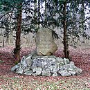
cenotaph | Memorial for forest workers who fell in World War I. |
|
|
| Forsthaus Köllnischfeld 52 ° 14 ′ 16 ″ N, 9 ° 31 ′ 17 ″ E |
Forest workers' houses |

|
||
| Behind the castle 1 52 ° 12 ′ 34 ″ N, 9 ° 33 ′ 32 ″ E |
school-building |

|
||
| Ostwall 6 52 ° 12 ′ 32 ″ N, 9 ° 33 ′ 27 ″ E |
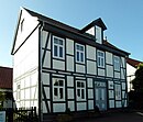
Residential building |
|
||
| Saupark; K 213 52 ° 11 ′ 26 ″ N, 9 ° 36 ′ 13 ″ E |
Forest house, outbuilding | One-story sandstone building in front of the Eispfad forestry service farm. |

|
|
| Saupark; L 461 52 ° 10 ′ 32 "N, 9 ° 36 ′ 28" E |
Forest service building | The sandstone buildings as on the eastern edge of the Saupark in the direction of Eldagsen. Such as the forester's house Mühlenbrink. |

|
|
| St.-Andreas-Strasse 1 52 ° 12 ′ 29 ″ N, 9 ° 33 ′ 14 ″ E |

|
|||
| St.-Andreas-Strasse 2 52 ° 12 ′ 29 ″ N, 9 ° 33 ′ 14 ″ E |
Residential building |

|
||
| St.-Andreas-Strasse 4 52 ° 12 ′ 28 ″ N, 9 ° 33 ′ 14 ″ E |
Agricultural bourgeoisie |

|
||
| St.-Andreas-Strasse 8 52 ° 12 ′ 27 ″ N, 9 ° 33 ′ 15 ″ E |
Residential building |

|
||
| Unter dem Ebersberge 52 ° 12 ′ 31 ″ N, 9 ° 32 ′ 0 ″ E |
Göbelbastei | The Göbelbastei is intended to commemorate Heinrich Göbel . This claimed that he invented the light bulb. |

|
|
| Völksener Strasse 52 ° 12 ′ 39 ″ N, 9 ° 33 ′ 35 ″ E |
graveyard | the old cemetery jump |

|
|
| Völksener Strasse 52 ° 12 ′ 40 ″ N, 9 ° 33 ′ 35 ″ E |
chapel | in the old cemetery |

|
|
| Völksener Strasse 52 ° 12 ′ 34 ″ N, 9 ° 33 ′ 39 ″ E |
graveyard | The cemetery, which was used from the end of the 19th century to 1938, is a protected cultural monument. There are two tombstones in the cemetery. | ||
| To Niederntor 7 52 ° 12 ′ 34 ″ N, 9 ° 33 ′ 27 ″ E |

|
|||
| To Niederntor 26 52 ° 12 ′ 32 ″ N, 9 ° 33 ′ 19 ″ E |
Old Town Hall |

|
||
| To Oberntor 1 52 ° 12 ′ 31 ″ N, 9 ° 33 ′ 12 ″ E |
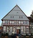
Ratskeller | Today's Ratskeller was built as a town hall in 1638. It is a two-story half-timbered house with a gable roof. The town hall was in the building until 1775, the administration until 1846. When it was converted into a restaurant, the building was largely rebuilt. |
|
|
| To Oberntor 2 52 ° 12 ′ 31 ″ N, 9 ° 33 ′ 12 ″ E |
District Court | The district court was built in 1775, it is a two-story half-timbered house with a hipped roof. The basement is very high. The side facing the street has nine axes, the three central axes form a risalit, above the risalit there is a triangular gable. |

|
|
| To Oberntor 7 52 ° 12 ′ 30 ″ N, 9 ° 33 ′ 10 ″ E |
Residential building |

|
||
| To Oberntor 9 52 ° 12 ′ 30 ″ N, 9 ° 33 ′ 9 ″ E |
Residential building |

|
||
| To Oberntor 11 52 ° 12 ′ 30 ″ N, 9 ° 33 ′ 9 ″ E |
Residential and commercial building |

|
||
| To Oberntor 13 52 ° 12 ′ 30 ″ N, 9 ° 33 ′ 8 ″ E |
Residential building | The building was erected in 1827. |

|
|
| To Oberntor 30 52 ° 12 ′ 30 ″ N, 9 ° 33 ′ 1 ″ E |
Residential building | The wall stud house was built around 1800. It was designated as the birthplace of Heinrich Göbel in 1929 . According to recent results of the source research, however, it is not the birthplace. |

|
Völksen
| location | designation | description |
ID |
image |
|---|---|---|---|---|
| Alte Töpferstrasse 14 52 ° 12 ′ 54 ″ N, 9 ° 37 ′ 23 ″ E |
Courtyard | The house as part of the courtyard was built in the first half of the 18th century. |

|
|
| Bohlweg 3 52 ° 12 ′ 54 ″ N, 9 ° 37 ′ 23 ″ E |
Residential building |

|
||
| Bohlweg 22 52 ° 12 ′ 47 ″ N, 9 ° 37 ′ 34 ″ E |
Residential building | House in a courtyard. Brick construction with a central bay house. |

|
|
| In the Ahnt 52 ° 12 ′ 48 ″ N, 9 ° 37 ′ 55 ″ E |
graveyard | The cemetery is in the south of the village. |

|
|
| Kirchstrasse 9 52 ° 12 ′ 56 ″ N, 9 ° 37 ′ 28 ″ E |
Rectory | The rectory dates from 1854. The house has five axes and is strictly symmetrical. The house has a hipped roof. |

|
|
| Kirchstrasse 11 52 ° 12 ′ 57 ″ N, 9 ° 37 ′ 31 ″ E |
church | The current church dates from the 17th century. A church has stood on the site of today's church since the 12th century, parts of the tower are from this time. In 1874 the interior of the church was redesigned according to plans by Conrad Wilhelm Hase . |

|
|
| Play castle 52 ° 12 ′ 55 ″ N, 9 ° 37 ′ 58 ″ E |
Jewish Cemetery | The only remaining grave in the cemetery dates from 1835. The first occupancy is not known. |
 More pictures |
|
| Steinhauerstrasse 52 ° 13 ′ 1 ″ N, 9 ° 37 ′ 41 ″ E |
Fountain |

|
||
| Steinhauerstrasse 52 ° 12 ′ 55 ″ N, 9 ° 37 ′ 58 ″ E |
cenotaph |

|
||
| Steinhauerstraße 9 52 ° 12 ′ 52 ″ N, 9 ° 37 ′ 40 ″ E |
Residential building | The house is a single storey residential building. |

|
|
| Steinhauerstrasse 23 52 ° 12 ′ 58 ″ N, 9 ° 37 ′ 40 ″ E |
Courtyard | Dreiseithof from the middle of the 19th century. Brick building with a central bay window. |

|
|
| Steinhauerstrasse 35 52 ° 13 ′ 1 ″ N, 9 ° 37 ′ 36 ″ E |
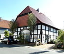
Residential building | The four-column hall house was built in 1804. |
|
|
| Steinkrüger Strasse 2/4 52 ° 13 ′ 8 ″ N, 9 ° 37 ′ 23 ″ E |
grange | A manor has been documented here since 1585. The buildings are partly made of quarry stone and partly of half-timbering. |

|
Wülfinghausen
| location | designation | description |
ID |
image |
|---|---|---|---|---|
| 52 ° 8 ′ 27 "N, 9 ° 39 ′ 53" E | Monastery property | The Wülfinghausen monastery was founded in 1236. The convent building, monastery property and ancillary building, rebuilt in 1740, form a unit. |
 More pictures |
|
| 52 ° 8 ′ 26 "N, 9 ° 40 ′ 0" E | Monastery garden | Park and ponds. |
 More pictures |
|
| 52 ° 8 ′ 27 "N, 9 ° 39 ′ 46" E | chapel | Cemetery chapel. | ||
| 52 ° 8 ′ 26 "N, 9 ° 39 ′ 46" E | graveyard |
Former architectural monuments
| location | designation | description |
ID |
image |
|---|---|---|---|---|
| Boitzum Am Thie 15 52 ° 9 ′ 3 ″ N, 9 ° 41 ′ 33 ″ E |
Bakehouse | The bakery probably dates from the middle of the 18th century. In the meantime it has given way to a newly built residential building. | ||
| Jump Am Markt 7 52 ° 12 ′ 31 ″ N, 9 ° 33 ′ 17 ″ E |

|
|||
| Jump Forsthaus Köllnischfeld 52 ° 14 ′ 10 ″ N, 9 ° 31 ′ 13 ″ E |
hut | Small forest workers hut. Plastered compartments under the hipped roof. No longer available in 2019. |

|
Individual evidence
- ↑ kirchenkreis-laatzen-springe.de: Our churches
- ^ Roderic von Bennigsen: 700 Years of the Bennigsen Manor , 2011
- ↑ www.hannover.de: Rittergut Bennigsen
- ↑ www.denkmalprojekt.org: Bennigsen (Memorial), City of Springe, Region Hanover, Lower Saxony
- ^ Roderic von Bennigsen: 700 Years of the Bennigsen Manor , 2011
- ↑ Hans-Herbert Möller (Ed.): Monument topography of the Federal Republic of Germany, architectural monuments in Lower Saxony, district of Hanover. Volume 13.1, Friedrich Vieweg & Sohn, Braunschweig / Wiesbaden 1988, ISBN 3-528-06207-X , p. 280.
- ↑ Hans-Herbert Möller (Ed.): Monument topography of the Federal Republic of Germany, architectural monuments in Lower Saxony, district of Hanover. Volume 13.1, Friedrich Vieweg & Sohn, Braunschweig / Wiesbaden 1988, ISBN 3-528-06207-X , p. 280.
- ↑ Hans-Herbert Möller (Ed.): Monument topography of the Federal Republic of Germany, architectural monuments in Lower Saxony, district of Hanover. Volume 13.1, Friedrich Vieweg & Sohn, Braunschweig / Wiesbaden 1988, ISBN 3-528-06207-X , p. 283.
- ↑ Hans-Herbert Möller (Ed.): Monument topography of the Federal Republic of Germany, architectural monuments in Lower Saxony, district of Hanover. Volume 13.1, Friedrich Vieweg & Sohn, Braunschweig / Wiesbaden 1988, ISBN 3-528-06207-X , p. 281.
- ↑ Hans-Herbert Möller (Ed.): Monument topography of the Federal Republic of Germany, architectural monuments in Lower Saxony, district of Hanover. Volume 13.1, Friedrich Vieweg & Sohn, Braunschweig / Wiesbaden 1988, ISBN 3-528-06207-X , pp. 281-282.
- ↑ Hans-Herbert Möller (Ed.): Monument topography of the Federal Republic of Germany, architectural monuments in Lower Saxony, district of Hanover. Volume 13.1, Friedrich Vieweg & Sohn, Braunschweig / Wiesbaden 1988, ISBN 3-528-06207-X , p. 281.
literature
- Monument topography Federal Republic of Germany , architectural monuments in Lower Saxony, Hanover district, Volume 13.1, published by Hans-Herbert Möller , edited by Henner Hannig, Friedrich Vieweg & Son, Braunschweig / Wiesbaden, 1988. ISBN 3-528-06207-X
Web links
Commons : Architectural monuments in Springe - Collection of images, videos and audio files

