List of cultural monuments in Boppard
The list of cultural monuments in Boppard includes all the cultural monuments of the Rhineland-Palatinate city of Boppard, including the city and districts Bad Salzig , Buchenau , Buchholz , Fleckertshöhe , Herschwiesen , Hirzenach , Holzfeld , Oppenhausen , Rheinbay , Weiler and Windhausen . In the Udenhausen district and the Hübingen and Ohlenfeld districts , no cultural monuments have been identified. The basis is the list of monuments of the state of Rhineland-Palatinate (as of August 9, 2017).
Boppard
Monument zones
| designation | location | Construction year | description | image |
|---|---|---|---|---|
| Marienberg Monastery Monument Zone | Marienberger Hohl 1 layer |
1739-53 | former Benedictine convent; baroque monastery complex; Four-wing complex with tower, abbess interior with column portal, priory building, cattle house, 1739–53, architect Thomas Neurohr , Tyrol; Park |
 more pictures more pictures
|
| Monument zone of the former royal court | Koblenzer Strasse 248 location |
around 1890 | so-called royal villa, two-wing Gothic brick building, around 1890; Coach house, 1½-storey brick building, partly half-timbered, half-hipped roof; Takenplatte, 18th century; overall structure with garden | |
| Monument zone Roman fort Boppard | Kirchgasse, Mergstraße location |
after 364 | probably after 364 to 375, Roman tower |
 more pictures more pictures
|
| Monument zone Hunsrückbahn | west of the location |
1906-08 | Section of the 1906-08 line, one of the steepest sections of the Prussian State Railways; two viaducts: Rauschenloch Viaduct (km 49.4) and Hubertus Viaduct (150 m length, km 49.6); five tunnels: Hinterburden tunnel 1 (route kilometers 48.0), Hinterburden tunnel 2 (route kilometers 48.3), Rauerberg tunnel (route kilometers 49.9), Talberg tunnel (route kilometers 50.2) and Kalmut tunnel (route kilometers 51.1); further sections to Emmelshausen, Halsenbach and Kratzenburg |
 more pictures more pictures
|
Individual monuments
| designation | location | Construction year | description | image |
|---|---|---|---|---|
| city wall | 12th Century | Remains of the Roman fort , probably after 364 to 375, Roman tower; Medieval city fortifications, first extension of the Roman fort to include the Friesenviertel, 12th century, after 1327 up to the middle of the 14th century, construction of the walls around the upper and lower town
|
 more pictures more pictures
|
|
| Small hospital "House of God" | At the Alten Posthof 2 location |
16th Century | later the old post office; hook-shaped half-timbered building, partly massive, hipped roof; in the core probably from the 16th century, remodeled in the 17th and 18th centuries |
 more pictures more pictures
|
| Evangelical Christ Church | Angertstrasse location |
1850-52 | cruciform romanised hall building with pillared vestibule, 1850–52, building inspector Althoff, Koblenz; Extension and west tower 1885–87 |
 more pictures more pictures
|
| Bethesda House | On the Zeil 20b location |
1858/59 | Plastered building, stair tower, 1858/59, extension in 1904 | |
| Remnants of the city wall | Bahnhofstrasse, at No. 2 location |
Rest of the city wall on the side of the house on Rheinallee |

|
|
| Cellar building | Binger Gasse 18 location |
around 1860 | neo-Gothic cellar building, brick, around 1860 |

|
| Residential building | Binger Gasse 21 location |
around 1870 | Stately classical house, two-story plastered building, around 1870 |

|
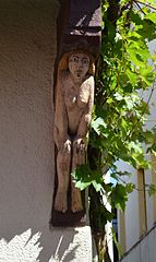
| Wooden consoles | Binger Gasse, at No. 34 Lage |
1607 | two carved wooden consoles (Adam and Eve), inscribed 1607 |
|
| House Sabelshöhe | Buchholzer Strasse 4 location |
around 1900 | Villa, around 1900; overall structure with garden | |
| Residential building | Burdengasse 1 location |
1681 | Half-timbered house, partly massive, marked 1681 |

|
| Residential building | Burdengasse 7 location |
17th century | Half-hipped roof building, plastered half-timbering, 17th century | |
| Residential and commercial building | Burgplatz 1 location |
19th century | three-storey plastered building, 19th century, part of the city wall |

|
| Electoral castle | Burgplatz 2 location |
after 1312 | Four-wing complex with two round towers, north wing extended, keep, changed soon after 1312, 1499 after fire and in the 17th century; on the east wing and on the former customs house, coat of arms of the Archbishops of Trier Karl Kaspar von der Leyen (1652–72) and Johann Hugo von Orsbeck (1672–1711) |
 more pictures more pictures
|
| Hotel "Römerburg" | Burgplatz 3 location |
around 1910 | two-storey solid construction, around 1910; Part of the city wall |
 more pictures more pictures
|
| Residential and commercial building | Burgstrasse 2 location |
around 1880 | Brick corner building, now plastered, around 1880, shop, around 1928 |

|
| Residential and commercial building | Eltzerhofstrasse 2 location |
around 1900/10 | three-storey plastered building, partly half-timbered, around 1900/10 | |
| Hotel "Zum Römer" | Eltzerhofstrasse 21 location |
second half of the 17th century | Half-timbered house, partly solid, plastered, second half of the 17th century |
 more pictures more pictures
|
| Residential and commercial building | Eltzerhofstraße 25 location |
1925 | Hipped mansard roof, marked 1925 |
 more pictures more pictures
|
| villa | Flogtstrasse 48 location |
around 1900 | Brick villa, around 1900 |

|
| Post office | Heerstrasse 177 location |
1895 | former post office; neo-Romanesque plastered building, 1895 |

|
| Acid Storm | Heerstrasse, next to No. 195 Lage |
Round tower on the southwest corner of the Niederstadt fortification, which was disturbed by the construction of the railway, partially demolished and rebuilt 1906-08; Part of the city wall |

|
|
| Residential building | Back alley 3 location |
1551 | Stately half-timbered house, marked 1551 and 1553, gable and roof from the 19th century |

|
| Residential building | Humperdinckstrasse 12 location |
around 1890 | Plastered building, partly half-timbered in the style of the 17th century, around 1890 |

|
| Residential building | Humperdinckstrasse 14 location |
around 1910 | Plastered building with weak gable projections, around 1910 |

|
| Humperdinckschlösschen | Humperdinckstrasse 25 location |
around 1870 | late classicist villa, around 1870, from 1897 to 1900 the main residence of the composer Engelbert Humperdinck ; overall structure with park |

|
| Catholic Carmelite Church and former Carmelite monastery | Karmeliterstrasse location |
1320 | Catholic Carmelite Church and former Carmelite monastery ; originally towerless hall, under construction in 1320, side aisle 1439–44; Monastery, simple baroque complex, marked 1730; overall structural system |
 more pictures more pictures
|
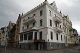
| Hotel "Karmeliterhof" | Karmeliterstraße 1/3 location |
after 1867 | former hotel "Karmeliterhof"; three-storey semi-detached house in the Tudor Gothic style, after 1867 |
 more pictures more pictures
|
| Stucco tondo | Koblenzer Straße, at No. 194 Lage |
in the middle of the 19th century | Stucco tondo with allegorical female figure, mid-19th century |

|
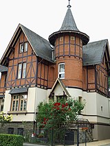
| villa | Koblenzer Straße 205 location |
around 1900 | Villa, partly half-timbered (brick shelves), round tower, local style, around 1900 |
|
| villa | Koblenzer Straße 236 location |
around 1900 | Brick villa with sandstone structure, neo-renaissance, around 1900 |

|
| Residential building | Way of the Cross 1 position |
1737 | Half-timbered building, mansard roof, marked 1737, slated west wing with tower, 19th century |

|
| White villa | Way of the Cross 2-4 location |
1875 | representative villa; classicist building with tower, 1875; overall structure with garden |

|
| Schunk's cross | Kreuzweg, corner of Rheinallee Lage |
1739 | Crucifixion group, marked 1739 |
 more pictures more pictures
|
| Catholic Parish Church of St. Severus | Kronengasse 3 location |
first quarter of the 12th century | former collegiate church; three-aisled gallery basilica, first half of the 13th century, choir flank towers possibly from the first quarter of the 12th century; outside crucifixion group of the former cemetery, inscribed 1516 |
 more pictures more pictures
|
| Residential building | Kronengasse 8 location |
16th Century | three-storey half-timbered house, partly massive, half-hip roof, 16th century |
 more pictures more pictures
|
| Franciscan convent of St. Martin | Mainzer Strasse 8 location |
1766-68 | former Franciscan convent of St. Martin; Klosterkirche Saalbau, 1766–68, portal with neo-Gothic sculpture of St. John; West wing of the former monastery building, the core from the 18th century, modified in the 19th and 20th centuries, the north wing from the 19th century |
 more pictures more pictures
|
| High cross | Mainzer Strasse, at no. 8 on the Rhine location |
1620 | So-called Hohes Kreuz, marked 1620, renewed in 1947 after being destroyed | |
| facade | Mainzer Straße, at No. 15 location |
around 1870 | Plastered facade of a villa, around 1870 |

|
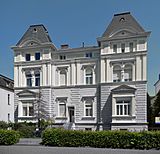
| villa | Mainzer Straße 16/18 location |
around 1890 | stately double villa, mezzanine, around 1890; overall structure with garden |
|
| villa | Mainzer Strasse 17 location |
around 1870 | Tuscan style villa around 1870; overall structure with garden |

|
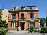
| villa | Mainzer Strasse 20 location |
around 1870 | Brick villa, neo-renaissance, around 1870; overall structure with garden |
|
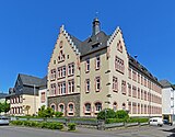
| Kant high school | Mainzer Strasse 24 location |
three-storey two-wing plastered building, neo-renaissance, 1903-06, extension in 1945; two-storey director's apartment building |
 more pictures more pictures
|
|
| villa | Mainzer Strasse 29 location |
1863 | Gothic brick villa, three-storey polygonal corner tower, 1863; overall structure with garden |

|
| villa | Mainzer Strasse 40 location |
around 1902 | Brick villa, hipped mansard roof, around 1902; overall structure with garden |

|
| villa | Mainzer Strasse 41 location |
around 1890 | Villa, around 1890; overall structure with garden |

|
| villa | Mainzer Strasse 46 location |
around 1875 | late classicist villa, around 1875; overall structure with garden |

|
| villa | Mainzer Strasse 54 location |
around 1870 | late classicist plastered villa, mezzanine, around 1870; overall structure with garden |

|
| villa | Marienberger Strasse 7 location |
around 1905 | neo-Gothic villa, around 1905 |

|
| Fountain | Marketplace location |
1854 | Well, basalt lava, marked 1854 |
 more pictures more pictures
|
| Residential and commercial building | Marktplatz 2 location |
around 1860 | Plastered building with rounded corner, around 1860 |

|
| Residential and commercial buildings | Marketplace 3/4 position |
16th Century | No. 3 four-story half-timbered house, 16th century; No. 4 four-storey half-timbered house, partly massive, late Gothic core, largely renovated in the 18th century |
 more pictures more pictures
|
| "Ratsstube" inn | Marktplatz 5 location |
1905 | Half-timbered house, marked 1905 |
 more pictures more pictures
|
| Residential building | Marktplatz 6 location |
17th century | three-storey half-timbered house, partly massive, plastered, in the core probably from the 17th century |
 more pictures more pictures
|
| Old Town Hall | Marktplatz 17 location |
1884/85 | Brick building, neo-renaissance, 1884/85 |
 more pictures more pictures
|
| Residential building | Michael-Bach-Strasse 1 location |
around 1870 | Late Classicist plastered building, corner stand bay window, around 1870 | |
| Residential building | Michael-Bach-Strasse 2 location |
around 1870 | representative hipped roof building, around 1870 | |
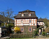
| Fondels Mill | Mühltal 8 location |
around 1760/62 | Half-timbered house, partly massive, tower-like risalit, hipped mansard roof, around 1760/62; Half-timbered house, hipped roof, 19th century; overall structural system |
|
| Holy House | Mühltal, at No. 42 location |
Holy house with baroque Mother of God | ||
| House of the Holy Spirit | Niederstadtstrasse 5 location |
16th Century | Half-timbered house, partly massive, plastered, in the core probably from the 16th century, remodeling in the 18th century, marked 1732 |

|
| Residential building | Niederstadtstrasse 7 location |
1655 | three-storey half-timbered house, partly massive, marked 1655; two-storey side wing, partly half-timbered, 18th century |
 more pictures more pictures
|
| Residential building | Niederstadtstrasse 8 location |
17th century | Half-timbered house, half-hip roof, 17th century; High water marks , including 1683, 1784; Remnants of the city wall in the garden (see there) |

|
| Residential building | Oberstrasse 58 location |
after 1885 | stately brick building, after 1885 |

|
| Commercial building | Oberstrasse 62 location |
1903 | Former practice school of the Catholic teachers' college (see Rheinallee 24); gothic plastered building, 1903; adjacent wall with gabled portal |

|
| Hotel "Deutsches Haus" | Oberstrasse 86 location |
1912 | three-storey plastered building, polygonal corner bay tower, half-hipped roof, marked 1912 |

|
| Bodenbach's house | Oberstrasse 90 location |
before 1615 | Rich three-storey half-timbered house with a wooden arbor, probably from the late Middle Ages in the core, extensive renovation marked 1615 |
 more pictures more pictures
|
| Residential and commercial building | Oberstrasse 92 location |
1906 | Residential and commercial building, Art Nouveau, 1906 | |
| Wasserfasshof | Oberstrasse 115 location |
Mid 16th century | also ark ; two-winged half-timbered house, partly massive, core from the middle of the 16th century, renovation and extension marked 1623/24, stable extension from the 19th century; Tombstone |

|
| Eltzer Hof | Oberstrasse 140/142 location |
1566 | Half-hipped roof structure, partly solid, plastered, late Gothic profiles, marked 1566; Baroque mansard hipped roof building, around 1738, connected to the old building by a corridor on the city wall; overall structural system, partly on the Roman city wall |
 more pictures more pictures
|
| Residential building | Oberstrasse 147 location |
18th century | Half-timbered house, partly massive, mansard hipped roof, 18th century |
 more pictures more pictures
|
| Votive Cross | Orgelbornstrasse 21 location |
1735 | Votive cross, basalt, marked 1735 | |
| Evangelical rectory | Pastorsgasse 9a – c location |
Late 18th century | former Protestant parish office; ten-axis early classicist plastered building, dwarf house with Palladiana , end of the 18th century |

|
| Residential building | Pützgasse 21 location |
16th Century | three-storey half-timbered house, partly massive, plastered, the core from the 16th century |

|
| Accident cross | Rheinallee, at No. 6 location |
18th century | Accident cross, basalt lava, probably from the 18th century | |
| villa | Rheinallee 19 location |
around 1910/20 | neo-baroque mansard roof villa, stair tower, around 1910/20; overall structural system with lattice and large park |
 more pictures more pictures
|
| Community Center St. Michael | Rheinallee 22 location |
former episcopal alumnate St. Michael; seven-axis plastered building with three-storey front, neo-renaissance, 1902-04, architect Joseph Mockenhaupt , Mayen |
 more pictures more pictures
|
|
| Ritter Schwalbach House | Rheinallee 23 location |
13th Century | late Gothic castle house; three-storey hipped roof building, stair tower, the core probably from the 13th century |
 more pictures more pictures
|
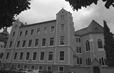
| Franciscan monastery and teacher training college | Rheinallee 24 location |
1683-86 | former Franciscan monastery with monastery church and former teacher training college, now Federal Academy for Public Administration ; Staircase of the monastery included in the teachers' college built in 1864–68; Teachers' seminar: irregular three and a half storey four-wing complex, plastered buildings with neo-Gothic stepped gables; Church: elongated, towerless hall building, 1683–86, Gothicizing Baroque; associated with the former practice school (see Oberstraße 62) |
|
| Knoodt's house | Rheinallee 26 location |
1778 | seven-axis plastered building, marked 1778, architect possibly Nikolaus Lauxen , Koblenz, extension 1896 |

|
| Hunter's House | Rheinallee 37 location |
1708 | stately baroque house from 1708 with an older core (1513) with parts of the high medieval city wall; defining the cityscape |

|
| Catholic rectory | Rheinallee 44 location |
1901 | three-storey plastered building, Neurokoko, 1901 |

|
| Josefshaus | Rheinallee 46 location |
1863-65 | former orphanage, today wing of the old people's home for the Holy Spirit ; originally two-storey plastered building, 1863–65, expanded in 1886/87, increased in 1901/02 |

|
| monument | Rheinallee, in front of No. 50 location |
1915 | gable stele in relief, artificial stone, inscribed 1915 |
 more pictures more pictures
|
| Hotel "Rheinvilla" | Rheinallee 51 location |
around 1865/70 | representative hipped roof building, classicistic gable portal, around 1865/70; overall structure with garden |

|
| villa | Rheinallee 52 location |
around 1865/70 | two and a half story villa, around 1865/70; overall structure with garden |

|
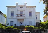
| villa | Rheinallee 53 location |
around 1865/70 | two and a half story villa, around 1865/70; overall structure with garden |
|
| Villa Belgrano | Rheinallee 55 location |
1890 | representative brick building, neo-renaissance, 1890; overall structure with garden |
 more pictures more pictures
|
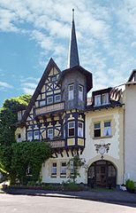
| Residential building | Ritter-Schwalbach-Straße 1 location |
around 1900 | Plastered building, partly decorative framework, around 1900 |
|
| Residential building | Sabelstrasse 26 location |
around 1900/10 | Plastered building, partly half-timbered, rich art nouveau decor, around 1900/10 | |
| House Sabelsberg | Sabelstrasse 27 location |
1910 | former vocational school St. Carolus; originally a villa with park and gatehouse, 1910; castle-like plastered building, stair tower, gatehouse, partly half-timbered; overall structure with garden and gatehouse |
 more pictures more pictures
|
| Residential building | Sabelstrasse 28 location |
around 1910 | Plastered building, rich art nouveau decor, around 1910 | |
| Templar House | Seminar street without number location |
second quarter of the 13th century | Late Staufer plastered building, second quarter of the 13th century, integrated into the Ursuline School as a chapel in 1896 and expanded in a neo-Romanesque style, reconstruction in 1956, three-storey, tower-like plastered building with three late Romanesque double arcade windows |
 more pictures more pictures
|
| villa | Simmerner Strasse 12 location |
around 1865 | Brick villa, around 1865 |

|
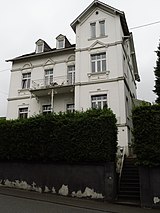
| villa | Simmerner Strasse 19 location |
around 1890 | Villa, around 1890 |
|
| Residential building | Steinstrasse 31 location |
second half of the 17th century | Half-timbered house, second half of the 17th century, extension in the 18th century |
 more pictures more pictures
|
| villa | Untere Fraubachstrasse 1 location |
around 1865/70 | Villa with house tower, around 1865/70 | |
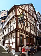
| Residential building | Untere Marktstrasse 5 location |
17th century | three-storey half-timbered house, 17th century |
 more pictures more pictures
|
| Residential building | Untere Marktstrasse 7 location |
16th Century | four-storey half-timbered house, core from the 16th century, change marked 1767 |
 more pictures more pictures
|
| Residential building | Untere Marktstrasse 8 location |
17th century | three-storey half-timbered house, plastered, essentially from the 17th century |
 more pictures more pictures
|
| Residential building | Untere Marktstrasse 9 location |
17th century | three-storey half-timbered house, partly solid, plastered, 17th century |
 more pictures more pictures
|
| Residential building | Untere Marktstrasse 10 location |
second half of the 16th century | Half-timbered house, second half of the 16th century |
 more pictures more pictures
|
| Residential building | Untere Marktstrasse 11 location |
17th century | three-storey, plastered half-timbered house, the core from the 17th century |
 more pictures more pictures
|
| Residential and commercial building | Untere Marktstrasse 24 location |
16th Century | four-storey half-timbered house, 16th century, mansard roof from the third third of the 18th century |
 more pictures more pictures
|
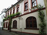
| Weinhaus "Heilig Grab" | Zelkesgasse 12 location |
around 1800 | Plastered building, around 1800 |
|
| milestone | north of the village on the B 9 to Spay Lage |
1818 | Prussian milestone , obelisk with side seat strips, 1818 |

|
| Kreuzberg Chapel | south of the location on the Kreuzberg location |
1709-24 | Kreuzberg Chapel with Way of the Cross; Stations of the Cross 1851/52; Chapel, 1709-24; Wayside cross, marked 1760; Forsthaus, half-timbered building, partly massive, marked 1769, extension in the 19th and 20th centuries; overall structural system |

|
| Stang's cross | south of the location on the Kreuzberg location |
1760 | Wayside cross, marked 1760 | |
| milestone | southeast of the location on the B 9 to St. Goar location |
1818 | Prussian milestone, obelisk with side benches, basalt, 1818 |

|
| portal | north of the location; at Jakobsberger Hof 1 location |
1601 | Basalt portal of the former monastery building, marked 1601 | |
| Jacob's Chapel | north of the location; at Jakobsberger Hof 1 location |
Hall building, essentially post-medieval, remodeling in the 18th and 19th centuries; Wayside cross, cast iron, end of the 19th century; Branch cross, early 20th century; 15 boundary stones |

|
Former cultural monuments
| designation | location | Construction year | description | image |
|---|---|---|---|---|
| Residential building | Pützgasse 1 location |
18th century | Half-timbered house, partly solid, plastered, 18th century; deleted from list of monuments |
Bad Salty
Individual monuments
| designation | location | Construction year | description | image |
|---|---|---|---|---|
| Boppard-Bad Salzig train station | At the station without a number location |
1937 | Angled slate quarry stone assembly, consisting of reception building, packing hall and
Outbuildings; homely style, 1937 |

|
| Crucifixion group | Bopparder Straße, at No. 49 location |
19th century | Crucifixion group, 19th century | |
| Residential building | Dammigstrasse 16 location |
first half of the 19th century | Half-timbered house, partly massive, first half of the 19th century | |
| Hotel "Anker im Burgfrieden" | Rheinbabenallee 1 location |
around 1925 | Plastered building with old building, around 1925; Crucifix, 18th century |

|
| Villa Frischauf | Rheinblick 4 location |
1930 | Villa, 1930, hipped mansard roof, natural slate roofing, quarry stone cellar, ground floor in solid construction, upper floor half-timbered. |

|
| Residential building | Rheinuferstraße 2 / 2a location |
1647 | Half-timbered house, partly massive, mansard roof, stair tower, marked 1647 | |
| Bathhouse | Salzbornstrasse, to No. 14 location |
1907 | three-part building complex, neo-baroque plastered building, 1907 | |
| Catholic rectory | St.-Agidius-Straße 6 location |
1905 | Plastered building, partly half-timbered, Heimatstil, 1905 | |
| Wayside cross | Sterrenbergstrasse, at No. 7 location |
1738 | Road cross, wood, marked 1738 and 1813, bronze body renewed in 1930 | |
| coat of arms | Sterrenbergstrasse, at No. 15 location |
1743 | Coat of arms, marked 1743 | |
| Catholic Parish Church of St. Aegidius | Hamlet way location |
1899-1902 | neo-Gothic relay hall, 1899–1902, architect Lambert von Fisenne , Gelsenkirchen; late Gothic west tower and choir, 15th century; outside: crucifix, second quarter of the 15th century; Mount of Olives, around 1480; in the cemetery: 22 grave crosses, 16th to 18th centuries; Grenzstein, eagle coat of arms, inscribed 1607; overall structure with cemetery and rectory |
 more pictures more pictures
|
| Myriameter stone | north of the locality on the B 9 (Rhine kilometer 567.6) location |
1867 | XL kilometer stone of the Rhine survey carried out in 1867, cubic red sandstone block with pyramid-shaped connection |
 more pictures more pictures
|
Buchenau
Monument zones
| designation | location | Construction year | description | image |
|---|---|---|---|---|
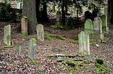
| Monument zone Judenfriedhof Boppard | northwest of the location on the L 210 location |
Early 17th century | Opened at the beginning of the 17th century (?), 130 tombstones, mainly from the end of the 19th and the first third of the 20th century, the oldest from 1605 |
 more pictures more pictures
|
Individual monuments
| designation | location | Construction year | description | image |
|---|---|---|---|---|
| Cemetery architecture | north of the village on the K 18, in the cemetery location |
from 1724 | Cemetery building, 1875; Cemetery cross, cast iron, second half of the 19th century; Kreuz, 1724; Tomb of Johann Baptist Berger , around 1888, neo-Gothic, tomb Clara Berger, around 1888 | |
| bridge | northwest of the location on the L 210 location |
1824 | Bridge, 1824, renewed |
Buchholz
Individual monuments
| designation | location | Construction year | description | image |
|---|---|---|---|---|
| Cross house | On the gardens 17 location |
first half of the 19th century | Transverse house, half-timbered plastered, first half of the 19th century | |
| Residential building | Heidestrasse 27 location |
around 1840 | former school; Slate quarrying, around 1840 | |
| Former Catholic Church of St. Sebastian | Heidestrasse 29 location |
1892-96 | dedicated, now used as an office; neo-Romanesque brick hall, 1892–96 | |
| Wayside cross | west of the location on the K 119 location |
1798 | Road cross, marked 1798 |
Fleckertshöhe
Individual monuments
| designation | location | Construction year | description | image |
|---|---|---|---|---|
| Catholic Chapel of St. Anna | Rheingoldstrasse, at No. 19a location |
1888 | neo-Gothic plastered building, 1888 |

|
Herschwiesen
Monument zones
| designation | location | Construction year | description | image |
|---|---|---|---|---|
| Monument zone Catholic parish church St. Pankratius | Pankratiusring location |
Ensemble of Catholic parish church St. Pankratius, rectory with parish barn (see Pankratiusring 6) and the curtain wall surrounding the former cemetery |
 more pictures more pictures
|
Individual monuments
| designation | location | Construction year | description | image |
|---|---|---|---|---|
| Residential building | 1 layer in the shooting trench |
18th century | Half-timbered house, half-hipped roof, oven extension, 18th century | |
| Catholic parish church of St. Pankratius | Pankratiusring location |
1744-46 | Saalbau, 1744–46, master builder Johann Neurohr, Tyrol, two sculptures, around 1750, sculptor Joseph Kindtgen , Ehrenbreitstein |
 more pictures more pictures
|
| Rectory | Pankratius ring 6 layer |
Early 17th century | former rectory; Half-timbered house, partly massive, in the core probably from the beginning of the 17th century, renovation marked 1715, extension 1930; Half-timbered barn, 18th century | |
| Residential building | Pankratiusring 21 position |
1700 | Half-timbered house, marked 1700 | |
| Wayside cross | south of the village on the K 120 to Windhausen Lage |
1748 | Wayside cross, marked 1748 | |
| Wayside cross | southeast of the village on the K 120 to Windhausen Lage |
1819 | Wayside cross, marked 1819 |

|
Hirzenach
Monument zones
| designation | location | Construction year | description | image |
|---|---|---|---|---|
| Monument zone of the former Benedictine provost in Hirzenach | Kirchstrasse / Propsteistrasse location |
after 1110 | former Benedictine provost church St. Maria and St. Johannes (see Catholic Church St. Bartholomäus), former Propsteigebuilding (see Propsteistraße 2) and former Catholic parish church St. Bartholomäus (see Kirchstraße 6) |
 more pictures more pictures
|
| Prehistoric fortifications in Hirzenach | north of the location |
The soil monument from the Iron Age is located on a prominent high plateau above the Rhine and is blocked off in the south-western part by a mighty rampart that is still several meters high. |
 more pictures more pictures
|
Individual monuments
| designation | location | Construction year | description | image |
|---|---|---|---|---|
| Catholic Church of St. Bartholomew | Kirchstrasse location |
after 1110 | former Benedictine provost church; Romanesque pillar basilica, probably started soon after 1110, nave, crossing, vestibule yoke, apse and basement tower from the first quarter of the 12th century; Western front and upper floors of the tower from the early 13th century (around 1220/30); early Gothic choir; Main portal and paradise around 1250; Churchyard with grave crosses |
 more pictures more pictures
|
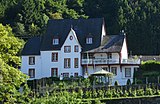
| Villa Brosius | Kirchstrasse 6 location |
former parish church of St. Bartholomew; Hall building, extension in the 19th century |
|
|
| Propsteigarten | Propsteistraße location |
first half of the 18th century | Rectangle with paths laid out at right angles with box hedges, with a small fountain in the center; first half of the 18th century |

|
| Catholic rectory | Propsteistraße 2 location |
former provost building, now a catholic rectory; stately baroque hipped mansard roof, marked 1716; In front of the main entrance the remains of a well system, marked 1569 |

|
|
| coat of arms | Propsteistraße, at No. 6 Lage |
1664 | Coat of arms, inscribed 1664 |
Wood field
Monument zones
| designation | location | Construction year | description | image |
|---|---|---|---|---|
| Memorial zone Judenfriedhof Holzfeld | north of the location; District Unterm Wingertsberg location |
in the middle of the 19th century | Opened in the middle of the 19th century, 15 tombstones from 1847 to 1924 |
 more pictures more pictures
|
Individual monuments
| designation | location | Construction year | description | image |
|---|---|---|---|---|
| Protestant church | Röhrenbornstrasse 1 location |
1769 | Hall building, 1769, medieval tower; overall structure with cemetery |
Oppenhausen
Individual monuments
| designation | location | Construction year | description | image |
|---|---|---|---|---|
| Wayside chapel | northeast of the village at the intersection of K 120 and K 119 Lage |
1850 | Slate stone hall, marked 1850 |
Rhine Bay
Individual monuments
| designation | location | Construction year | description | image |
|---|---|---|---|---|
| Catholic branch church St. Sebastian | Hauptstraße, corner of St.-Sebastian-Straße Lage |
1897-99 | Slate quarry stone hall, 1897–99 | |
| Villa Ludwigsruh | southwest of the location |
around 1900 | late historic villa, around 1900 |
hamlet
Individual monuments
| designation | location | Construction year | description | image |
|---|---|---|---|---|
| Catholic Church of St. Peter in Chains | To the Peterskirche location |
second quarter of the 13th century | Choir, second quarter of the 13th century, hall building, second half of the 13th century, roof truss dating from the time of construction; Roof turret 18th century; overall structure with cemetery |
 more pictures more pictures
|
Windhausen
Monument zones
| designation | location | Construction year | description | image |
|---|---|---|---|---|
| Monument zone Burg Schöneck | south of the location on the extension of the K 120 location |
around 1200 | Mentioned in 1222, fiefdom of Reichsministerial Philipp von Schöneck, partly since the Eltz feud (1331–36), completely Trierian since 1354, destroyed in 1618; Terraced system on ridge: only the ring wall with round shell towers and the outer bailey and two arches of the access road will be preserved; former forester's apartment in the outer bailey from 1805; the main castle was expanded in 1846 and at the beginning of the 20th century |

|
Individual monuments
| designation | location | Construction year | description | image |
|---|---|---|---|---|
| Pilgrimage Chapel to the Black Mother of God | Schönecker Strasse location |
around 1770/80 | Hall building, around 1770/80 |
 more pictures more pictures
|
| Residential building | Schönecker Strasse 9 location |
first third of the 18th century | Half-timbered house, half-hipped roof, first third of the 18th century |
literature
- General Directorate for Cultural Heritage Rhineland-Palatinate (Ed.): Informational directory of cultural monuments in the Rhein-Hunsrück district (PDF; 1.7 MB). Mainz 2017.
- Alkmar Freiherr von Ledebur (editor): The art monuments of the Rhine-Hunsrück district. Part 2.1: City of Boppard. Deutscher Kunstverlag, Munich 1988. ISBN 3-422-00567-6 .
Web links
Commons : Kulturdenkmäler in Boppard - Collection of pictures, videos and audio files
- Geoportal Rhein-Hunsrück - Map with the cultural monuments in the Rhein-Hunsrück district
Individual evidence
- ↑ a b c d e f g h i j District administration Rhein-Hunsrück-Kreis: Statutory ordinances on the protection of monument zones in the Rhein-Hunsrück-Kreis (PDF; 49 kB); Retrieved October 18, 2011
- ↑ Alkmar Freiherr von Ledebur (editor): The art monuments of the Rhine-Hunsrück district. Part 2.1: City of Boppard. Deutscher Kunstverlag, Munich 1988. ISBN 3-422-00567-6 , p. 605.
- ↑ The "Message Directory of Cultural Monuments Rhein-Hunsrück-Kreis" only shows the building with the house number 142, but the building at Oberstrasse 140 with the year 1566 is shown. Compare with the book "Alkmar Freiherr von Ledebur (editor): The art monuments of the Rhein-Hunsrück-Kreis. Part 2.1: City of Boppard. Deutscher Kunstverlag, Munich 1988. ISBN 3-422-00567-6 . "
- ↑ geoportal-rheinhunsrueck.de