List of streets in Essen-Rellinghausen
The list of streets in Essen-Rellinghausen describes the street system in the Essen district of Rellinghausen with the corresponding historical references.
Introduction and overview
In Essen-Rellinghausen today 3581 inhabitants (March 31, 2020) live on an area of 1.4 square kilometers. The district belongs to the zip code district 45134.
In the east of Rellinghausen, south of Frankenstrasse, the coal mine colony of the Gottfried Wilhelm colliery was built around 1910 , in which many street names refer to mining and were named after coal seams and mine fields.
The district boundary of Rellinghausen is formed clockwise from the north as follows:
the St. Annental road to northern Bergerhausen ; the Ruhr to the eastern Überruhr ; part of the Wuppertaler Straße and the Heisinger Bach to the south of Heisingen ; from Mattheyweg over Pilgrimsteig and further through the housing estate to the north, crossing Frankenstraße and Am Glockenberg street to the southwestern district of Stadtwald .
There are 42 designated traffic areas in Rellinghausen, including two squares .
Of these, the following streets are only partially in the district:
Frankenstraße, Kantorie, Konrad-Adenauer-Brücke , Kuckucksrain, Oberstraße, Rellinghauser Straße, Renteilichtung, Riesweg, Wuppertaler Straße
Run through the Rellinghausen district
- the federal road 227 from Heisingen on the Wuppertaler Straße to Bergerhausen and
- the state road L441 from Essen-Stadtwald on the Frankenstrasse to Bergerhausen.
List of streets
The following table gives an overview of the streets and paths in the district with corresponding information.
- Name : current name of the street or square.
-
Length / dimensions in meters:
The length information contained in the overview are rounded overview values that were determined in Google Earth using the local scale. They are used for comparison purposes and, if official values are known, are exchanged and marked separately.
For squares, the dimensions are given in the form a × b.
The addition (in the district) indicates that the length is that of the street section within Huttrop, as the street continues into neighboring districts.
The addition (without a cul-de-sac) indicates the length of the “main street” in the case of branched streets. - Derivation : origin or reference of the name
- Date of designation : first official designation
- Notes : additional information
- Image : Photo of the street or an adjacent object
| Surname | Length / dimensions (in meters) |
Derivation | Date of designation | Remarks | image |
|---|---|---|---|---|---|
| Old oak trees | 270 | Oaks , botany | Jan 15, 1936 | It was named after an old oak tree on this street. The Alte Eichen street connects Schellenbergstrasse with Kantorie street in an arch. |
|
| At the Ardey | 120 | Foothills of the Ardey Mountains | 16 Sep 1910 | The nearby Schellenberg Forest forms the last foothills of the Ardey Mountains. The street Am Ardey, which was previously called Marktstraße , borders Ardeyplatz to the west. |
|
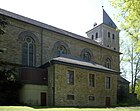
| On the Glockenberg | 490 | Bell tower of the Rellinghauser collegiate church | 16 Sep 1910 | The road leads from the Rellinghauser Mühlenbachtal up to the collegiate church of St. Lambertus and got its name in relation to the bell tower. The street on Glockenberg, which previously had the names Glockenbergstraße , Kurzestraße , Steinstraße in parts and was a northern part of Stiftstraße in the south , leads in a western extension of street St. Annental to the south and west around the collegiate church on Frankenstraße. Almost in its entirety, it forms the boundary between the district and the city forest . |
|
| At Schellenberg Castle | 260 | Schellenberg Castle | May 18, 2005 | The street Am Schloss Schellenberg is a southern cul-de-sac of the street Renteilichtung, west of the castle. |

|
| At the pen | 85 | Rellinghausen Abbey | Oct 16, 1910 | The Essen abbess Mathilde contributed to the establishment of the Rellinghauser Stift. The need arose to found a branch of the women's monastery in Essen for the daughters of the free and servants, since the large women's monastery was only open to the nobility and excluded others. The abbess Mathilde acquired the Oberhof Ruoldinghus, in the place of which she had a church built in 998 in honor of the Holy Cross and St. Lambertus . A monastery was connected to this, the chapter of which included a large number of canonies and several clerics , similar to the Essen monastery. Abbess Mathilde head of the newly founded congregation took over himself. Later a became Provost of the Essen canonesses elected as head of Rellinghauser pen, which had its seat in Essen. The second dignitary, the dean , came from the circle of the Rellinghauser canons. The street Am Stift, which was previously called Turmstrasse , connects Frankenstrasse with Oberstrasse. It is therefore close to the former Rellinghauser monastery buildings. |

|
| Ardeyplatz | 70 × 50 | Foothills of the Ardey Mountains | 16 Sep 1910 | The nearby Schellenberg Forest forms the last foothills of the Ardey Mountains. Ardeyplatz, which was previously called Marktplatz , is located south of Frankenstrasse on Am Ardey, which borders it to the west. |
|
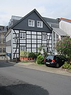
| Ardeystrasse | 160 | Foothills of the Ardey Mountains | July 9, 1915 | The nearby Schellenberg Forest forms the last foothills of the Ardey Mountains. Ardeystraße, which previously belonged to Schellenbergstraße in the western area and was then called Unterstraße for a short time , connects Ardeyplatz with Oberstraße. |
|
| Eisenbahnstrasse | 190 | Railway line Mülheim-Heißen-Altendorf (Ruhr) | 16 Sep 1910 | The Eisenbahnstraße leads to the former railway line from Mülheim- Heißen to Altendorf (Ruhr) , which is now a walking and cycling path. Eisenbahnstrasse, previously called Bahnhofstrasse , connects Rellinghauser Strasse with Frankenstrasse. |
|
| Finefraustraße | 280 | Finefrau, name of a coal seam | Finefrau was the name of a coal seam. The former Finefrau colliery, whose original owners were Wilhelm Huisken, Henrich Albert and Wirich Schürmann, was located in Göntersiepen and was bought by the city pensioner Heinrich Huyssen in 1770/71. In 1831 it was consolidated with the Henriettenglück , Adelgunde and Bänksgen collieries to form the Ludwig colliery . Finefraustraße, which was originally called Carl-Funke-Straße , is located in the former Gottfried Wilhelm colliery colony and connects Rübezahlstraße with Frankenstraße.
|
||
| Frankenstrasse | 1210 (in the district) |
Tribal border between Franconia and Saxony | 16 Sep 1910 | The Rüttenscheid peasantry was separated from the Bredeney , Haarzopf and Fulerum tribes by the Essen tenth border, the marca Francorum et Saxonum, the tribal border of the Franks and Saxons . The road led west to the former Franconian region and established such a connection for the first time. A precise borderline is not proven. After the street was called Steeler Straße in its eastern course in Rellinghausen and Stadtwald until 1910 , it was called Rellinghauser Straße until 1915 in its western part in Bredeney. In 1969 the city of Essen renamed Frankenstraße after the important politicians of the post-war years in Rellinghausen as Kurt-Schumacher- Straße and in the western part as Konrad-Adenauer- Straße. This was followed by protests by the population in the form of a collection of signatures and actions by the citizens' alliance. After a few weeks, the city gave in and the entire length of the street was renamed Frankenstrasse. The Frankenstraße leads from the Wuppertaler Straße to the west to the Stiftplatz and further through the Stadtwald, crosses the Stadtwaldplatz and leads to the Bredeney. It is part of the L441 state road.
|

|
| Gottfried-Wilhelm-Strasse | 200 | Johann Gottfried Wilhelm Waldthausen , operator of the Gottfried Wilhelm colliery | 16 Sep 1910 | Gottfried-Wilhelm-Strasse is located in the former Gottfried Wilhelm colliery colony and connects Mausegattstrasse with Frankenstrasse. | |
| Baptism of witches | 670 | Hexentaufe, place on the Ruhr , vernacular | around 1899 | In Rellinghausen, at the time of the witch hunt, people suspected of witchcraft were subjected to a so-called water test. She was thrown into the dysentery, hand and foot tied in a deep place on a rope. Whoever sank was innocent. Anyone who swam above was mistaken for a witch or a wizard and burned after a torture-obtained confession. In Rellinghausen alone, 42 people were executed by this type between 1570 and 1595. The original street Hexentaufe was until 1937 down on the Ruhr in the area of today's Wuppertaler Straße. Today's upper street Hexentaufe got its name on November 20, 1937. It was previously called Möllenbeckstraße since September 16, 1910 . Today it branches off north of Sartoriusstrasse, leads in an easterly arc around the former coal mine colony Gottfried Wilhelm and ends in the north over the Ruhr as a dead end. |
|
| Hundsnockenstrasse | 120 | Hundsnocken, name of a coal seam | 16 Sep 1910 | The Hundsnocken colliery mined coal in the seam of the same name. Hundsnockenstraße is located in the former Gottfried Wilhelm colliery colony and connects Schatzreichstraße with Rübezahlstraße. |
|
| Cantory | 770 (in the district) |
Cantory, field name | Nov 12, 1934 | The Cantorei is mentioned in the so-called Kordenbuch in 1821. The income from this piece of land was due to the respective cantor or sexton von Rellinghausen. It was later exchanged for Schellsche's site on Rellinghauser Mühlenbach. The street Kantorie, coming from the city forest , leads in an easterly direction to the Ruhr heights and ends after a northern arch as a dead end. |
|
| Konrad Adenauer Bridge | 100 (in the district) |
Konrad Adenauer , first Federal Chancellor of the Federal Republic of Germany | Feb. 17, 1982 | The Konrad-Adenauer-Brücke connects Rellinghausen over the Ruhr with Überruhr -Hinsel. | |
| Cuckoo strain | 190 (in the district) |
Name invented based on the location of the street | Oct 18, 1921 | The street Kuckucksrain leads from the Schellenbergstraße in a south-westerly direction into the city forest . | |
| Liafburgastrasse | 180 | Liafburga, name of a coal seam | 16 Sep 1910 | The coal seam is named after Liafburga, the mother of Liudger , the founder of the Werden monastery . Liafburgastrasse is located in the former Gottfried Wilhelm colliery colony and connects Gottfried-Wilhelm-Strasse with Sartoriusstrasse. |
|
| Mattheyweg | 120 | Joseph Matthey, Landgeometer of the Essen Abbey | Nov 12, 1934 | Joseph Matthey was born on April 17th, 1763 in Wesel . He was the land geometer of the Essen monastery and rent master of Baron von Schell. In this capacity he headed the Schellenberger Glashütte around 1817. He died on July 31, 1835 in Rellinghausen. The Mattheyweg connects the Kantorie street with Renteilichtung street. |
|
| Mausegattstrasse | 190 | Mausegatt , name of a coal seam | 16 Sep 1910 | Mausegattstrasse is located in the former Gottfried Wilhelm colliery colony and connects Nottekampstrasse with Silberbankstrasse. | |
| Mentor Street | 120 | Mentor, name of a coal seam | 16 Sep 1910 | Mentorstrasse is located in the former Gottfried Wilhelm colliery colony and connects Rübezahlstrasse with Schatzreichstrasse. | |
| Nebenbankstrasse | 150 | Side bench, name of a coal seam | 16 Sep 1910 | The Nebenbankstrasse is located in the former Gottfried Wilhelm colliery colony and connects Sartoriusstrasse with Liafburgastrasse in a northern corner. It originally connected the latter with Frankenstrasse, but was given its current route on February 2, 1959. | |
| Nottekampstrasse | 220 | Nottekamp, name of a coal seam | 16 Sep 1910 | The Nottekamp seam is identical to the Sonnenschein seam; see also Nottekampsbank colliery . Nottekampstrasse is located in the former Gottfried Wilhelm colliery colony and connects Rübezahlstrasse with Frankenstrasse. |
|
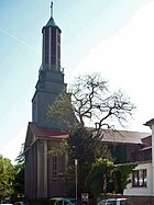
| Oberhofstrasse | 200 | Oberhof Kirchfeld of the Rellinghausen Abbey | Feb. 4, 1903 | At times up to 40 courtyards belonged to the Oberhof Kirchfeld. In the 10th century a branch convent (provost office) was founded on the lands belonging to the farm. From this the village and monastery Rellinghausen developed. According to the lease book of the Werden monastery from 1589–90, Johan upm Kerckfeldt had to pay interest for Kerckfeltz gudt as a tenant. The entire farmer Kirchfeld is mentioned in 1795 and the farm is referred to as a leasehold and the Rellinghausen capital as the landowner. On March 5, 1810, Johann Kirchfeld was the last profit maker. In the mother role of 1866 Arnold Kirchfeld is named as the owner and farmer of Rellinghausen. Oberhofstrasse is a western cul-de-sac from St. Annental. |
|
| Oberstrasse | 300 (in the district) |
Location in the upper part of Rellinghausen | Feb. 4, 1903 | There was once a sub- street in Rellinghausen , today Ardeystraße , which was called Oberstraße in the upper part and was extended to Stadtwald on September 16, 1910 . Today's course of Oberstraße begins on Am Ardey and ends in a westerly direction in the neighboring district of Stadtwald. |
|
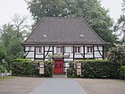
| Pilgrim path | 450 | Pilgrim von der Leiten, pebbles of the Essen monastery | 17 Sep 1924 | Pilgrim von der Leiten was Erbdrost of the Essen monastery from 1413 to 1440 and lived at Schellenberg Castle . The von der Leiten or von Leytene were an old Essenes ministerial family who probably descended from the Leite family near Kray . Leithe is the name of an Essen district today. The Pilgrimsteig connects the Renteilichtung street with Schellenbergstraße and forms the border to the city forest along its entire length . |
|
| Rauensiepenstrasse | 100 | Rauensiepen, name of a coal seam | 16 Sep 1910 | The Rauensiepen seam belonged to the Gottfried Wilhelm colliery . In 1773 the seam was mortgaged, which is identical to the Wolfsdelle and Tutenbank seam. Rauensiepenstrasse is located in the former Gottfried Wilhelm colliery colony and connects Rübezahlstrasse with Hexentaufe Strasse. |
|
| Rellinghauser Strasse | 400 (in the district) |
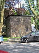
Rellinghausen as a former mayor's office | 16 Sep 1910 | The street is reminiscent of the former mayor's office in Rellinghausen. From 1815 to 1875 Rellinghausen belonged to the mayor's office of Steele . In 1876 the Rellinghausen mayor's office was formed from Rellinghausen, Bergerhausen and Heide. In 1884 Rüttenscheid came to the Rellinghausen mayor's office as a former part of Stoppenberg , but left it again in 1900. In 1910, Rellinghausen was incorporated into a district of Essen. Rellinghauser Strasse branches off north of Frankenstrasse and continues through the districts of Bergerhausen , Huttrop , Rüttenscheid and Südviertel . Today's section from Frankenstraße to the left bend to Eisenbahnstraße was previously part of the Am Glockenberg street . |
|
| Rent dividend | 360 (in the district) |
Clearing near the pension building | Nov 12, 1934 | In the Schellenberg Forest the road forms a clearing and leads past the pension building of Baron von Vittinghoff (called Schell). The Renteilichtung road branches off to the west of Schellenberstraße and continues to Stadtwald from the Mattheyweg junction . |
|
| Riesweg | 130 (in the district) |
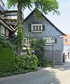
Riesweg, forest property | Feb. 4, 1903 | The original spelling was Reisweg. The following announcement comes from the year 1827: On Saturday, September 15th. J. in the morning at 10 a.m., to eat in the business premises of the rent office in the district of Heide, Mayor of Steele, 31 Morgen, 31 Ruthen, 70 feet large domanial forest place, called the Reisweg, in front of the royal rent master Mr. Keller publicly, namely alternative: a) for free purchase, b) for sale with reservation of a pension. The Riesweg branches off south of the Oberstraße and continues in a westerly direction to Stadtwald . |
|
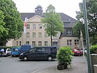
| Rübezahlstrasse | 450 | Rübezahl, name of a mine field | 16 Sep 1910 | A mine field of the Gottfried Wilhelm colliery was named after the legendary figure Rübezahl . This pit field gives the street its name. Rübezahlstrasse is located in the former Gottfried Wilhelm colliery colony and connects Frankenstrasse with Sartoriusstrasse. |
|
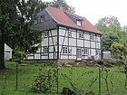
| Sartoriusstrasse | 880 | Joseph Sartorius , Mayor of Rellinghausen Mayor | Feb. 27, 1928 | Joseph Sartorius was the first and only mayor of the Rellinghausen mayor, which was formed in 1876 and which was incorporated into the city of Essen in 1910. Sartoriusstraße, which was originally called Heisinger Straße , branches off south of Frankenstraße and meets Wuppertaler Straße to the south-east in the Ruhr valley . |
|
| Schatzreichstrasse | 240 | Treasure rich, name of a coal seam | 16 Sep 1910 | There was a mine called Schatzreich und Justitia in the former Werden mining area . This made, to the north by mine Gottfried Wilhelm of mine Sutansbank abutment, one of the most valuable, yet disposable and untouched remaining fields at the Ruhr . In 1901 the mine was divided, with Schatzreich going to Pörtingsiepen colliery , the majority of which belonged to Gottfried Wilhelm at the time. Justitia fell to the Rhenish Anthracite Coal Works. The Schatzreichstrasse is located in the former Gottfried Wilhelm colliery colony, branches off from the Hexentaufe road to the south and leads back to it in this direction.
|
|
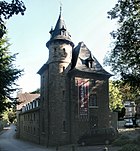
| Schellenbergstrasse | 1070 (without access roads) |
Schellenberg Castle , a former knight's seat | July 9, 1915 | Schellenbergstrasse, which was previously called Schloßstrasse , branches off from Ardeystrasse and runs in a south-easterly direction into the Ruhr Valley , where it meets Wuppertaler Strasse. |
|
| Schnabelstrasse | 470 (without access roads) |
Colliery Schnabel to the east | Apr 15, 1969 | Schnabelstrasse is an eastern spur road from Rellinghauser Strasse and is now an industrial area. | |
| Silberbankstrasse | 330 | Silberbank, name of a coal seam | 16 Sep 1910 | The Silberbank colliery in today's Fischlaken district dismantled, among other things, the Silberbank seam. Silberbankstraße is located in the former Gottfried Wilhelm colliery colony and connects Liafburgastraße with Schatzreichstraße. |
|
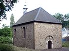
| St. Annental | 1030 | St. Anne's Chapel | Sep 18 1926 | The street St. Annental, which was previously called Kapellenstraße , was from 1910 part of the street Im Walpurgistal , then Walpurgisstraße , which continues west to Bergerhausen today . St. Annental Street leads east from Rellinghauser Strasse, where it meets Frankenstrasse. With the exception of about 30 meters to Frankenstrasse, it forms the border with Bergerhausen.
|
|
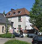
| Stiftplatz | 70 × 35 | Rellinghausen Abbey | The Essen abbess Mathilde contributed to the establishment of the Rellinghauser Stift. The need arose to found a branch of the women's monastery in Essen for the daughters of the free and servants, since the large women's monastery was only open to the nobility and excluded others. The abbess Mathilde acquired the Oberhof Ruoldinghus, in the place of which she had a church built in 998 in honor of the Holy Cross and St. Lambertus . A monastery was connected to this, the chapter of which included a large number of canonies and several clerics , similar to the Essen monastery. Abbess Mathilde head of the newly founded congregation took over himself. Later a became Provost of the Essen canonesses elected as head of Rellinghauser pen, which had its seat in Essen. The second dignitary, the dean , came from the circle of the Rellinghauser canons. Stiftplatz, which was previously called Kaiserplatz , is north on Frankenstrasse. The monastery buildings of Rellinghausen were located here. |
|
|
| Four oak height | 200 | Oaks , botany | Jan 15, 1936 | It was named after four oaks, which were legally protected at the time, on this street on the hill above the Ruhr . The street Viereichenhöhe leads in an arch from the street Alte Eichen back to it. |
|
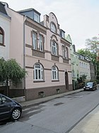
| Weir road | 110 | Volunteer firefighter | Feb. 4, 1903 | The Rellinghausen Volunteer Fire Brigade was founded on August 8, 1908 in Franzen. In 1904, an iron riser tower with automatic hose washing and a tool shed were built on a piece of land owned by the community on Wehrstrasse using surpluses from the savings bank. The Wehrstraße connects the Riesweg with the Kuckucksrain street. |
|
| Weneswaldstrasse | 80 | Weneswald, name of a coal seam | 16 Sep 1910 | The name Weneswald is first mentioned in a document for a large forest area on the Ruhr in 837. Liudger founded his monastery in Werethina ( Werden ) or Diapenbeei, a place in the Weneswald on the lower Ruhr. Weneswaldstraße is located in the former Gottfried Wilhelm colliery colony and connects Schatzreichstraße with Hexentaufe street. |
|
| Wippenbeckhang | 120 | Wippenbecke, waters | Nov 20, 1937 | The street Wippenbeckhang got its name due to its location on the slope of the Wippenbecke brook. Today's Wippenbeckhang street has been developed for residential development since March 5, 1980, at this point a southern cul-de-sac of Sartoriusstrasse. The original street was about a hundred meters to the west on Sartoriusstraße and was previously called Kutscherweg . |
|
| Wuppertaler Strasse | 1480 (in the district) |
Runs towards Wuppertal | Nov 20, 1937 | Wuppertaler Strasse, which was called Hexentaufe in the Rellinghauser area from around 1899 until it was expanded in 1937 , runs from Bergerhausen along the right side of the Ruhr to Heisingen . It is part of the federal highway 227 . |
List of former street names
The list of former street names does not claim to be complete.
| Surname | from | to | renamed to (current) | Derivation | Remarks |
|---|---|---|---|---|---|
| Bahnhofstrasse | Feb. 4, 1903 | 16 Sep 1910 | → Eisenbahnstrasse | Former Rellinghausen station | Bahnhofstrasse led to the former Rellinghausen station, which existed between 1879 and 1965, although passenger traffic on the railway line was discontinued in 1959. The station was demolished and today's discounter was later built at this point. An old buffer stop with a plaque reminds of the train station. The railway line is now a pedestrian and cycle path. |
| Carl-Funke-Strasse | 16 Sep 1910 | → Finefraustraße | Carl Funke , industrialist, city councilor | ||
| Glockenbergstrasse | Feb. 4, 1903 | 16 Sep 1910 | → On the Glockenberg | Part of today's street Am Glockenberg was previously called Glockenbergstraße. The other parts were called Kurzestraße , Steinstraße and Stiftsstraße . | |
| Heisinger Strasse | Feb. 4, 1928 | → Sartoriusstrasse | Road to Heisingen | ||
| Kaiserplatz | Feb. 4, 1903 | 16 Sep 1910 | → Stiftplatz | ||
| Kapellenstrasse | Feb. 4, 1903 | 16 Sep 1910 | → St. Annental | St. Anne's Chapel | In 1910, Kapellenstrasse became part of Walpurgisstrasse , which continued to Bergerhausen . In 1926 the section that forms the border with Rellinghausen was renamed St. Annental. |
| Kurzestrasse | Feb. 4, 1903 | 16 Sep 1910 | → On the Glockenberg | Part of today's street Am Glockenberg was previously called Kurzestraße. The other parts were called Glockenbergstrasse , Steinstrasse and Stiftsstrasse . | |
| Coach path | Feb. 4, 1903 | Nov 20, 1937 | → Wippenbeckhang | ||
| Marketplace | Feb. 4, 1903 | 16 Sep 1910 | → Ardeyplatz | ||
| Market street | Feb. 4, 1903 | 16 Sep 1910 | → At the Ardey | ||
| Möllenbeckstrasse | 16 Sep 1910 | Nov 27, 1937 | → baptism of witches | ||
| Schlossstrasse | Feb. 4, 1903 | July 9, 1915 | → Schellenbergstrasse | Schellenberg Castle , a former knight's seat | |
| Steeler Street | Feb. 4, 1903 | 16 Sep 1910 | → Frankenstrasse | Former Steele Mayorry | |
| Steinstrasse | Feb. 4, 1903 | 16 Sep 1910 | → On the Glockenberg | Part of today's street Am Glockenberg was previously called Steinstraße. The other parts were called Kurzestraße , Glockenbergstraße and Stiftsstraße . | |
| Turmstrasse | Feb. 4, 1904 | Oct 16, 1910 | → On the pen | Location at the Blücherturm , the court tower of the Rellinghausen monastery | |
| Under road | 16 Sep 1910 | July 9, 1915 | → Ardeystrasse | Location in the lower part of Rellinghausen | |
| Walpurgisstrasse | 16 Sep 1910 | Sep 18 1926 | → St. Annental | Walburga or Walpurgis , feminine given name | The name was named after a first name through a Rüttenscheider resolution of 1895. The original Kapellenstrasse became part of Walpurgisstrasse in 1910, which continued to Bergerhausen . In 1926 the section that forms the border with Rellinghausen was renamed St. Annental. |
See also
- List of streets in Essen-Bergerhausen
- List of streets in Essen-Heisingen
- List of streets in Essen-Stadtwald
Individual evidence
- ↑ Unless otherwise stated, the source used is: Erwin Dickhoff: Essener Strasse . Ed .: City of Essen - Historical association for the city and monastery of Essen. Klartext-Verlag, Essen 2015, ISBN 978-3-8375-1231-1 .
- ^ City of Essen: Population figures. Retrieved May 21, 2020 .
- ↑ Michael Heiße: Battle of the Rellinghauser for Frankenstrasse ; In: Westdeutsche Allgemeine Zeitung of January 27, 2018
- ^ Official Journal of the Government of Düsseldorf No. 41/1827
- ↑ Ludwig Achepohl: The RWTH mine industrial area . 2nd Edition. Alfred Silbermann, Essen / Leipzig 1894.
