
Lodner
| Lodner | ||
|---|---|---|
 Lodner seen from the northwest |
||
| height | 3219 m slm | |
| location | South Tyrol , Italy | |
| Mountains | Texel Group , southern Ötztal Alps | |
| Dominance | 1.28 km → Hochweiß | |
| Coordinates | 46 ° 44 ′ 6 ″ N , 11 ° 2 ′ 19 ″ E | |
|
||
| rock | metamorphic limestone (marble) in the summit area, in the lying area also gneiss | |
| First ascent | July 23, 1872 by Victor Hecht and Johann Pinggera over the northwest flank | |
| Normal way | from the north as a high tour over the Lodnerferner | |

The Lodner ( Italian Cima Fiammante ), also called Lodnerspitze , is a 3219 (according to other information: 3228) meter high mountain of the Texel Group in the southern Ötztal Alps , located in the Italian province of South Tyrol . The mountain has a characteristic flat shape in the summit area, which promotes a layer of firn . The Lodner sends out pronounced ridges to the north and south-east. The first ascent took place in 1872 from the north over the Lodnerferner, which today has shrunk significantly due to global warming and is mostly aperen (no snow cover) in summer .
Location and surroundings
The Lodner is about six kilometers as the crow flies northwest of the village of Partschins (681 m) in Vinschgau . It rises to the east above the Zieltal , a high mountain valley that leads north from the Vinschgau into the Texel Group. Like the surrounding area, it is part of the Texel Group Nature Park . The mountain is surrounded by rapidly dwindling glaciers. To the northwest lies the Lodnerferner , to the northeast the Adelsferner and to the east an insignificant nameless ice field. Neighboring mountains in the course of the strongly pronounced north ridge are the Hochweiß with 3278 meters and in the south the Lazinser Rötelspitze with 3037 meters above sea level. To the west, towards the target valley, the Lodner has a great geographical dominance , it is the dominant mountain, its steep, rocky west flank rises about 300 meters above the debris cone created by erosion.
geology
Geologically speaking, the Lodner belongs to the Schneeberger Zug , a slate zone consisting of gray, mineral-rich mica schists that extends from the western edge of the Texel Group to Sterzing . The special feature of the Lodner is its summit structure made of light marble ( limestone transformed by pressure and heat ). The typical solid gneiss can also be found alternating with the marble layers, especially on the ridges , as well as the brittle garnet mica slate in the lower layers.
Base and ascent
The Prague alpinist Victor Hecht and his mountain guide Johann Pinggera set out from the Lower Zielalpe on July 23, 1872 and walked through the Zieltal, a side valley of the Adige Valley , in a north-easterly direction up to the Lodnerferner and then in a south-easterly direction to the Lodner summit. Today's normal route follows the first climbers over the 40 ° inclined glacier as an alpine tour (only with appropriate equipment and experience). The summit is reached via the north-west side and the north ridge with partly easy to moderately difficult climbing in difficulty level UIAA I - II . Today's base for an ascent of the mountain is the Lodnerhütte , located at an altitude of 2259 meters. According to the literature, the walking time from the hut to the summit is about 3½ hours, whereby the ascent of the Lodnerferner, which is usually aperous in midsummer, is often critical. Other tours to the summit lead over the northwest , south and east ridge in some very difficult climbing in UIAA grades II - IV.

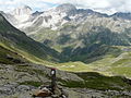
View of the Lodnerhütte with Lodner (left)
View of Hochweiß (left) and Lodner (middle) on the descent from Gingljoch


etymology
The etymology of the mountain name, which first appeared around 1900, is unclear. A connection with the German blaern seems to be very unlikely as a down-to-earth education, since the word does not appear in the local dialects. However, if the name of the mountain were coined by alpine circles of the 19th century, then the white flare of the marble rock would be a perfectly conceivable motif . The Italian name Cima Fiammante ("peak of flames"), created by Ettore Tolomei in the 20th century, is clearly a translation of this reading. Another theory suspects the similarity of the black amphibolite stripes in Lodner marble with the folds of a loden coat as a naming motif .
Literature and map
- Walter Klier : Alpine Club Guide Ötztaler Alpen , Bergverlag Rudolf Rother, Munich 2006. ISBN 3-7633-1123-8
- Casa Editrice Tabacco , Tavagnacco: Carta Topografica 1: 25.000, sheet 04, Schnalstal / Val Senales, Naturns / Naturno
Web links
Individual evidence
- ^ Raimund von Klebelsberg : Geologie von Tirol , Verlag Gebrüder Borntraeger, Berlin 1935, p. 185 u. 196
- ^ Journal of the German and Austrian Alpine Association , Volume V, Munich 1874, p. 316 ff.
- ^ Walter Klier: Alpenvereinsführer Ötztaler Alpen , Munich 2006, p. 425 ff., Margin no. 3811 ff.
- ^ Johannes Ortner: South Tyrolean mountain names . In: Experience the mountains - The magazine of the Alpine Association of South Tyrol . No. 6 , 2019, pp. 50-51 .