
Madulain
| Madulain | |
|---|---|
 |
|
| State : |
|
| Canton : |
|
| Region : | Maloja |
| BFS no. : | 3783 |
| Postal code : | 7523 |
| Coordinates : | 791 179 / 162 157 |
| Height : | 1697 m above sea level M. |
| Height range : | 1669–3157 m above sea level M. |
| Area : | 16.28 km² |
| Residents: | 210 (December 31, 2018) |
| Population density : | 13 inhabitants per km² |
| Website: | www.madulain.ch |
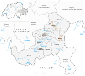
 Madulain |
|
| Location of the municipality | |
  |
|
Madulain ( , German and officially until 1943 Madulein ) is a municipality in the Maloja region of the canton of Graubünden in Switzerland .
geography

The village is located between La Punt-Chamues-ch and Zuoz about 10 km from St. Moritz on the banks of the Inn in the La Plaiv countryside . With only around 200 inhabitants, it is the smallest municipality in the Upper Engadin . Madulain is one of the villages with the best-preserved center of the Upper Engadin and is officially one of the most beautiful villages in Switzerland. Madulain is characterized by its originality and belongs to the "other" Engadine, which is quieter than St. Moritz and its surroundings. The ruins of Guardaval Castle are enthroned above the village .
The Val Prünella exclave makes up about half of the area of the municipality . The Alp Prünella , located at the bottom of Val Prünella, is km in a straight line about 10 km south from the village of Madulain. It can be reached via La Punt-Chamues-ch and the scenic Val Chamuera . The Alp is a destination for hikers and mountain bikers , with further, challenging trails towards Val da Fain and the Bernina Pass .
population
| year | 1806 | 1850 | 1900 | 1950 | 1980 | 2000 | 2005 | 2010 | 2012 | 2014 | 2016 |
|---|---|---|---|---|---|---|---|---|---|---|---|
| Residents | 93 | 63 | 54 | 77 | 94 | 180 | 116 | 194 | 234 | 232 | 216 |
languages
In Madulain, a minority of turkeys is spoken, an Engadin dialect of Romansh . Until the first half of the 19th century, this was the colloquial language for all residents. Language changes to German took place early on. In 1880, only 69% said Romansh was their mother tongue. This value fell to 55% by 1900. In 1910 the community was overturned; 36 Romansh speakers were compared to 47 German speakers. In the interwar period, the majority of languages changed back again (50% Romansh speakers in 1941). The language change took place after 1970. Although 50.8% in 1990 and 43% in 2000 were able to communicate in Romansh, today the community speaks (mostly) German.
| languages | 1980 census | 1990 census | 2000 census | |||
|---|---|---|---|---|---|---|
| number | proportion of | number | proportion of | number | proportion of | |
| German | 42 | 44.68% | 48 | 40.00% | 97 | 53.89% |
| Romansh | 35 | 37.23% | 33 | 27.50% | 40 | 22.22% |
| Italian | 15th | 15.96% | 28 | 23.33% | 31 | 17.22% |
| Residents | 94 | 100% | 120 | 100% | 180 | 100% |
Religions and denominations
The Reformation was introduced in 1554.
Origin and nationality
Of the 177 residents at the end of 2005, 138 (= 77.97%) were Swiss citizens.
traffic
Madulain is connected to the Bever – Scuol – Tarasp railway line and to Hauptstrasse 27 . The regional train Pontresina - Samedan - Zuoz - Zernez - Scuol -Tarasp, as well as individual routes of the accelerated RegioExpress St. Moritz - Landquart GR, stop every hour at the train station in the village center of Madulain . The EngadinBus bus line 7 runs every half hour from La Punt Chamues-ch via Zuoz alternately to Cinuos-chel - Brail or to the national park . This line serves Madulain's only bus stop Madulain vih in the village center.

coat of arms
Blazon : In black, a silver (white) halftone placed on a pole covered with a silver horn whose cord is looped around the shaft of the halftone. The coat of arms depicts the name of Guardaval Castle above the village.
Attractions
The small reformed village church is a listed building .
literature
- Erwin Poeschel : The art monuments of the canton of Graubünden III. The valley communities Räzünser Boden, Domleschg, Heinzenberg, Oberhalbstein, Upper and Lower Engadine. (= Art Monuments of Switzerland. Volume 11). Edited by the Society for Swiss Art History GSK. Bern 1940. DNB 760079625 .
- Constant Wieser: Madulain. In: Historical Lexicon of Switzerland . 2008 .
Web links
- Madulain on the ETHorama platform
- Official website of the municipality of Madulain
- Madulein on elexikon.ch
Individual evidence
- ↑ Permanent and non-permanent resident population by year, canton, district, municipality, population type and gender (permanent resident population). In: bfs. admin.ch . Federal Statistical Office (FSO), August 31, 2019, accessed on December 22, 2019 .
- ↑ FM1 today
- ↑ Constant Wieser: Madulain. In: Historical Lexicon of Switzerland . 2008 .
Bever | Bregaglia | Celerina / Schlarigna | La Punt-Chamues-ch | Madulain | Pontresina | St. Moritz | Samedan | S-chanf | Sils in the Engadin / Segl | Silvaplana | Zuoz
Former parishes: Bondo | Casaccia | Castasegna | Soglio | Stampa | Vicosoprano
Canton of Graubünden | Regions of the Canton of Graubünden | Municipalities of the Canton of Graubünden