Montclar (Alpes-de-Haute-Provence)
| Montclar | ||
|---|---|---|

|
|
|
| region | Provence-Alpes-Cote d'Azur | |
| Department | Alpes-de-Haute-Provence | |
| Arrondissement | Digne-les-Bains | |
| Canton | Seyne | |
| Community association | Provence-Alpes agglomeration | |
| Coordinates | 44 ° 24 ' N , 6 ° 20' E | |
| height | 1,082–2,500 m | |
| surface | 23.38 km 2 | |
| Residents | 414 (January 1, 2017) | |
| Population density | 18 inhabitants / km 2 | |
| Post Code | 04140 | |
| INSEE code | 04126 | |
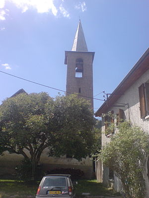
 Saint-Michel au Serre Nauzet church |
||
Montclar is a commune with 414 inhabitants (at January 1, 2017) in the department of Alpes-de-Haute-Provence in the region Provence-Alpes-Cote d'Azur . It belongs to the Arrondissement of Digne-les-Bains and the Canton of Seyne .
geography
Montclar borders Ubaye-Serre-Ponçon with La Bréole in the northwest and Saint-Vincent-les-Forts in the northeast, Le Lauzet-Ubaye in the east, Seyne in the southeast and Selonnet in the southwest. 969 hectares of Montclar are forested.
Population development
| year | 1962 | 1968 | 1975 | 1982 | 1990 | 1999 | 2008 | 2016 |
|---|---|---|---|---|---|---|---|---|
| Residents | 229 | 204 | 220 | 258 | 327 | 399 | 458 | 414 |
Web links
Commons : Montclar - collection of images, videos and audio files
