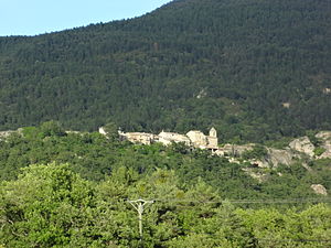
Beynes (Alpes-de-Haute-Provence)
| Beynes | ||
|---|---|---|

|
|
|
| region | Provence-Alpes-Cote d'Azur | |
| Department | Alpes-de-Haute-Provence | |
| Arrondissement | Digne-les-Bains | |
| Canton | Riez | |
| Community association | Provence-Alpes agglomeration | |
| Coordinates | 44 ° 0 ′ N , 6 ° 13 ′ E | |
| height | 537-1,601 m | |
| surface | 41.24 km 2 | |
| Residents | 125 (January 1, 2017) | |
| Population density | 3 inhabitants / km 2 | |
| Post Code | 04270 | |
| INSEE code | 04028 | |
 Beynes |
||
Beynes is a french commune with 125 inhabitants (at January 1, 2017) in the department of Alpes-de-Haute-Provence in the region Provence-Alpes-Cote d'Azur . It belongs to the arrondissement of Digne-les-Bains and the canton of Riez .
geography
The river Asse forms the municipal boundary in the north and west. The neighboring municipalities are Châteauredon and Entrages in the north, Chaudon-Norante in the east, Senez ( enclave ) in the southeast, Estoublon in the south and Mézel in the west. In addition to the main settlement, Beynes also includes the hamlets of Saint-Pierre, Creisset, Palus and Les Guberts .
Population development
| year | 1962 | 1968 | 1975 | 1982 | 1990 | 1999 | 2008 | 2015 |
|---|---|---|---|---|---|---|---|---|
| Residents | 63 | 51 | 54 | 75 | 93 | 114 | 121 | 126 |
Attractions
- Saint-Pierre-et-Saint-Martin church
Web links
Commons : Beynes - collection of images, videos and audio files
