Sainte-Croix-du-Verdon
| Sainte-Croix-du-Verdon | ||
|---|---|---|

|
|
|
| region | Provence-Alpes-Cote d'Azur | |
| Department | Alpes-de-Haute-Provence | |
| Arrondissement | Digne-les-Bains | |
| Canton | Valensole | |
| Community association | Provence-Alpes agglomeration | |
| Coordinates | 43 ° 46 ' N , 6 ° 9' E | |
| height | 443-669 m | |
| surface | 13.7 km 2 | |
| Residents | 119 (January 1, 2017) | |
| Population density | 9 inhabitants / km 2 | |
| Post Code | 04500 | |
| INSEE code | 04176 | |
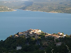
 Sainte-Croix-du-Verdon over the lake |
||
Sainte-Croix-sur-Verdon is a French municipality with 119 inhabitants (at January 1, 2017) in the department of Alpes-de-Haute-Provence in the region Provence-Alpes-Cote d'Azur . It belongs to the Arrondissement of Digne-les-Bains and the Canton of Valensole . The inhabitants call themselves Saint-Cruxiens .
geography
Sainte-Croix-sur-Verdon is located in the French Maritime Alps on the northern bank of the Lac de Sainte-Croix , a reservoir of the Verdon River . The opposite municipalities are Bauduen and Les Salles-sur-Verdon . Sainte-Croix-sur-Verdon is also bordered by Roumoules in the north, Moustiers-Sainte-Marie in the northeast, Baudinard-sur-Verdon in the south and Montagnac-Montpezat in the west. The village center lies at 513 m .
Population development
| year | 1962 | 1968 | 1975 | 1982 | 1990 | 1999 | 2009 | 2016 |
|---|---|---|---|---|---|---|---|---|
| Residents | 106 | 107 | 61 | 77 | 87 | 102 | 124 | 119 |
Web links
Commons : Sainte-Croix-du-Verdon - Collection of images, videos and audio files

