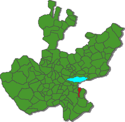
Municipio Valle de Juarez
| Valle de Juarez | |
|---|---|

|
|
| Basic data | |
| Country | Mexico |
| State | Jalisco |
| Seat | Valle de Juarez |
| surface | 195.8 km² |
| Residents | 5798 (2010) |
| density | 29.6 inhabitants per km² |
| founding | 1895 |
| INEGI no. | 14112 |
| politics | |
| Presidente municipal | José Manuel Chávez Rodríguez |
Coordinates: 19 ° 56 ′ N , 102 ° 57 ′ W
Valle de Juárez is a municipality in the Mexican state of Jalisco in the Sureste region . The municipality had 5,798 inhabitants at the 2010 census; the area of the municipality is 195.8 km². Until 1911 the name of the municipality was Valle de Mazamitla .
The largest place in the municipality and administrative seat is the Valle de Juárez of the same name . Another place with at least 500 inhabitants exists with Paso de Piedra . The municipality comprises a total of 39 localities.
The municipality of San Gabriel is bordered by the municipalities of Quitupan , Santa María del Oro , Tamazula de Gordiano and Mazamitla, as well as the state of Michoacán .
The municipality is at an average altitude of around 1800 m . More than 70% of the community area is forested, around 14% is used for agriculture.
Web links
- Enciclopedia de los Municipios y Delegaciones de México: Municipio Valle de Juárez (Spanish)
- INEGI : Datos Geográficos: Municipio Valle de Juárez (Spanish; PDF)
- jalisco.gob.mx: Valle de Juárez (Spanish)
