Nashua, Iowa
| Nashua | |
|---|---|
 |
|
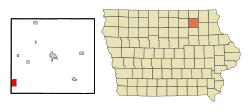
| Location in Iowa | |
| Basic data | |
| Foundation : | 1854 (settled) 1869 (incorporated) |
| State : | United States |
| State : | Iowa |
| Counties : |
Chickasaw County Floyd County |
| Coordinates : | 42 ° 57 ′ N , 92 ° 32 ′ W |
| Time zone : | Central ( UTC − 6 / −5 ) |
| Residents : | 1,663 (as of 2010) |
| Population density : | 204.6 inhabitants per km 2 |
| Area : | 8.13 km 2 (approx. 3 mi 2 ) |
| Height : | 297 m |
| Postal code : | 50658 |
| Area code : | +1 563 |
| FIPS : | 19-55335 |
| GNIS ID : | 459437 |
| Website : | www.nashua-iowa.com |
| Mayor : | Deanne R. Lantow |
 The Little Brown Church in the Vale in Nashua |
|
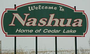
Nashua is a small town (with the status " City ") in Chickasaw County and to a lesser extent in Floyd County in the US -amerikanischen State Iowa . In 2010 Nashua had 1663 residents, the number of which decreased to 1641 by 2013.
geography
Nashua is located in northeast Iowa at the confluence of the Little Cedar River with the Cedar River , which is part of the Mississippi River basin over the Iowa River . This forms the border between Iowa and Wisconsin and Illinois and flows around 125 east of Nashua. The Minnesota border runs approximately 75 km north. A few hundred meters above the mouth of the Little Cedar River is a dam with which the Cedar River is dammed into Cedar Lake and which, in addition to regulating water, is used to generate energy.
The geographical coordinates of Nashua are 42 ° 57'10 "north latitude and 92 ° 32'11" west longitude. The city covers an area of 8.13 km² and is spread over the Bradford Township of Chickasaw County and the Riverton Township of Floyd County.
Nashua's neighbors are Bassett (14.9 km north), Ionia (15.5 km northeast), Frederika (27.7 km southeast), Bradford (on the southern city limits), Plainfield (14.1 km south) and Charles City (19.9 km northwest).
The nearest major cities are Rochester in Minnesota (147 km north), La Crosse in Wisconsin (183 km northeast), Wisconsin's capital Madison (291 km east), Dubuque at the interface of the states of Iowa, Wisconsin and Illinois (192 km east-southeast), the Quad Cities in Iowa and Illinois (172 miles southeast), Waterloo (40 miles southwest), Cedar Rapids (151 miles in the same direction), Iowa's capital Des Moines (216 miles southwest), and the Twin Cities in Minnesota, Minneapolis and Saint Paul ) (266 km north-northwest).
traffic
US Highway 218 , which has been converted into a freeway, runs north-south through the west of the city. The Iowa State Highway 346 runs from west to east direction as the main road through the center of Nashua. All other roads are subordinate country roads, some unpaved roads and inner-city connecting roads.
The Illinois Central Railroad (now the Canadian National Railway (CN)) runs north-south through the urban area of Nashua.
With the Northeast Iowa Regional Airport there is a small airfield 19.7 km north-northwest. The nearest commercial airport is Waterloo Regional Airport , 57 km south-southeast , from where there are feeder flights from several airlines to the major airports in Chicago O'Hare and Minneapolis-Saint Paul .
| Population development | |||
|---|---|---|---|
| Census | Residents | ± in% | |
| 1870 | 817 | - | |
| 1880 | 1116 | 36.6% | |
| 1890 | 1240 | 11.1% | |
| 1900 | 1268 | 2.3% | |
| 1910 | 1102 | -13.1% | |
| 1920 | 1317 | 19.5% | |
| 1930 | 1363 | 3.5% | |
| 1940 | 1439 | 5.6% | |
| 1950 | 1609 | 11.8% | |
| 1960 | 1737 | 8th % | |
| 1970 | 1712 | -1.4% | |
| 1980 | 1846 | 7.8% | |
| 1990 | 1476 | -20% | |
| 2000 | 1618 | 9.6% | |
| 2010 | 1663 | 2.8% | |
| 2013 estimate | 1641 | -1.3% | |
| 1870-2000 2010 | |||
population
According to the 2010 census , Nashua had 1,663 people in 712 households. The population density was 204.6 inhabitants per square kilometer. Statistically, 2.34 people lived in each of the 712 households.
The racial the population was composed of 98.6 percent white, 0.4 percent African American and 0.5 percent Asian; 0.5 percent were descended from two or more races. Regardless of ethnicity, 0.1 percent (one person) of the population was Hispanic or Latino of any race.
26 percent of the population were under 18 years old, 54 percent were between 18 and 64 and 20 percent were 65 years or older. 50.9 percent of the population were female.
The average annual income for a household was 37,039 USD . The per capita income was $ 21,863. 11.3 percent of the population lived below the poverty line.
Known residents
- Kent Taylor (1906–1987) - actor - born in Nashua
Individual evidence
- ↑ City of Nashua - City Information.Retrieved December 4, 2014
- ↑ Landmark Hunter - Little Brown Church in the Vale.Retrieved December 4, 2014
- ↑ a b c American Fact Finder. Retrieved December 4, 2014
- ↑ Distance information according to Google Maps. Accessed December 4, 2014
- ↑ AirNav.com - Northeast Iowa Regional Airport Accessed on December 4, 2014
- ^ Iowa Data Center. Retrieved December 4, 2014
