
Arakabesan
| Arakabesan | ||
|---|---|---|
 |
||
| Waters | Pacific Ocean | |
| Archipelago | Palau Islands | |
| Geographical location | 7 ° 19 '57 " N , 134 ° 27' 11" E | |
|
||
| length | 3 km | |
| width | 1.25 km | |
| surface | 2.28 km² | |
| Highest elevation | Roiskebesang 110 m |
|
| main place | Meyungs | |
 |
||

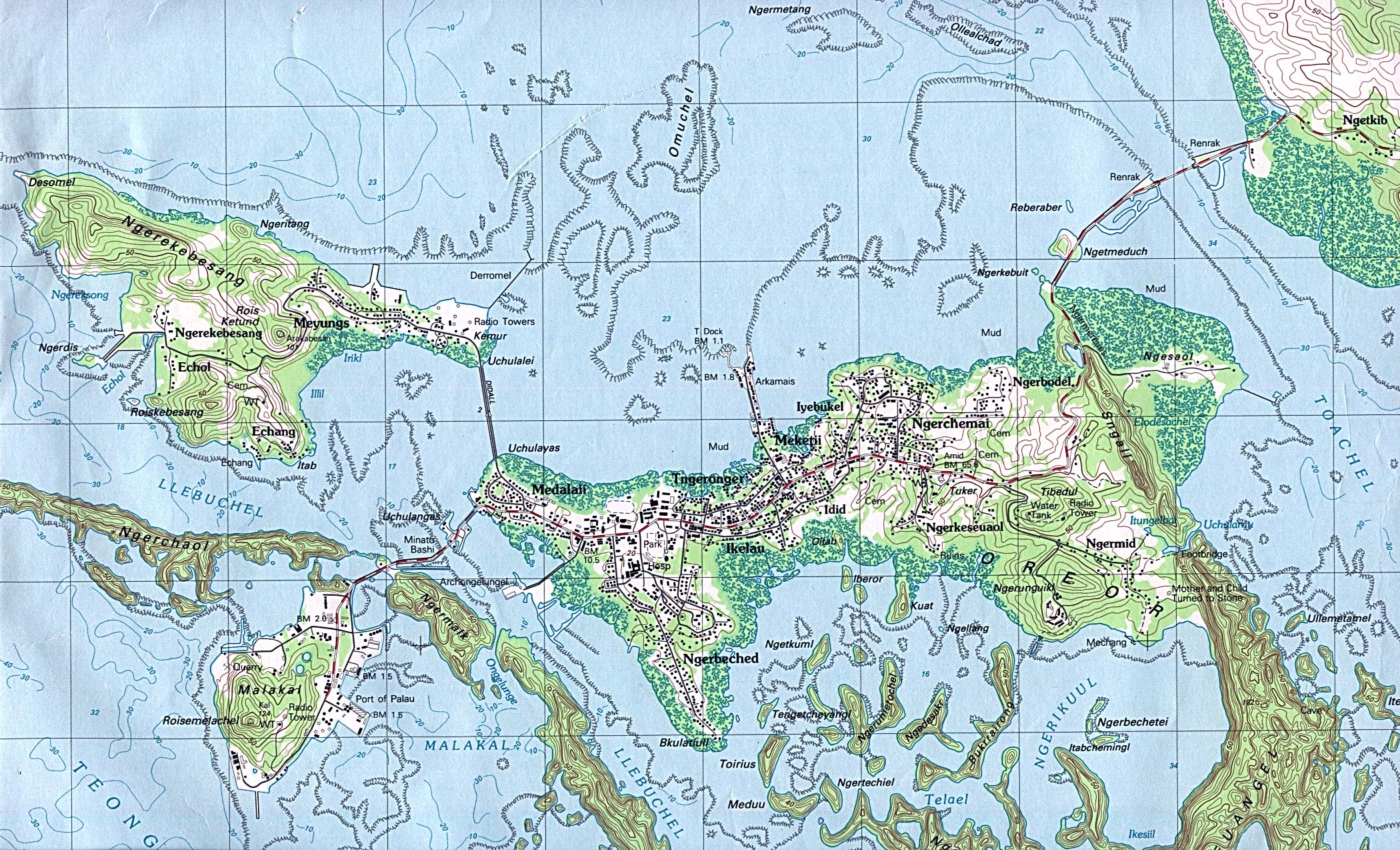
Arakabesan , also called Ngerekebesang , is a small island in the western Pacific Ocean ; geographically it belongs to the Palau Islands and administratively to the state of Koror of the island republic of Palau .
The approximately 2.3 km² large and densely forested island is 600 meters northwest of the island of Koror , to which it is connected by a bridge. The main town of Arakabesan is Meyuns on the east coast, next to it are the settlement Eang and the homonymous Ngerekebesang on the island. The latter settlement was at times also the seat of the President of Palau.
In the west of the island there are mainly tourist, leisure facilities and hotel complexes that were built after 1980. The extreme northwestern part of Arakabesan is not inhabited. Here is the 85 meter high Desomel . The highest point on the island, however, is the Roiskebesang in the south at 110 meters above sea level.
Individual evidence
- ^ Edwin Horace Bryan: Guide to place names in the Trust Territory of the Pacific Islands: (the Marshall, Caroline and Mariana Islands) (Paperback). Honolulu: Pacific Scientific Information Center, 1971 (Original: 0.88 sq. Mi., 361 feet, 279 feet). Names of the elevations from the topographic map .
Web links
Islands: Angaur | Arakabesan | Babeldaob | Dmasech | Dongosaro | Express Malk | Fanna | Helen Island | Kayangel | Koror | Malacal | Merir | Ngercheu | Ngeriungs | Peleliu | Pulo Anna | Tobi | Ulebsechel
Archipelagos: Palau Islands | Chelbacheb | Iberor | Kayangel | Mecherchar | Ngemelis | Ngeroi | Ngerukeuid | Sonsorol | Ulebsechel | Ulong | Urukthapel | ( Southwest Islands ) | ( Helen Reef )