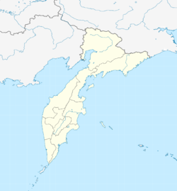
Oktyabrsky (Kamchatka)
| settlement
Oktyabrsky
Октябрьский
|
||||||||||||||||||||||||||||||||
|
||||||||||||||||||||||||||||||||
|
||||||||||||||||||||||||||||||||
Oktjabrski ( Russian Октя́брьский ) is a settlement in the Kamchatka region ( Russia ) with 1720 inhabitants (as of October 14, 2010).
geography
The settlement is located about 170 km as the crow flies west-southwest of the regional administrative center Petropavlovsk-Kamchatsky on the southwest coast of the Kamchatka Peninsula , on the Sea of Okhotsk . It is located on a mostly less than 1 km wide and about 35 km long spit that separates a lagoon, mainly formed by the Bolshaya River , from the open sea. About 5 km south of the center of the village there is another district on the spit, the settlement near the former Kolkhoz Bolscherezki. It is a good 20 km to the top of the spit, where the lagoon opens to the sea.
Oktyabrsky belongs to Rajon Ust-Bolsheretsk and is the administrative center of Ust-Bolsheretsk approximately 150 kilometers to the south.
history
The place was created in 1933 in connection with the establishment of a fish processing plant. The factory and settlement (Mikojanowski) were later named after the politician Anastas Mikojan . In 1940 the place received urban-type settlement status. In the second half of the 1950s, the settlement was given its current name after the October Revolution (Russian oktjabr for 'October' ). Oktyabrsky has had the status of a settlement since 2010.
Population development
| year | Residents |
|---|---|
| 1959 | 5500 |
| 1970 | 3150 |
| 1979 | 3854 |
| 1989 | 3813 |
| 2002 | 2331 |
| 2010 | 1720 |
Note: census data
Economy and Infrastructure
The main industry is fishing and processing. A road leads across the spit to the Ust-Bolscherezk district center and further across the peninsula to the R454 regional road, which comes from Petropavlovsk-Kamchatsky.
Individual evidence
- ↑ Oktjabrski municipality on the Rajon administration website (Russian)
- ↑ a b Itogi VPN-2010. Administrativno-territorialʹnoe delenie kraja. (Results of the 2010 census. Administrative-territorial division of the region.) Table 2 (Download from the website of the Territorial Organ of the Kamchatka Region of the Federal Service of State Statistics of the Russian Federation)
- ↑ Scheme of the spatial planning of the Ust-Bolscherezk district . Section III, Volume 1 with the basic data; Client: Ust-Bolscherezk district administration. Rostov-on-Don, 2009. p. 19 (Microsoft Word file, Russian; HTML )
Web links
- Oktyabrsky on the regional administration website (Russian)

