Osttünnen
|
Osttünnen
City of Hamm
Coordinates: 51 ° 38 ′ 40 ″ N , 7 ° 53 ′ 8 ″ E
|
|
|---|---|
| Height : | 67 (62-96) m above sea level NN |
| Area : | 5.44 km² |
| Residents : | 604 (Sep 30, 2012) |
| Population density : | 111 inhabitants / km² |
| Incorporation : | 1st January 1968 |
| Incorporated into: | Rhynern |
| Postal code : | 59069 |
| Area code : | 02385 |
|
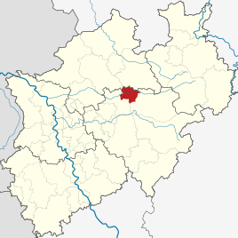
Location of Hamm in North Rhine-Westphalia
|
|
|
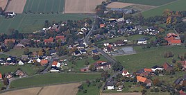
Osttünnen, aerial view
|
|
Osttünnen is a district of Hamm in North Rhine-Westphalia , is located in the Hamm-Rhynern district and borders the Westtünnen district .
The large municipality of Rhynern is the namesake of the Hamm-Rhynern district, which was newly established in 1975 .
history
The name Osttünnen is derived from the noble lords and counts of Thunen, who had their residence in the early Middle Ages north of today's “Von Thünen-Straße” between Westtünnen and Osttünnen. The village did not emerge until the 20th century and initially consisted of scattered farms. The first homes were built in the 1950s and 1980s.
On January 1, 1968, the previously independent municipality of Osttünnen was incorporated into the municipality of Rhynern. On January 1, 1975, it was reclassified into the independent city of Hamm as part of the regional reform.
Population development
| year | Residents |
|---|---|
| 1849 | 331 |
| 1910 | 366 |
| 1931 | 399 |
| 1956 | 673 |
| 1961 | 593 |
Infrastructure
- In addition to four farms that are still fully gainfully employed, there are four garden centers, two medical practices, two car repair shops, a carpenter's shop, a farm shop, a physiotherapist, a building renovator, an energy consultant and an agricultural cooperative in town.
- The place has neither a school nor shops or other public facilities.
- Osttünnen is close to the federal motorway 2 and on the state road 672
- The ICE railway line "Hamm - Kassel" runs through the town
- There is a bus connection for pupils to the schools in Rhynern, Berge and Werries.
- The focal point is the old school on "Davidisstrasse". The children from Osttünnen were taught here until the 1960s. The rooms are used by the volunteer fire brigade as a "service building" and the "Dorfgemeinschaft Osttünnen eV" for club events.
Web links
Individual evidence
- ↑ Martin Bünermann: The communities of the first reorganization program in North Rhine-Westphalia . Deutscher Gemeindeverlag, Cologne 1970, p. 64 .
- ^ Federal Statistical Office (ed.): Historical municipality directory for the Federal Republic of Germany. Name, border and key number changes in municipalities, counties and administrative districts from May 27, 1970 to December 31, 1982 . W. Kohlhammer, Stuttgart / Mainz 1983, ISBN 3-17-003263-1 , p. 329 .
- ^ MF Essellen: Description and brief history of the Hamm district and the individual localities in the same . Verlag Reimann GmbH & Co, Hamm 1985, ISBN 3-923846-07-X , p. 129 .
- ↑ www.gemeindeververzeichnis.de: Population figures 1910
- ↑ Handbook of the offices and rural communities in the Rhine province and in the province of Westphalia , Prussian Landgemeindetag West, Berlin 1931.
- ^ Otto Lucas: Kreis-Atlas Unna . Unna / Münster 1957.
- ↑ Martin Bünermann, Heinz Köstering: The communities and districts after the municipal territorial reform in North Rhine-Westphalia . Deutscher Gemeindeverlag, Cologne 1975, ISBN 3-555-30092-X , p. 236 .


