Hamm-Pelkum
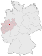
| coat of arms | map |
|---|---|

|

|
| Basic data | |
| State : | North Rhine-Westphalia |
| Administrative region : | Arnsberg |
| Regional association : | Westphalia-Lippe |
| Regional Association Ruhr | |
| Circle : | District of the independent city of Hamm |
| Geographic location : | 51 ° 38 ′ N , 7 ° 45 ′ E |
| Height : | 61.87 m above sea level NN |
| Area : | 30.19 km² |
| Incorporation of Pelkums: | 1st January 1975 |
| Postal code : | 59077 |
| Primaries : | 02307, 02381, 02383, 02385, 02389 |
| License plate : | HAM |
| District structure: | Subdistricts |
| Address of the district representative: |
Kamener Str. 177 59077 Hamm |
| politics | |
| District Head : | Udo Schulte ( SPD ) |
| population | |
| Residents : | 19,223 (as of December 31, 2017) |
| Population density : | 637 inhabitants per km² |
| Proportion of foreigners : | 12.9% (December 31, 2017) |
Hamm-Pelkum is a district of the city of Hamm . It has 19,223 inhabitants and covers an area of 30.19 km². This corresponds to a population density of 637 inhabitants per km².
Geographical location
Pelkum is located in the heart of Westphalia on the south side of the Lippe . The area of the city district is limited by the city districts Herringen and Mitte in the north and Rhynern in the east. In the south, the municipality of Bönen joins, in the west the cities of Kamen and Bergkamen . The districts of Kirchspiel, Westerheide, Lerche , Neustadt, Wiescherhöfen , Selmigerheide and Weetfeld also belong to the municipality of Pelkum .
history
Pelkum emerged from the Schulzenhof of the Abbey ( Deutz ), which had existed since 1018 . After secularization and Napoleonic occupation, it was assigned to the Prussian province of Westphalia and became the Pelkum office. This included Herringen , Bergkamen , healing, over mountains and Rünthe. This made it temporarily the largest office in the province of Westphalia . Since the time it was established, the office had various offices before moving into the office building in 1906. The place developed from 1900 with the onset of mining and the beginning of industrialization of the region to an industrial place on the eastern edge of the Ruhr area. On June 30, 1965, the municipality of Herringen was spun off, followed by the municipalities of Bergkamen, Heil, Overberge and Rünthe on December 31, 1965 . Just two years later, the municipalities of Herringen, Lerche, Pelkum, Sandbochum, Weetfeld and parts of Wiescherhöfen were merged on January 1, 1968 to form the new larger municipality of Pelkum. This 40.65 km² large community with 25,337 inhabitants was dissolved again by the municipal reform on January 1, 1975 and incorporated into the city of Hamm . Until December 31, 1974, Pelkum and Herringen belonged to the Unna district .
politics
District Representation
coat of arms
The coat of arms of Pelkum shows a red shark on a golden background, which is sometimes interpreted as a belt buckle, the top of the shield is filled by a three-row Brandenburg chess bar.
Sights and recreation
Hunting lodge Haus Reck in Lerche on the border with the city of Bergkamen is one of the oldest buildings in the city. The ground monument "Im Bremmen", a mound castle, is located near Gut Nordhof . The Jakobuskirche is a listed building .
In the Selbachpark in the Pelkum district there is, among other things, a wave pool. Most of the Kissinger Höhe is in the Wiescherhöfen district and is part of the Lippepark Hamm. Friedrich-Ebert-Park is also partly located in the city district.
Art figure Gerda at the roundabout Kamener Strasse / Alte Landwehrstrasse.
traffic
There is a connection to the German motorway network via the junction of the A 1 Hamm / Bergkamen and the A 2 Bönen . There is a rail connection via the Nordbögge stop (direction Dortmund and Hamm) in Bönen-Nordbögge and the Hamm main station. The city district is integrated into the Hamm city bus network . There is also an indirect connection to the waterway network through the city harbor of Hamm .
Public facilities
The Selbachpark outdoor pool (wave pool), a youth center, three elementary schools, two secondary schools, a grammar school and the Waldorf School are located in the city district.
Blowout event on June 6, 2018
When drilling for a geothermal project, a methane gas pocket was drilled at a depth of 80 meters. Over a hundred people had to be temporarily evacuated. The gas was finally conducted via a hose to an adjacent field and was able to flow out until the bag was empty after two days. The suspicion that a pit cavity from the coal mining past of the place was drilled has not been confirmed as the coal mining bypassed much deeper.
Trivia
In FC Pelkum began Horst Hrubesch to 1971 his career as a football player.
The shooting club 1823 Pelkum eV is currently the oldest shooting club in Hamm.
Web links
Individual evidence
- ↑ Martin Bünermann: The communities of the first reorganization program in North Rhine-Westphalia . Deutscher Gemeindeverlag, Cologne 1970, p. 64 .
- ↑ Martin Bünermann, Heinz Köstering: The communities and districts after the municipal territorial reform in North Rhine-Westphalia . Deutscher Gemeindeverlag, Cologne 1975, ISBN 3-555-30092-X , p. 125 .
- ↑ https://www.wa.de/hamm/pelkum-ort370530/tritt-gasleitung-aus-kamener-strasse-hamm-pelkum-gesperr-9929305.html
- ↑ http://lvbb-nrw.de/index.php/aktuelles/218-grubengasaustritt
- ↑ https://www.antenneunna.de/nachrichten/kreis-unna/nachrichten/art749,1542283
- ↑ https://www1.wdr.de/mediathek/video/sendung/aktuelle-stunde/video-gasblase-in-hamm-angebohrt--100.html
- ↑ https://www1.wdr.de/nachrichten/ruhrgebiet/hamm-gasblase-100.html
