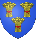
Outarville
| Outarville | ||
|---|---|---|

|
|
|
| region | Center-Val de Loire | |
| Department | Loiret | |
| Arrondissement | Pithiviers | |
| Canton | Pithiviers | |
| Community association | Plaine du Nord Loiret | |
| Coordinates | 48 ° 13 ' N , 2 ° 1' E | |
| height | 120-139 m | |
| surface | 46.61 km 2 | |
| Residents | 1,337 (January 1, 2017) | |
| Population density | 29 inhabitants / km 2 | |
| Post Code | 45480 | |
| INSEE code | 45240 | |
| Website | http://www.mairie-outarville.fr/ | |
Outarville is a French commune with 1,337 inhabitants (as of January 1 2017) in the department of Loiret in the region Center-Val de Loire . It belongs to the Arrondissement of Pithiviers and the Canton of Pithiviers (until 2015: Canton Outarville ). The inhabitants are called Outarvillois .
geography
Outarville is about 35 kilometers northeast of Orléans . Outarville is surrounded by the neighboring communities of Erceville in the north, Autruy-sur-Juine in the northeast, Charmont-en-Beauce in the east and northeast, Léouville in the east, Greneville-en-Beauce in the southeast, Bazoches-les-Gallerandes in the south, and Chaussy in the South and southwest, Toury in the west and southwest, Oinville-Saint-Liphard in the west and Boisseaux in the northwest.
Population development
| year | 1962 | 1968 | 1975 | 1982 | 1990 | 1999 | 2008 | 2013 |
| Residents | 421 | 443 | 1,268 | 1,371 | 1,305 | 1,441 | 1,458 | 1,400 |
| Source: Cassini and INSEE | ||||||||
Attractions
- 17th century Saint Laurent Church in Outarville
- Saint-Pierre Church in Allainville
- Church in Saint-Péravy
Personalities
- Octave Houdas (1840-1916), orientalist


