
Palatinate Weinsteig
| Palatinate Weinsteig | |
|---|---|
 Palatinate Weinsteig near Eschbach |
|
| Data | |
| length | ≈ 172 km |
| location | Palatinate Forest , Haardtrand |
| Markers | red and white wave |
| Starting point |
Bockenheim an der Weinstrasse 49 ° 36 ′ 34.6 ″ N , 8 ° 10 ′ 52.3 ″ E |
| Target point |
Schweigen-Rechtenbach 49 ° 3 ′ 7.9 ″ N , 7 ° 57 ′ 22.7 ″ E |
| Type | Prädikatswanderweg |
| Height difference | 557 m |
| The highest point | 673 |
| Lowest point | 116 |
| particularities | longest grade hiking trail in the Palatinate |
The Palatinate wine trail is 172 km in length and eleven reported daily stages the longest predicate trail - before the Palatinate Forest path and the Palatine Trail - in the Palatinate ( Rheinland-Pfalz ). The long-distance hiking trail was opened in December 2010 and received its award as a predicate hiking trail in September 2011. The eleventh section in the north, which was missing for more than four years, was opened at the end of March 2015.
course
The Palatinate Weinsteig leads in a north-south direction from Bockenheim to Schweigen-Rechtenbach , where there is a connection to the Palatinate Forest Path . The hiking route changes back and forth between the Palatinate wine-growing region on the German Wine Route and the eastern part of the Palatinate Forest . The Palatinate wine-growing region is the second largest in Germany, the Palatinate Forest forms the northern part of the German - French Palatinate Forest-Northern Vosges biosphere reserve .
description
overview
The components of the name Wein and Steig make it clear that the hiking trail links the two main tourist attractions of the Palatinate with one another, namely viticulture on the western edge of the Rhine plain and the largely wooded low mountain range with its uphill and downhill stretches to the west . Over the entire route, the elevation profile shows 4870 vertical meters uphill and 4810 downhill. The lowest point is 116 m in the country town of Deidesheim on the Weinstrasse and the highest is 673 m on the summit of Kalmit , the highest point in the Palatinate Forest.

Stages
Since 2015, eleven stages between 12 and 21 km have been recommended for the entire hike.
| begin | target | Route length (km) | |
|---|---|---|---|
| 1. | Bockenheim ad Weinstrasse | Newcomers | 17th |
| 2. | Newcomers | Bad Dürkheim | 18th |
| 3. | Bad Dürkheim | Deidesheim | 15th |
| 4th | Deidesheim | Neustadt an der Weinstrasse | 19th |
| 5. | Neustadt an der Weinstrasse | St. Martin | 21st |
| 6th | St. Martin | Burrweiler | 15th |
| 7th | Burrweiler | Dernbach | 16 |
| 8th. | Dernbach | Annweiler am Trifels | 15th |
| 9. | Annweiler am Trifels | Klingenmünster | 17th |
| 10. | Klingenmünster | Bad Bergzabern | 12 |
| 11. | Bad Bergzabern | Schweigen-Rechtenbach | 15th |
Stations and sights
Stations and sights are sometimes dealt with in more detail by various interest groups.
- House of the German Wine Route at its northern end
- Historic town center
- Neuleiningen castle ruins
- Lightning tubes natural monument
- Dürkheimer Wurstmarkt , the largest wine festival in the world, at the Dürkheimer giant barrel (1,700,000 liters)
- Hardenburg ruins ; Limburg monastery ruins ; Roman quarry Kriemhildenstuhl ; Celtic settlement Heidenmauer ; former cult object Teufelsstein
- Historic old town with town hall and parish church of St. Ulrich
- Folk festival billy goat auction
- Fliehburg Heidenlöcher
- Collegiate Church and historic old town
- German grape harvest festival with the largest German winegrowers' parade and the coronation of the German Wine Queen
- Almond blossom festival in the Gimmeldingen district; Donkey skin festival in the Mußbach district
- Hambacher Schloss , 1832 scene of the Hambacher Festival ; Winzingen Castle ruins with Haardter Castle ; Wolfsburg ruin
- Villa Ludwigshöhe Palace ; Rietburgbahn chairlift
- Historical old city
- Castle Group Trifels , Anebos and Scharfenberg
- Deutsches Weintor at the southern beginning of the German Wine Route
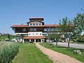
House of the German Wine Route in Bockenheim

Ornamental floats at the Neustadt winegrowers' parade

Villa Ludwigshöhe near Edenkoben

German wine gate in silence


.JPG)


literature
- Hiking start with a distinction . In: Die Rheinpfalz , LEO season "Spring" . Ludwigshafen April 2011, p. 8-11 .
- Palatinate long-distance hiking trails: Palatinate Weinsteig - Palatinate Forest Trail - Palatinate High Trail (= Roth hiking guide ). 2nd Edition. Bergverlag Rother, Oberhaching 2016, ISBN 978-3-7633-4401-7 .
Web links
- Pfälzer Weinsteig on the Palatinate hiking menu
- Palatinate Weinsteig near Deutsche Weinstrasse
- Pfälzer Weinsteig on outdooractive with gpx data
Individual evidence
- ↑ a b c d Pfälzer Weinsteig, Bockenheim - Schweigen - Rechtenbach (= Leporello hiking map 1: 25,000 ). 2nd Edition. Publicpress, Geseke 2016, ISBN 978-3-89920-677-7 .
- ↑ Pfälzer Weinsteig: Numbers, data, facts. Rhineland-Palatinate Tourism, accessed on November 6, 2013 .
- ↑ a b gsp (author's abbreviation): Pfälzer Weinsteig is complete . In: Die Rheinpfalz , local edition Frankenthaler Zeitung . Ludwigshafen April 1, 2015, p. 24 .
- ↑ Sport and Fitness. Pfalz-Touristik, accessed on April 7, 2011 (menu item).
- ↑ hiking. Wanderportal Pfalz, accessed on April 7, 2011 (menu item).