Poum (North Macedonia)
| Poum Поум Poumi |
||||
|---|---|---|---|---|
|
||||
| Basic data | ||||
| Region : | southwest | |||
| Municipality : | Struga | |||
| Coordinates : | 41 ° 17 ' N , 20 ° 43' E | |||
| Height : | 1075 m. i. J. | |||
| Residents : | 168 (2002) | |||
| Telephone code : | (+389) 046 | |||
| Postal code : | 6338 | |||
| License plate : | SU | |||
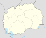
Poum [ ˈpoˌum ] is a village in Opština Struga in southwest Macedonia . It is located at 1075 meters above sea level and has 168 inhabitants.
Surname
In Macedonian the village is called Poum ( Cyrillic : Поум), with the emphasis on the first syllable, thus: [ ˈpoˌum ]. In Albanian, on the other hand, the emphasis on the indefinite village name is reversed, ie: [ ˌpoˈum ]. The specific form in Albanian is Poumi [ ˌpoˈumi ], which means that the noun is a masculine, as is the case in Macedonian.
geography
Poum is located on the southwest slope of a range of hills that belongs to the Karaorman massif. A three-kilometer-long stream valley begins just below the village in the southwest and ends west of the neighboring village Delogoždi . There the stream continues to flow, takes in more and then flows into the Sateska and Schwarzer Drin river systems .
Poum is a typical street village that stretches in a south-east-north-west length, and arose on the road from Delogoždi towards Mislodežda . The people who traditionally lived from agriculture and cattle breeding found fertile, rivulet-riddled and only slightly rising mountain slopes that they could cultivate.
To the northeast of the settlement area, the mountain slope rises steeply and is forested over 400 meters. On the hilltops there are alpine pastures that were formerly used by cattle.
Neighboring villages are in the north Radomirovo (8 km as the crow flies), in the northeast Crvena Voda (6.5 km), in the east Botun (6.7 km), in the southeast Klimeštani (5.5 km) and Korošišta (4 km), im South Delogoždi (2.4 km) and Dolno Tateši (2.8 km), in the south-west Gorno Tateši (3.5 km), in the west Toska (2.9 km), Bogojci (3.2 km) and Brčevo (3 , 4 km) and in the northwest Mislodežda (2.2 km).
Demographics
According to the last census carried out in 2002, Poum had 168 residents living in 34 households, which included 43 buildings. This resulted in almost five people per household. Ethnically, 164 people (98%) saw themselves as Albanians , the remaining four belonged to other ethnic groups. As a mother tongue, the distribution was exactly the same: 164 had Albanian as their mother tongue, the remaining four spoke other languages. And also in the denomination 164 people saw themselves as Muslims , while the remaining four confessed to others.
history
In 1873 there were 27 households in the village in which 71 Muslim men lived. The statistics carried out by the Ottoman Empire at that time did not include women.
In 1900 Vasil Kančov's statistics in Poum counted 360 Muslim Albanians.
dialect
The villagers speak the Central Gian dialect of Albanian. For example, in this area one does not say mirë [ ˈmiˌɾ (ə) ], “good”, or shtëpi [ ˌʃt „ pi ], “(a) house”, (standard Albanian ), but mëjr [ ˈməjɾ ] or shpëj [ ˌʃpəj ].
Individual evidence
- ↑ a b c Macedonia Census. In: State Statistical Office. 2002, accessed January 17, 2016 .
- ^ The Former Yugoslav Rep. Of Macedonia (country code +389). In: International Telecommunication Union. Retrieved January 17, 2016 (English, PDF file; 41.7 kB).
- ↑ Rrjeti postal. (No longer available online.) In: Macedonische Post. Archived from the original on December 6, 2015 ; accessed on January 17, 2016 (Albanian, post office is in Delogoždi ). Info: The archive link was inserted automatically and has not yet been checked. Please check the original and archive link according to the instructions and then remove this notice.
- ↑ Македонски научен институт, Macedonian Research Institute (ed.): Македония и Одринско. Статистика на населението от 1873 г. (Macedonia and Adrianople. Population statistics from 1873) . Sofia 1995, p. 104-105 .
- ↑ Македония. Етнография и Статистика. Retrieved January 17, 2016 (Bulgarian).
Remarks
- ↑ Average height in meters above sea level in the settlement area


