
Railaco (administrative office)
| Railaco administration office | |||
|
|||

|
|||
| Administrative headquarters | Railaco | ||
| surface | 92.15 km² | ||
| population | 12,128 (2015) | ||
| Sucos | Population (2015) | ||
| Deleso | 503 | ||
| Fatuquero | 2,371 | ||
| Liho | 2,057 | ||
| Matata | 1,373 | ||
| Railaco Craic | 1,435 | ||
| Railaco Leten | 1,379 | ||
| Samalete | 1.108 | ||
| Taraco | 587 | ||
| Tocoluli | 1,315 | ||
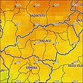
| Overview map | |||

|
|||

|
|||

Railaco is an East Timorese administrative office ( Portuguese Posto Administrativo ) in the municipality of Ermera . The administrative headquarters are in Railaco .
geography

Until 2014, the administrative offices were still referred to as sub-districts . Until 2014, the administrative offices were still referred to as sub-districts . Before the 2015 regional reform, Railaco had an area of 105.73 km². Now there are 92.15 km².
The Railaco administrative office is located in the northeast of the municipality of Ermera. To the southeast is the Ermera administrative office . In the north, Railaco borders on the administrative office Bazartete belonging to the municipality Liquiçá and in the east on the administrative offices Laulara and Aileu belonging to the municipality Aileu . The border with Ermera is formed by the Rio Gleno , a tributary of the Lóis, flowing westwards . The Maurotieramata , which rises in the southeast of Railaco, also flows into the Gleno , while Buamara and Balele flow north into the Comoros system . Railaco Subdistrict divided into nine Sucos : Deleso ( Deleco , Oeleso ) Fatuquero , Liho ( Lihu ), Matata , Railaco Subdistrict Craic ( Railaco Subdistrict Kraik , "sub-Railaco Subdistrict" ), Railaco Subdistrict Leten ( Railako Leten , "Ober-Railaco Subdistrict" ), Samalete ( Samaletes ), Taraco ( Taraso , Taraço ) and Tocoluli ( Tokoluli ).
- Climate data
Annual rainfall (2000)
Average annual temperature (2000)


Residents
12,128 people live in the administrative office (2015), of which 6,350 are men and 5,778 women. The population density is 131.6 inhabitants / km². The largest language group are the speakers of the national language Mambai . The average age is 17.5 years (2010, 2004: 15.8 years).
history


In 1975, 70 Sucos residents of Taraco and Samalete fled into the woods after intimidation by UDT supporters . At the same time, seven UDT members were murdered by FRETILIN supporters. The murdered are said to have been involved in murders of FRETILIN supporters themselves. Another FRETILIN supporter was later killed by UDT members in revenge.
In March / April 1976, Indonesian troops penetrated into what was then the Railaco sub- district . Civilians were also deliberately murdered. East Timorese were forcibly resettled to better control the country. For this they were housed in transit camps . One of the worst camps was in Railaco from the end of 1979. The Indonesian Battalion 721 interned people in it who had lived with the resistance fighters in the mountains for a particularly long time. Survivors report that they had to gather roots and leaves to avoid starvation. Only once did the internees receive a small amount of corn and salted fish from the soldiers. The fish caused diarrhea in the undernourished, which was often fatal. Aid organizations never visited the camp. According to the reports, up to ten people died a day, mostly children and the elderly.
In 1992 the inhabitants of Eraulo (Suco Samalete) were forcibly relocated to the island of Atauro . The reason was that they allegedly had family members who sought refuge in the woods. Three of the forced deportees died within two months.
There were also acts of violence in Railaco after the independence referendum in East Timor in 1999 by pro-Indonesian militias .
politics

During the Indonesian occupation, Lino de Jesus Torrezão was the administrator of Railaco between 1997 and 1999.
The administrator of the administrative office is appointed by the central government in Dili. In 2015 it was Bacelar C. Martins .
economy
81% of the households in Railaco grow cassava, as many maize, 77% coffee, 66% vegetables, 66% coconuts and 10% rice.
Web links
Individual evidence
- ↑ a b c d e Direcção-Geral de Estatística : Results of the 2015 census , accessed on November 23, 2016.
- ↑ Jornal da República : Diploma Ministerial no 24/2014 de 24 de Julho - Orgânica dos Postos Administrativos ( Memento of March 4, 2016 in the Internet Archive )
- ↑ a b Direcção Nacional de Estatística: 2010 Census Wall Chart (English) ( Memento of the original from August 12, 2011 in the Internet Archive ) Info: The archive link was automatically inserted and not yet checked. Please check the original and archive link according to the instructions and then remove this notice. (PDF; 2.5 MB)
- ^ Timor-Leste GIS-Portal ( Memento from June 30, 2007 in the Internet Archive )
- ↑ a b Seeds of Life
- ↑ Direcção Nacional de Estatística: Census of Population and Housing Atlas 2004 ( Memento of November 13, 2012 in the Internet Archive ) (PDF; 14 MB)
- ↑ CAVR Chega Files: Part 7.2: Unlawful Killings and Enforced Disappearances ( Memento of the original from March 25, 2016 in the Internet Archive ) Info: The archive link was inserted automatically and has not yet been checked. Please check the original and archive link according to the instructions and then remove this notice. (PDF; 2.5 MB)
- ↑ a b c CAVR Chega Files: Part 7.3: Forced Displacement and Famine ( Memento of the original from November 28, 2015 in the Internet Archive ) Info: The archive link was inserted automatically and has not yet been checked. Please check the original and archive link according to the instructions and then remove this notice. (PDF; 1.3 MB)
- ↑ Ministério da Administração Estatal: Lino Jesus Torrezão, Vice-Ministro da Administração Estatal: Nota Biográfica , accessed on August 29, 2020.
- ↑ Ministério da Administração Estatal: Administração Municipal ( Memento of the original from June 1, 2016 in the Internet Archive ) Info: The archive link has been inserted automatically and has not yet been checked. Please check the original and archive link according to the instructions and then remove this notice.
- ↑ Direcção Nacional de Estatística: Suco Report Volume 4 (English) ( Memento of the original from April 9, 2015 in the Internet Archive ) Info: The archive link was inserted automatically and has not yet been checked. Please check the original and archive link according to the instructions and then remove this notice. (PDF; 9.8 MB)
Coordinates: 8 ° 40 ′ S , 125 ° 26 ′ E
The administrative borders within East Timor changed in 2015. This article must therefore be checked and updated if necessary. See New Administrative Boundaries .