Sèvre Niortaise
| Sèvre Niortaise | ||
|
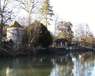
Image of the river near Niort |
||
| Data | ||
| Water code | FR : N --- 0060 | |
| location | France , Nouvelle-Aquitaine regions and Pays de la Loire | |
| River system | Sèvre Niortaise | |
| source | at Sepvret 46 ° 17 '32 " N , 0 ° 6' 9" W. |
|
| Source height | approx. 150 m | |
| muzzle | north of La Rochelle in the Atlantic Coordinates: 46 ° 18 ′ 30 " N , 1 ° 7 ′ 48" W 46 ° 18 ′ 30 " N , 1 ° 7 ′ 48" W |
|
| Mouth height | approx. 0 m | |
| Height difference | approx. 150 m | |
| Bottom slope | approx. 0.95 ‰ | |
| length | 158 km | |
| Left tributaries | Lambon , mignon | |
| Right tributaries | Pamproux , Autise , Vendée | |
| Medium-sized cities | Niort | |
| Small towns | Saint-Maixent-l'École , La Crèche | |
| Navigable | from the mouth to Niort | |
The Sèvre Niortaise is a river in western France . It rises near Sepvret in the Deux-Sèvres department and runs in an east-west direction to the Atlantic Ocean , where it flows into the bay of L'Aiguillon-sur-Mer after 158 kilometers north of La Rochelle .
It is not to be confused with the Sèvre Nantaise , which has its source about 40 kilometers further northwest, flows in a south-north direction and flows into the Loire in Nantes . The two rivers of the same name gave the Deux-Sèvres (German: Zwei Sèvres ) its name.
River landscape
The landscape of the Sèvre Niortaise changes its character a few times in its course:
- In the upper reaches, up to Niort , the river runs through a hilly landscape with many meander loops . The gradient was used by around 50 water mills , some of which were largely disused and converted into residential buildings.
- At Niort the river enters a lowland , which is the remains of a former Atlantic bay ( Gulf of Pictons ) that has been gradually drained since the 11th century . Here the Sèvre Niortaise becomes a broad and often wind-exposed river. It flows through and drains the Marais Poitevin with the Venise Verte and turns into a marshland river .
- From Marans onwards it is influenced by the tides and turns into a tidal river , which then flows into the Anse d'Aiguillon , an Atlantic bay north of La Rochelle and the island of Île de Ré .
shipping
The Sèvre Niortaise is navigable for 72 kilometers from Niort to its mouth in the Atlantic.
- The section between Niort and Marans is canalized, with some river loops being shortened by canals . Here the ships are also connected to the canalized rivers Mignon and Jeune Autise , as well as to the Canal de la Vieille Autise .
- The section from Marans to the estuary is one of the sea waterways . A bypass canal , the Canal Maritime de Marans au Brault, was created for part of this route , a sea canal through which coastal vehicles can reach the small seaport of Marans.
The main purpose of the Sèvre Niortaise was to enable timber to be transported from the Marais du Poitevin to the seaports of Marans and La Rochelle. Some tugs are still busy rafting wood downstream, otherwise the transport volume is low. Pleasure boats also rarely get lost in this area. In the marshland of the Marais de Poitevin, however, excursions with small tourist boats are often organized.
Crossed departments
Places on the river
- Sepvret
- La Mothe-Saint-Héray
- Saint-Maixent-l'École
- La crèche
- Chauray
- Échiré
- Niort
- Coulon
- Damvix
- L'Île-d'Elle
- Marans
Web links
Individual evidence
- ↑ a b geoportail.fr (1: 16,000)
- ↑ a b The information on the length of the river is based on the information on the Sèvre Niortaise from SANDRE (French), accessed on November 28, 2011, rounded to full kilometers.

