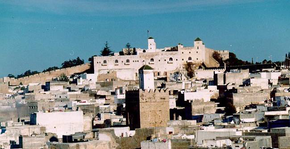
Safi (province)

Safi ( Arabic إقليم آسفي) Is a nearly 4100 square kilometers comprehensive province with about 700,000 inhabitants in today's Region Marrakech-Safi in western Morocco on the coast of the Atlantic Ocean . When the province of Youssoufia split off in 2009, it was reduced in size. It has belonged to the Marrakech-Safi region since 2015 (previously to Doukala-Abda ) and is located southwest of Casablanca .
geography
location
The province extends along an approx. 120 km long coastal strip on the Atlantic. Most places in the hinterland are at an altitude of about 150 to 300 m above sea level. d. M .; the highest elevations in the province with approx. 500 to 600 m above sea level. d. M. are located in the mountainous border area to the southwest bordering province of Essaouira . Apart from a few streams that only form after heavy or prolonged rainfall, there is no major river in the province.
climate
The province's climate is influenced to a large extent by the Atlantic Ocean and by Moroccan standards it is more moderate.
Places (selection)
Only the cities of Safi , Jamaat Shaim and Sebt Gzoula are classified as urban settlement areas ( municipalités ); the other places are considered rural communities ( communes rurales ).

| local community | 1994 residents |
2004 residents |
Residents 2014 |
|---|---|---|---|
| Safi (M) | 262.276 | 284,750 | 308.508 |
| Jamaat Shaim (M) | 13,548 | 15,325 | 11,251 |
| Sebt Gzoula (M) | 10,363 | 13,943 | 18,543 |
| Bouguedra | 21,457 | 21,700 | 16,014 |
| Lamrasia | 15,639 | 16,812 | 18,335 |
| Lama agate | 12,463 | 13,892 | 15,389 |
| Ayir | 20,586 | 24,176 | 27.608 |
| Hrara | 20,894 | 23,711 | 26,103 |
| Saadla | 13,475 | 14,988 | 16,633 |
economy
The inhabitants of the coastal province make a living from fishing; Agriculture, which also includes cattle breeding, is mainly carried out in the hinterland - capers are also picked for export here . Larger companies only exist in the Safi area; the city also attracts local and international tourists and offers a corresponding infrastructure.
history
Little is known about the older and medieval history of the region due to the lack of written records. Safi was founded by the Portuguese in the middle of the 15th century; the base could be held until the beginning of the 17th century.
Attractions
The most important sights are all located in the city of Safi: The sea castle ( Dar el Bahr ) built by the Portuguese is located directly above a rock that slopes steeply towards the sea. The Chapelle Portugaise is a church building in Manueline style from the beginning of the 16th century that has only been partially preserved . In the Kechla there is a museum for ceramic art.
In the southwest of the province, at the mouth of the Oued Tensift, rise the walls of the Portuguese fortress Souira Kedima, built in the early 16th century .
literature
- Arnold Betten: Morocco. Antiquity, Berber Traditions and Islam - History, Art and Culture in the Maghreb. DuMont, Ostfildern 2012, ISBN 978-3-7701-3935-4 , p. 320ff.
Web links
- Safi and Province - Photos + Info (French)
Individual evidence
- ^ Safi Province - Maps and Statistics
- ↑ Safi - climate tables
- ↑ Bouguedra - climate tables
- ↑ Population statistics Morocco ( Memento from March 3, 2016 in the Internet Archive )

