Schlabendorfer Mining Landscape - Lichtenauer See
|
Schlabendorfer Mining Landscape - Lichtenauer See
|
||
| location | Brandenburg , Germany | |
| surface | 4.65 km² | |
| Identifier | 1116 | |
| WDPA ID | 165396 | |
| Geographical location | 51 ° 49 ' N , 13 ° 53' E | |
|
|
||
| Setup date | January 16, 1997 | |
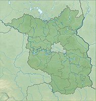
The Schlabendorfer Mining Landscape - Lichtenauer See nature reserve is located in the Oberspreewald-Lausitz district in Brandenburg .
The area with the identification number 1116 was placed under nature protection by ordinance of January 16, 1997 . The approximately 465 hectare nature reserve with the 326 hectare Lichtenauer See extends east of Schlabendorf am See , a district of the city of Luckau , and west of Lichtenau , a district of the Lübbenau district of Kittlitz . The state road L 526 runs to the north, the A 13 to the east and the L 52 to the south. The 600-hectare Schlabendorfer See extends to the south-west and the 140-hectare Schönfelder See to the east .
See also
- List of nature reserves in the Oberspreewald-Lausitz district
- List of FFH areas in Brandenburg
- Schlabendorf-Nord opencast mine
- Post-mining landscape
Web links
- World Database on Protected Areas - Schlabendorfer Mining Landscape - Lichtenauer See (English)
- Schlabendorfer Mining Landscape - Lichtenauer See on Niederlausitzer-landruecken-naturpark.de, accessed on November 13, 2019

