Schlade (Bergisch Gladbach)
|
Schlade
City of Bergisch Gladbach
Coordinates: 51 ° 0 ′ 13 ″ N , 7 ° 8 ′ 59 ″ E
|
||
|---|---|---|
|
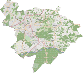
Location of Schlade in Bergisch Gladbach |
||
|
In the Schlade
outcrop in the fore reef area |
||
The Schlade is a dry valley in the Paffrather Kalkmulde and a district in the Hebborn and Romaney districts of Bergisch Gladbach . Due to the diversity of the morphological treasure trove, the geological history and the extraordinary vegetation , the valley is now protected as a nature reserve , geotope and ground monument .
description
The word Schlade means gorge or valley . The road In der Schlade leads through a gorge from Hebborn to Romaney. The name Schlade corresponds to the historical circumstances, since the original cadastre gives the name of the tub in the Schlade . The name In der Schlade therefore refers to the topography and describes the location and course of the road in a valley. The Schlade is a dry valley in a Devonian reef limestone area and a geological research area of supra-local importance. No surface water runs through the valley floor. The reason for this is a deep karstification of the subsoil, which is based on the water solubility of the limestone . The waters in karst areas often follow an underground course along crevices and fissures, which can expand into caves when the limestone is further dissolved .
Geological evolution
400 to 370 million years ago, today's area around Bergisch Gladbach was close to the equator on the south coast of the Old Red continent . From the Lower Middle Devon, a mainland emerged in the Siegerland area. Between the so-called Siegerland Block in the south and the Old Red continent in the north, a flat shelf area with individual islands developed, at the edges of which reef bodies could form under the then prevailing tropical climate conditions. These reefs were mainly formed from corals and stromatopores . In the Tertiary , the Lower Rhine Bay began to sink in more intensely, combined with intensive karstification of the Devonian reef limestone and the lowering of the groundwater level in the Schlade.
The Schlade has been a national geotope since 2006 . In the middle of a nature reserve, the different facies areas of a reef - from the surf zone to the reef lagoon - are excellently developed.
Grubenfeld quarry
In the Grubenfeld quarry, the transition from the reef rubble on the outside of the reef to the reef core with a surf zone and limestone formations that have arisen in a lagoon protected from the surf is exposed from west to east . Some of the former limestones are deeply dolomitized . Through the unfolding of the Rhenish Massif in the Upper Carboniferous , the former mainly are horizontally deposited rocks have been adjusted so that the limestone beds today over large areas with 40-60 ° occur .
Quarry at the Kohlenbusch
In the “Am Kohlenbusch” quarry, mainly biogenic carbonate rocks that were formed in the reef lagoon are exposed. The limestones are characterized by the appearance of brachiopods and snails as well as small stromatopores (amphipora), which are also partially dolomitized in this quarry. In the south-western part of the quarry, platy limestone occurs, which was sedimented on the border between the Middle and Upper Devonian in the central lagoon areas.
Lime kiln
A large quarry was operated in the Schlade until the middle of the 20th century. This was particularly associated with the lime kiln, which was widespread throughout the Paffrath Kalkmulde .
Mining
Up to 1925, Prince Wilhelm iron ore was mined at the mine , which was most recently used for the chemical industry, especially because of its ocher content . Pinging from the Albert pit can be found in the southeastern part of the Schlade.
Ground monument
The entire area of the Schladetal, in which a lime kiln used to stand in a quarry , and the area of the Prince Wilhelm mine were entered under No. 7 in the list of archaeological monuments in Bergisch Gladbach .
See also
literature
- Ulrich Jux : On the stratigraphic structure of the Devonian profile of Bergisch Gladbach (Rheinisches Schiefergebirge) , Decheniana , Volume 117, Issue 1/2, Bonn 1964.
- Harald Frater: Geologische Streifzüge - Cologne, Bergisch Gladbach and the surrounding area , Cologne 2004, ISBN 3-7616-1754-2 .
Individual evidence
- ^ A b Andree Schulte, Bergisch Gladbach, city history in street names , published by the Bergisch Gladbach city archive, volume 3, and by the Bergisches Geschichtsverein department Rhein-Berg e. V., Volume 11, Bergisch Gladbach 1995, p. 94 f., ISBN 3-9804448-0-5
- ↑ Jürgen Klasen, Ulrich Jux and others: The Schlade, a dry valley in the Bergisch Gladbach-Paffrather Kalkmulde , Rhineland Regional Association , Landscape Management Section, No. 9.1, Cologne 1969
- ↑ a b Geotop Schlade accessed on February 3, 2013
- ↑ Harald Frater: Geologische Streifzüge - Cologne, Bergisch Gladbach and surroundings , Cologne 2004, ISBN 3-7616-1754-2 , 111f.
- ↑ Harald Frater: Geologische Streifzüge - Cologne, Bergisch Gladbach and surroundings , Cologne 2004, ISBN 3-7616-1754-2 , 113
- ^ Hans Leonhard Brenner : The history of the lime distillery in Bergisch Gladbach , Verlag Gronenberg, Gummersbach 1992, ISBN 3-88265-171-7
Web links
- A prehistoric coral reef is excellently developed here, accessed on February 3, 2013
- National geotope ?? Limestone reef Schladetal ?? - Kölner Stadt-Anzeiger from March 15, 2007. Accessed March 2, 2017


