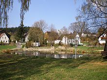
Same forest
| Same forest | |
|---|---|
|
The Fichtelgebirge in northeast Bavaria |
|
| Highest peak | Wartberg near Selb ( 688 m above sea level ) |
| location | Bavaria |
| part of | Thuringian-Franconian low mountain range |
| Classification according to | Handbook of the natural spatial structure of Germany |
| Coordinates | 50 ° 11 ′ N , 12 ° 12 ′ E |
The Selber Forest is a mountain range that is almost completely covered with spruce forests at 500 to 688 m above sea level. NN and former community-free forest area in the eastern Fichtel Mountains . With effect from April 1, 2013, the Selber Forest was incorporated into the municipality of Selb .
In natural terms, the Selber Forest represents the subunit 39501 or 395-B within the main unit Selb-Wunsiedler plateau (395). Since September 2010 there has been a new design of the natural areas of northeast Bavaria.
geography
The Selber Forest extends in the north of Längenau near Selb along the state border with the Czech Republic to the south to northwest of Schirnding and extends in the west to the Höchstädt area .
Its continuation on the Czech side is the Hazlovská pahorkatina (German about: Haslauer Hügelland).
topography
A rough topographic classification in terms of largely of mixed forest existing vegetation can next to the department DIY forestry department Kaiserhammer Forst-West , Kaiserhammer Forest East and Hohenberger Forst done.
geology
Geologically , the mountain range consists essentially of granite . The history of its orogeny begins in the Precambrian about 750–800 million years ago - the mountains cover almost 20% of the earth's history , which only applies to a few of the rump mountains that still exist today . The Selber Forest is often interspersed with basalt cones .
mountains
The highest mountain in the Selber Forest is the Wartberg near Selb at 688 m above sea level. NN .
- For more mountains see Selb-Wunsiedler plateau .
Localities
Smaller towns such as Längenau, Silberbach , Neuhaus an der Eger or Sommerhau and many hamlets and wastelands are scattered in the Selber Forest.
Waters
The rivers Eger , Silberbach , Selb and Steinselb, as well as chains of ponds on the northern and southern edge of the Wellertal. The shop fountain is located on the eastern edge of the Selber Forest, directly on the border with the Czech Republic . Lausenbach and Großbach also arise in the eastern part, on the northern slopes of Hohe Wart and Brandberg . While the Lausenbach runs west, later south-west, towards Wellertal and flows into the Eger there, the Großbach runs only briefly in Bavarian territory. It runs off east to the Czech Republic and flows there as Libský potok into the Schladabach , which also runs only briefly in the Selber Forst , which rises as Slatinný potok south of Aš and flows into the Ohře via Hazlov and Františkovy Lázně east of the town of Cheb .
natural reserve
The significant landscape has many high quality habitats. The designation of nature reserves and the establishment of a nature park also take this into account.
Biotopes
The Selber Forest is a retreat for the black stork and a territory for the re- expansion of the lynx .
history
The name Waldsteinerkette, used until the 19th century for the northwest flank of the Fichtelgebirge, has been forgotten and is no longer used.
proof
- ↑ Upper Franconian Official Gazette No. 3 of March 26, 2013 ( Memento of the original of March 4, 2016 in the Internet Archive ) Info: The archive link was inserted automatically and has not yet been checked. Please check the original and archive link according to the instructions and then remove this notice. (PDF; 199 kB), Government of Upper Franconia
- ↑ Natural subdivision
- ^ E. Meynen and J. Schmithüsen : Handbook of the natural spatial structure of Germany
- ↑ Map services of the Federal Agency for Nature Conservation ( information )
- ^ Karl Heinrich Vollrath: Viola in Northeast Bavaria (page 132-133)
- ↑ Geodata with the BayernAtlas
- ^ Heinrich Berghaus: The Fichtel Mountains and the Franconian Jura in: Deütschlands Höhen - Contributions to the exact knowledge of the same (1834), on books.google.de
cards
- Fritsch hiking map 1: 50,000 Fichtelgebirge-Steinwald
Web links
- BfN landscape profiles
- Fichtel Mountains
- Wellertal (Eger)
- Längenau near Selb


