Moravice (river)
|
Moravice (German: Mohra ) |
||
|
Source of the Moravice |
||
| Data | ||
| location | Moravskoslezský kraj , Czech Republic | |
| River system | Or | |
| Drain over | Opava → Or → Stettiner Haff | |
| source | Velký Kotel at the southeastern foot of the Vysoká hole in the Jeseníky Mountains 50 ° 3 ′ 17 ″ N , 17 ° 14 ′ 22 ″ E |
|
| Source height | 1170 m nm | |
| muzzle | east of the city of Opava , opposite Malé Hoštice, in the Opava coordinates: 49 ° 55 ′ 38 ″ N , 17 ° 56 ′ 45 ″ E 49 ° 55 ′ 38 ″ N , 17 ° 56 ′ 45 ″ E |
|
| Mouth height | 242 m nm | |
| Height difference | 928 m | |
| Bottom slope | 9.2 ‰ | |
| length | 100.5 km | |
| Catchment area | 899.9 km² | |
| Reservoirs flowed through | Dam Slezská Harta , dam Kružberk | |
The Moravice (German: Mohra ) is a right tributary of the Opava in the Czech Republic .
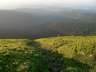
It rises on the main ridge of the Jeseníky Mountains at the southeastern foot of the Vysoká hole ( High Heide , 1464 m). Their source is 1170 m above sea level. M. in the Velký Kotel glacier cirque ( Great Basin ). On its way to the southeast, the Moravice flows through Karlov pod Pradědem and turns south in Malá Morávka . Via Lesní Mlýn, Dolní Moravice , Malá Štáhle and Velká Štáhle , the course of the Moravice leads into the Lower Jeseníky to Břidličná , where it changes direction to the east. The Bruntál - Rýmařov railway line runs along the Moravice between Velká Štáhle and Valšov .
Between the villages of Dolní Moravice and Malá Štáhle, the 41.98 hectare nature reserve Niva Moravice was declared in 1998 . The river meanders and the bordering wet meadows are on the main migration route of Central Europe and offer bird life an important breeding and retreat area. For example, the honey buzzard , the tree hawk , the eagle owl and the hoopoe can be found here.
- Slezská Harta dam
The Slezská Harta dam was built between Nová Pláň , Roudno , Razová and Leskovec nad Moravicí between 1987 and 1997 . It is used to supply Ostrava with drinking water and to protect against floods. Its dam is located at the foot of Na Hartě ( Hart , 577 m) and is 64.8 m high and 540 m long. Parts of Nová Pláň, the village of Karlovec and several layers along the river were flooded.
- Kružberk dam
Below the dam are the settlements Slezská Harta, Moravská Harta and Dvorecký Mlýn on the Moravice, which now flows to the southeast and reaches the Kružberk Dam after two kilometers . The plans for the construction of this dam with a water surface of 287 ha, which also serves to supply Ostrava with water, were made between 1930 and 1932. The construction took place between 1948 and 1955. The dam is 33 m high and 280 m long. The Kružberk reservoir extends over a length of 10 km and reaches a depth of 31 m. At the upper end of the reservoir are the remains of the Medlice and Šternek castles on both sides. In the course of the construction of the dam, the villages of Medlice , Kerhartice and Lesy in the immediate vicinity were demolished. Below the dam are the Cvičné skály climbing rocks.
The Moravice then winds in numerous river loops in eastern directions. The towns of Kružberk , Jánské Koupele, Mokřinky and Zálužné lie along the river . Above Podhradí, the Moravice is dammed again by means of a weir in the Podhradí compensation reservoir (Vyrovnávací nádrž Podhradí). On the left side above the valley are the ruins of the Vikštejn castle .
At the Albrechtický mlýn ( Olbersdorf Mill ) runs on the left side of the river the three and a half kilometers long Weisshuhn Canal (Weisshuhnův kanál). The aqueduct built for Carl Weisshuhn's paper mill in Žimrovice between 1890 and 1891 leads over two aqueducts and through three tunnels. The channel is still fully operational.
At Žimrovice over the river finally winds to the northeast, reaching over Hradec nad Moravicí , Branka u Opavy and Kylešovice east of the city Opava the Opava . After 100.5 km the Moravice flows across from Malé Hoštice at 242 m above sea level. M. in the Opava. The catchment area of the Moravice is 899.9 km².
Tributaries
- Bělokamenný potok ( white stone river , l), Malá Morávka
- Rudný potok (r), Malá Morávka
- Mlýnský potok ( Seifenbach , r), Lesní Mlýn
- Moravický potok ( Kleinmohraubach , r), Dolní Moravice
- Podolský potok ( Podolskybach , r), above Velká Štáhle
- Polička ( Politzbach , r), Břidličná
- Lomnický potok ( Tillendorfer Bach , r) near Valšov
- Kočovský potok ( Kriegsdorfer Bach , l) near Valšov
- Mýdlový potok (r) near Nová Pláň
- Černý potok ( Schwarzbach , l), Slezská Harta dam
- Volárenský potok ( Ochsenbach , r), Slezská Harta dam
- Razovský potok ( Raasebach , l), Slezská Harta dam
- Lesná ( Kreibischbach , r), Moravská Harta
- Bílčický potok ( Heidenpiltscher Bach , r), below Moravská Harta
- Lobník ( Lobnig , r), Kružberk dam
- Melčský potok ( Ratkauer Bach , l), above the Albrechtický mlýn
- Meleček ( Meleczekbach , l), Žimrovice
- Hradečná ( Hradecznabach , r), Hradec nad Moravicí
- Hvozdnice ( Hasnitz , l) above Kylešovice
Web links
- www.vodak.zlin.cz
- Nature reserve Niva Moravice (Czech) ( Memento from March 12, 2009 in the Internet Archive )
Individual evidence
- ↑ Vodní nádrž Kružberk (in Czech)
