Lower Castle (Rheinbreitbach)
| Lower castle | ||
|---|---|---|
|
The foundation walls of the Lower Castle (2010) |
||
| Creation time : | 14th Century | |
| Castle type : | Niederungsburg, location | |
| Conservation status: | Foundation walls | |
| Place: | Rheinbreitbach | |
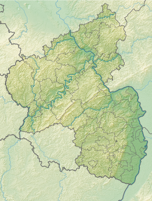
| Geographical location | 50 ° 37 '1.7 " N , 7 ° 13' 50.6" E | |
| Height: | 80 m above sea level NHN | |
|
|
||
The Lower Castle in Rheinbreitbach , a local community in the Rhineland-Palatinate district of Neuwied , dates back to the second half of the 14th century at the latest. The moated castle was the ancestral seat of the von Breitbach family , only the foundation walls of the main building have been preserved.
location
The area of the lower castle, so called to distinguish it from the southern upper castle , is 80 m above sea level. NHN in the center of Rheinbreitbach and adjoins the parish church of St. Maria Magdalena and Burgstrasse to the east. In the south the area is bounded by the Westerwaldstrasse (Rheinbreitbach - Breite Heide ), in the north by the Breitbach .
history
The noble family of the Lords of Breitbach has been documented since the middle of the 13th century. In 1264 they owned a farm in the Mühlental (former name for the Breitbach valley) as an Electorate of Cologne fief . A house also belonged to it, which is regarded as the predecessor of the later castle. In 1473 the Lords of Breitbach moved their seat to the Bürresheim Castle near Mayen , but kept the castle and their property in Rheinbreitbach. Major repairs were carried out on the building in 1613, as well as in 1661 after it was destroyed by Swedish troops. Further construction measures are mentioned for the years 1707/08, 1726 and lastly in 1764, when outbuildings were demolished. In 1797 the male line of the noble family ended and the lower castle was bequeathed to the grandson of the sister of the last male representative, Count Clemens Wenzeslaus von Renesse.
The castle remained in the possession of the von Renesse family, but after the Second World War at the latest it fell into disrepair and overgrown it more and more and was finally abandoned to the last at the end of the 1960s. In the 1970s, most of the former enclosing wall had to give way to the expansion of Westerwaldstrasse. From the end of 2006 to spring 2009, the foundation walls of the castle were exposed as part of a park-like redesign of the surrounding area under the name Renesse-Platz and restored as a dry stone wall in order to be able to permanently preserve it as a ground monument and present it to the public.
investment
The origin and core of the Lower Castle was a four to five-story residential tower on a square floor plan with a pyramidal slate roof . The window arrangement was irregular. A moat five meters wide and three to four meters deep (as of 1940) surrounded the building. A three-storey extension on the west side with a barrel vault on the ground floor is dated to the late Gothic period. In the 17th century, a four-storey southern wing including a staircase was built, the ground floor of which had a groin vault and was probably used as a chapel . The upper half of this wing was a half-timbered construction, as was the commercial extension on the north side and a two-storey structure of the late Gothic western wing . The entrance to the castle dates from the end of the 17th century when it was renovated. To the south of the castle building there were cellars and stables, to the north, directly on the Breitbach, a former farm building of the Lower Castle has been preserved with an elongated half-timbered building from the 18th century.
After the renovation of the castle ruins, which was completed in 2008/2009, the exposed and restored foundation walls of the main building are around one meter high. On the east and south sides of the ruin, part of the original ditch is again water-bearing. To the west, the area is delimited by the part of the former surrounding wall with the arched gate entrance directly opposite the church .
The round-arched gate of the Lower Castle and the former farm buildings from the 18th century stand as cultural monument under monument protection , the ground floor as a monument. The Lower Castle is one of the oldest moated castles in the Rhineland .
literature
- Heinrich Neu, Hans Weigert: The art monuments of the district of Neuwied (= The art monuments of the Rhine Province . Volume 16, Section II), Schwann, Düsseldorf 1940, pp. 351–353.
- Thomas Napp: Castles in Rheinbreitbach (= Rheinbreitbacher Heimatheft. No. 16), Rheinbreitbach 2011, pp. 8–39.
Web links
- Entry on the Lower Castle in the scientific database " EBIDAT " of the European Castle Institute
- Lower castle (PDF; 356 kB) at hermann-joseph-loehr.de
Individual evidence
- ↑ Rheinbreitbacher Wasserburg becomes an idyllic gem , General-Anzeiger , April 23, 2008
- ↑ On the trail of history with pick and shovel , General-Anzeiger, March 2, 2007
- ^ General Directorate for Cultural Heritage Rhineland-Palatinate (ed.): Informational directory of cultural monuments - Neuwied district. Mainz 2019, p. 56 (PDF; 6.4 MB).


