Pfalzgrafenstein Castle
| Pfalzgrafenstein Castle | ||
|---|---|---|
|
General view of Pfalzgrafenstein Castle from the southeast. |
||
| Alternative name (s): | The Palatinate near Kaub | |
| Creation time : | 1326 to 1327 | |
| Castle type : | Inselburg | |
| Conservation status: | Receive | |
| Standing position : | High nobility | |
| Place: | Chew | |
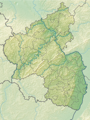
| Geographical location | 50 ° 4 '59.3 " N , 7 ° 45' 56" E | |
| Height: | 71.5 m above sea level NN | |
|
|
||
The Pfalzgrafenstein Castle , the Palatinate near Kaub called, was of Ludwig of Bavaria , the Count Palatine of the Rhine and later Holy Roman Emperor and King, in the Rhine at Kaub as a toll castle built. It was her job to monitor the collection of the ship's duty in the opposite right-Rhenish pay office in Kaub. Because of this purpose, the Inselburg - unlike other castles on the Middle Rhine - never served for residential purposes. The building emerged over the years from a tower built by Ludwig the Bavarian between 1326 and 1327.
Pfalzgrafenstein is one of the few undestroyed and hardly changed castles in the Upper Middle Rhine Valley , along with the Marksburg and Boppard Castle . Furthermore, an exact chronological dating could be carried out by means of dendrochronological investigations. In 1803 the castle came to the Duchy of Nassau under Napoleon . It was not until 1867, after both sides of the Rhine had become Prussian , that the last customs officers left the island.
Pfalzgrafenstein Castle has been part of the Upper Middle Rhine Valley UNESCO World Heritage Site since 2002 ; it is also a protected cultural asset under the Hague Convention .
Geographical location
Pfalzgrafenstein Castle is an island castle on the rocky island known as Falkenau in the Rhine, 110 meters from the right and 160 meters from the left bank of the Rhine. Due to the comparatively narrow river bed, which is narrowed by rocks, the left arm of the Rhine at the level of the Palatinate is up to nine meters deep. Pfalzgrafenstein is the lowest medieval fortification on the Middle Rhine. A passenger ferry runs from Kaub to the castle. If the water level is more than 4.00 meters at the Kaub gauge , the ferry can no longer dock on the island.
Until the expansion of the Rhine in the 19th century, almost all shipping traffic on the right bank of the Rhine ran between the Palatinate and the city of Kaub. In the left arm of the river, a good kilometer above the Palatinate, there was a rapids, Wildes Hazard , which was only passable for the descent with good water flow. Thus, the positions for catapult guns and cannons were mainly directed towards the right fairway. After expansion work in the 1970s, there is only one fairway that runs to the left of the Pfalzgrafenstein and a long way from the Kauber Ufer. This current traffic situation gives hardly any inkling of how dominant Kaub's position in connection with the Palatinate and Gutenfels Castle was over shipping on the Rhine.
history
In 1277, the Rhineland Count Palatine Ludwig II from the Wittelsbach family bought Kaub and Gutenfels Castle along with the customs rights. In 1324 Count Palatine Ludwig the Bavarian was banned from the church by the Pope because he kept the customs revenue for himself and did not pass it on to the church. In addition, Ludwig was the anti-king of the Pope preferred Frederick the Fair .
In order to secure the customs revenue, Ludwig first built the pentagonal tower on the island in 1327 (construction may begin as early as 1326). From 1339 to 1342 the twelve meter high and up to 2.60 meter thick curtain wall with a covered battlement was added. In addition, the castle has a dungeon , the floor of which rose as a raft during high water. In the second half of the 15th century, the tower was probably increased with half-timbered construction , corner towers and a gable roof to protect the customs revenue. Due to permanent damage from ice drifts, a massive spike was added to the building in 1606/1607 on the side upstream of the Rhine and reinforced with iron clips; This gives the castle the impression of a battleship floating on the Rhine. The conversion was used to build a gun platform on this point, which corresponded to the weapon technology of the time. A second one with loopholes for handguns was built under the top battlement . In 1658 extra bay windows were added to flank the walls.
The castle was given its current appearance when the baroque spire was put on in 1714. This means that the tower is 36 meters high. At the turn of the year 1813/14, during the Wars of Liberation , the Prussian Field Marshal Gebhard Leberecht von Blücher crossed the Rhine at the castle with 60,000 soldiers, 20,000 horses and 200 artillery pieces to pursue Napoléon Bonaparte's troops . Until the Austrian-Prussian War , the castle was a customs station and was subsequently used as a beacon for shipping until the 1960s.
present
Since the end of its use as a signal station, Pfalzgrafenstein Castle has been owned by the State of Rhineland-Palatinate as a tourist property and is subordinate to the organization Castles, Palaces, Antiquities of Rhineland-Palatinate , since 1998 the successor organization to the State Castle and Palatinate Administration . It is accessible to visitors and can be reached via a regular passenger ferry from Kaub. Pfalzgrafenstein is also one of the masterpieces between the Rhine and Moselle . Occasionally, cultural events take place here. Since 2007, after the restoration , the building has had a historically documented paint coat and can be illuminated in the dark.
literature
- Karl Hahn: The Palatinate or the Pfalzgrafenstein in the Rhine near Caub . Eschborn 1926 ( digitized ).
- Magnus Backes: Pfalzgrafenstein Castle and the Rhine toll . Schnell & Steiner, Regensburg 2003, ISBN 3-7954-1567-5 (booklets of the Edition Burgen, Schlösser, Altertümer Rheinlandpfalz, issue 11).
- Lorenz Frank: The building history of the Pfalzgrafenstein near Kaub am Rhein . In: Castles and Palaces . Vol. 47, No. 3, 2006, ISSN 0007-6201 , pp. 143-153.
- Michael Fuhr: “Who wants to be the custodian of the river?” 40 castles and palaces on the Middle Rhine . Schnell & Steiner, Regensburg 2002, ISBN 3-7954-1460-1 , pp. 112-115.
- Heiko Laß: The Rhine. Castles and palaces from Mainz to Cologne . Michael Imhof, Petersberg 2005, ISBN 3-937251-64-2 , pp. 67-68.
- Eduard Sebald: The Pfalzgrafenstein and the Kauber customs station in the context of the territorial policy of the Pfalzgrafenstein near the Rhine . In: Castles and Palaces . Vol. 47, No. 3, 2006, ISSN 0007-6201 pp. 123-135.
- Alexander Thon, Manfred Czerwinski: Middle Rhine Valley World Heritage Site . Superior, Kaiserslautern 2003, ISBN 3-936216-14-2 , pp. 18-19.
Web links
- Entry by Reinhard Friedrich zu Pfalzgrafenstein in the scientific database " EBIDAT " of the European Castle Institute
- Overview of the castles, palaces, antiquities of Rhineland-Palatinate with Pfalzgrafenstein
- Pfalzgrafenstein Castle - Pfalzgrafenstein Customs Station near Kaub (private site)
- Image by Pfalzgrafenstein from JF Dielmann, A. Fay, J. Becker (draftsman): FC Vogel's Panorama of the Rhine. Pictures of the right and left banks of the Rhine . Lithographic institute FC Vogel, Frankfurt 1833.
References and comments
- ↑ Topographic map 1: 25,000
- ↑ In relation to the equivalent water level , see Karl Felkel: Model investigations for the expansion of the Rhine near Kaub. In: Journal for inland navigation and waterways. ISSN 0175-7091 1973 (100), pp. 256-262, here p. 256.
- ↑ Ferry to Pfalzgrafenstein Castle at Fährgemeinschaft Kaub GbR (accessed on January 11, 2015)
- ^ Eduard Nobiling : News about the Rhine stream. In: Journal of Construction. 1856 (6), columns 310-354, here column 323 ( urn : nbn: de: kobv: 109-opus-86963 ).


