Sauerburg
| Sauerburg | |
|---|---|
|
Curtain wall with tower |
|
| Creation time : | 1355 |
| Castle type : | Hilltop castle |
| Conservation status: | partially preserved |
| Standing position : | Counts, nobles |
| Place: | Sauerthal |
| Geographical location | 50 ° 4 '58.1 " N , 7 ° 49' 2.6" E |
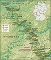
The Sauerburg is the ruin of a hilltop castle above the Tiefenbach im Taunus, which flows into the Wisper . It is located about four kilometers east of Kaub am Rhein near Sauerthal in the Rhein-Lahn district in Rhineland-Palatinate . The border to Hesse is in the immediate vicinity east of the castle.
The Sauerburg has been part of the Upper Middle Rhine Valley UNESCO World Heritage Site since 2002 .
Residents and owners
On February 26, 1355, Count Palatine Ruprecht I received permission from Archbishop Gerlach of Nassau of Mainz to build a castle near Suerburn in order to protect its territory against attacks by robber barons from nearby Waldeck Castle . The approval was apparently given afterwards, because the fortified complex was already a Palatinate fief in 1339 . The complex was one of the last medieval castles on the Rhine. In terms of defense technology, it was repeatedly brought up to date with the latest technology, including the installation of a roundabout and a casemated bastion .
In 1505, Count Palatine Philipp the Sincere sold the complex as an inheritance to his Marshal Philipp von Kronberg. In 1618 it was inherited by the Brömser family from Rüdesheim . They had the now dilapidated castle restored and modernized with the already mentioned bastion . But their efforts did not last long, because as early as 1668, when the Sauerburg was inherited by the Barons von Metternich-Winneburg , it was already in bad shape again.
In 1672 the castle came into the possession of the Imperial Counts of Sickingen , a noble family from which the famous Franz von Sickingen comes and whose last descendant, also named Franz von Sickingen, is buried in the Sauerthal cemetery. At the time of his death in 1834 the castle was already a ruin since 1689 has been keep in the Nine Years War by troops of the French king Louis XIV. Blown up and burned down the houses of the castle.
Frequent changes of ownership followed, in 1888 and 1907 even through foreclosure auctions . When the secret Legation Councilor Loehr bought the ruins, he had them partially rebuilt from 1909 to 1912. Even today, the half-ruin is privately owned, but can be booked for events and viewed in the presence of the manager.
In 2004 the castle was converted into a high quality hotel with a few rooms. The interior rooms are renovated and designed in the original style. The hotel and event operations have been inactive since 2009. The castle is for sale.
description
The main castle is enclosed by a trapezoidal bering , with a six-story keep in the northeast. The 22-meter-high, square residential tower has six floors and housed a dungeon on its ground floor . All were equipped with chimneys.
In the place of today's residential building used to be a three-storey palace . Another residential building on the west side has disappeared today.
To the south of the main castle is the roughly rectangular lower castle (first outer castle ), which is also surrounded by a well-preserved curtain wall.
Another, younger outer bailey with a triangular floor plan can be found on the east side of the complex. Secured by a reinforced gate , there used to be mainly farm buildings that are no longer there. The castle chapel is located in the southeast corner of this second outer bailey . Upstream is a kennel .
In the 16th and 17th centuries, the entire area was reinforced by a bastion in the south and a cannon roundabout in the northeast.
Web links
- www.sauerburg.com
- The Sauerburg at burgenwelt.de
- Entry by Jens Friedhoff zu Sauerburg in the scientific database " EBIDAT " of the European Castle Institute


