
New Jersey Turnpike
- This article is about the modern freeway. For the 19th century turnpike, see Jersey Turnpike.
| ||||
|---|---|---|---|---|
 | ||||
| Route information | ||||
| Length | 122.1 mi (196.5 km) 11.03 mi (17.75 km) Western Spur 6.6 mi (10.6 km) Pennsylvania Extension 8.3 mi (13.4 km) Newark Bay Extension[1] | |||
| Existed | 1951–present | |||
| Major junctions | ||||
| File:New Jersey 168.svg NJ 168 near Camden File:New Jersey 18.svg NJ 18 in East Brunswick Twp File:Garden State Parkway shield.png File:New Jersey 495.svg NJ 495 in Secaucus | ||||
| Location | ||||
| Country | United States | |||
| State | New Jersey | |||
| Highway system | ||||
| ||||

The New Jersey Turnpike is a toll road in New Jersey and is one of the most heavily traveled highways in the United States. A segment of it is part of the Interstate Highway System. Construction of the Turnpike from conceptualization to opening took 23 months, from 1950 to 1952. The Turnpike boasts 12-foot-wide lanes, 10-foot-wide shoulders, 13 rest areas named after notable New Jerseyans, and unusual exit signage that was considered the pinnacle of highway building in the 1950s. The Interstate Highway System took some of its design guidelines by copying the Turnpike's design guidelines.
Route description
The main trunk of the New Jersey Turnpike runs from Carneys Point Township in the south to Ridgefield in the north. It is designated as unsigned Route 700 from Exit 1 (Delaware Memorial Bridge) in Carneys Point Township, through to Exit 6 and as Interstate 95 from Exits 6 (Mansfield Township) through 18 (Secaucus/Carlstadt). The number of lanes ranges from 4 lanes south of Exit 4, the interchange with Route 73, to 6 lanes between Exits 4 (Mount Laurel Township) and 8A (Monroe Township), the interchange with Route 32.

The main headquarters for the Turnpike is in East Brunswick Township. There, the New Jersey Turnpike Authority monitors vehicular volume on the entire length on the Turnpike. They operate three AM Radio channels, which broadcast advisories (weather, traffic, events) on the turnpike. Also, the main headquarters operates the VMS (Variable Message Signs) on the turnpike, which alerts motorists of poor weather, accidents, or congestion. Speed Limit signs are also VMS. When the main sign flashes “REDUCE SPEED,” the speed limit VMS changes from its usual speed limit to a lowered one. The Authority also has a few closed-circuit TV cameras that show pictures of current traffic conditions. The cameras are located in Newark (2 cameras), Secaucus (1), Elizabeth (2), East Brunswick Township (1), and Monroe Township (2).
Before the advent of the interstate highways, the whole Turnpike was designated by the New Jersey Department of Transportation as Route 700, with the Pennsylvania Turnpike Extension being Route 700P and the Newark Bay Extension being Route 700N at one time. The western spur is officially known as Route 95W but signed as Interstate 95 (see below). None of these state highway designations have ever been signed.

North of Exit 8A, the Turnpike splits into a "dual-dual" configuration, with the outer lanes open to all vehicles and the inner lanes limited to cars only, unless signed otherwise because of unusual conditions. From here to Exit 14 (Newark), the interchange with Interstate 78, the road ranges from 10 to 14 lanes wide. Starting in Monroe Township (going north), the turnpike has a total of 10 lanes, 5 in each direction (2-3-3-2). From East Brunswick Township, the turnpike has a total of 12 lanes, 6 in each direction (3-3-3-3). From Woodbridge Township, the turnpike has a total of 14 lanes, 7 in each direction (4-3-3-4). Between Woodbridge Township and Newark, HOV lanes exist on the outer roadway (outer truck lanes), which is the reason for the extra lane. The HOV lanes are in effect on weekdays, from 6:00-9:00 northbound, and 16:00-19:00 (4pm-7pm) southbound.
Between Exits 14 and 18, the Turnpike splits into two spurs, an eastern spur and a western spur. Both spurs are posted as I-95, although technically the eastern spur is I-95 as that was built first. The western spur is posted as I-95 for through traffic on I-95, while traffic entering at the ends of the split is routed via the eastern spur. The New Jersey Department of Transportation (NJDOT), which calls every class of highway Route, calls the western spur Route 95W.
The Turnpike also has two extensions: The first, the Newark Bay Extension, was opened in 1956 and is a part of Interstate 78. It connects Newark with Lower Manhattan via the Holland Tunnel in Jersey City and intersects the mainline near Newark Liberty International Airport. This extension contains three exits (Exits 14A, 14B, and 14C) and due to its design (four lanes with a shoulderless Jersey barrier divider), it has a 50 m.p.h. (80 km/h) speed limit.

The second extension connects the mainline of the New Jersey Turnpike with the Pennsylvania Turnpike at Exit 6. A 6-mile long six-lane highway, it not only connects the Pennsylvania Turnpike with the mainline, but also has an exit to U.S. Route 130 near Florence. Although it is officially designated as Route 700P, it will become a future segment of I-95 when the Pennsylvania Turnpike/Interstate 95 Interchange Project is completed in 2009.
A four-mile stretch of I-95 north of U.S. Route 46 came under Turnpike Authority jurisdiction in 1992, as the NJDOT "sold" the road in order to balance the state budget. This section of the road is also "dual-dual", split into local and express lanes. This portion of the turnpike connects to the George Washington Bridge.
On July 9, 2003, Governor of New Jersey James McGreevey's plan to merge the New Jersey Turnpike Authority and the New Jersey Highway Authority (which had operated the Garden State Parkway) into one agency was completed.
A section of the Turnpike and the surrounding land in Elizabeth and Newark, New Jersey has been called "the most dangerous two miles in America" by New Jersey Homeland Security officials[2] due to the high volume of traffic in conjunction with the density of potential terrorist targets in the surrounding area.
Bridges
A number of bridges are included as part of the New Jersey Turnpike:
- The Basilone Bridge spans the Raritan River, connecting Edison on the north with New Brunswick on the south.
- The Newark Bay Bridge (officially the Vincent R. Casciano Memorial Bridge) is a steel cantilever bridge spanning Newark Bay and connecting Newark and Bayonne. It was completed April 4, 1956, as part of the Turnpike's Newark Bay Extension.
- The Chaplain Washington Bridge and the Harry Laderman Bridge are steel girder spans that carry the Turnpike's eastern and western spurs, respectively, over the Passaic River at Newark.
Rest areas
The New Jersey Turnpike is noted for naming its rest areas after people who lived or worked in New Jersey. From south to north, the rest areas are:
- Clara Barton (southbound, milepost 5.4, in Oldmans Township)
- John Fenwick (northbound, 5.4, in Oldmans Twp)
- Walt Whitman (southbound, 30.2, in Cherry Hill Township)
- James Fenimore Cooper (northbound, 39.4, in Mount Laurel Township; officially "J. Fenimore Cooper")
- Richard Stockton (southbound, 58.7, in Hamilton Township (Mercer County))
- Woodrow Wilson (northbound, 58.7, in Hamilton Township (Mercer County))
- Molly Pitcher (southbound, 71.7, in Cranbury Township)
- Joyce Kilmer (northbound, 78.7, in East Brunswick Township)
- Thomas Edison (southbound, 92.9, in Woodbridge Township)
- Grover Cleveland (northbound, 92.9, in Woodbridge Township)
- Alexander Hamilton (southbound, eastern spur, 111.6, in the Town of Secaucus)
- Vince Lombardi (northbound/southbound, 116.0 (eastern spur), 115.5 (western spur), in the Boro of Ridgefield)
Even long-time local motorists frequently do not know who some of these people were, or in the case of Kilmer, even what gender they were. (Kilmer's full name is Alfred Joyce Kilmer.) Several of the northbound rest stops are named after people better known by their middle names, rather than first names, these including Thomas Woodrow Wilson, the aforementioned Alfred Joyce Kilmer, and Stephen Grover Cleveland. "Molly Pitcher" is a name given to a woman (reportedly a water-bearer who helped cannoneers during a New Jersey battle during the American Revolutionary War) who may or may not have existed. Contemporary New Jersey writers such as Calvin Trillin and Philip Roth have ruefully commented that they hope they don't get a rest stop named after them once they die.
Perhaps surprisingly, the Looking for America book describes the Edison, Lombardi, and Kilmer rest stops as possible hot spots for heterosexual, homosexual, and prostitution activities respectively.
Turnpike rest areas comprise mostly of Burger King and Big Boy (which isn't a New Jersey chain but is featured in the rest stops) fast-food restaurant locations. Most rest stops also include a Sunoco, with gas price signs posted about half a mile before reaching the rest stop.
Toll collection
The New Jersey Turnpike is a closed-system toll road, using a system of long-distance tickets, obtained once by a motorist upon entering and surrendered upon exiting at toll gates. The toll gates exist at all exits and entrances (except for the Meadowlands Sports Complex) and also at the highway extension toward the Hudson River. The toll fee depends on the distance traveled between entrance and exit, and longer distances result in higher tolls. As of 2004, the automobile toll from Exit 1 to Exit 18 is $6.45. Discounts were available to users of the E-ZPass electronic toll collection system until 2004. Since then, the costly implementation of the E-ZPass system forced the Turnpike Authority to eliminate the discounts, and instead impose a $1 per month E-ZPass fee to their account holders, causing many New Jersey E-ZPass holders to obtain transponders through other toll authorities which do not impose the fee. Express E-ZPass implementation is underway, allowing E-ZPass customers at some of the toll plazas to travel through toll areas at highway speeds, via the addition of E-ZPass sensors on an overhead gantry. One of these high-speed toll gates is located at the northern terminus of the road, as southbound Interstate 95 traffic enters the turnpike. The newest one is located at the southern terminus in Carneys Point Township. At each location, traditional E-ZPass and cash lanes are also available.
When travelling from the North, users who exit at the Meadowlands Sports Complex pay no toll, but the Turnpike Authority counts cars electronically and is paid a fee for each vehicle by the New Jersey Sports and Exposition Authority.
The non-tolled Interstate 295, which parallels the Turnpike for much of its southern length, is often used as an alternate route for shunpiking by locals and through travelers alike; prior to the expansion of the Exit 1 toll plaza, this route was promoted through signage and radio announcements from the New Jersey State Police as a bypass of summer congestion at the plaza.
History


The task of building the turnpike was not an easy one. One major problem was the construction in the city of Elizabeth, where either 450 homes or 32 businesses would be destroyed, depending on the chosen route. The builders decided to go through the residential area, considering it the grittiest and the closest route to both Newark Airport and the Port Newark-Elizabeth Marine Terminal seaport.
When construction finally got to Newark, there was a new challenge; Deciding to build either over or under the Pulaski Skyway. If construction went above the skyway, the costs would be much higher. If they went under, the costs would be lower, but the roadway would be very close to the Passaic River, making it harder for ships to pass through. The engineers chose to go under.
While continuing up to the New Jersey Meadowlands, the crossings were harder because of the fertile marsh land of silt and mud. Near the shallow mud, engineers filled the mud with crushed stone, and built the roadway above the water table. In the deeper mud, engineers sank caissons down to a firm stratum, filled the caissons with sand, then both the caissons, and the surrounding areas were covered with blankets of sand. Gradually, the water was brought up, and drained into adjacent meadows. Then, the construction of the two major bridges over the Passaic River and Hackensack River were completed. The bridges were built to give motorists a clear view of the New York City skyline, but with high retaining walls to make it seem as if you are not even crossing a river. The 6,955 ft. Passaic River (Chaplain Washington) Bridge cost $13.7 million to construct and the 5,623 ft. Hackensack River Bridge cost $9.5 million.
A controversial project through the East Brunswick area involved a proposed widening from six to twelve lanes. Analysis of noise (Shadely, 1973) and air quality impacts were made in a lawsuit decided in New Jersey Superior Court. This case in the early 1970s was one of the early U.S. examples of environmental scientists playing a role in the design of a major highway. The computer models allowed the court to understand the effects of roadway geometry (width in this case), vehicle speeds, proposed noise barriers, residential setback and pavement types. The outcome was a compromise that involved substantial mitigation of noise pollution and air pollution impacts.
Future developments
- In January 2004, the Authority opened up the refurbished 18W toll gate in Carlstadt. The refurbishment includes two E-ZPass Express Lanes in both directions.
- In July 2004, the New Jersey Turnpike Authority opened the new Exit 1 toll gate in Carney's Point Township. The new 23-lane toll gate is near milepost 2.4, featuring a glass-enclosed overhead walkway for toll collectors, including "a concrete lighthouse to serve as a 'gateway' to the state as well as to the turnpike"[3]. The toll gate features 5-lanes heading north, 14-lanes heading south, and two "E-ZPass Express" Lanes in both directions.
- In 2005, the Authority opened Exit 15X to allow access to the newly-built Secaucus Junction train station.
- In February 2006, the Authority updated Exit 8A in Monroe Township. The former exit ramp that allowed traffic onto Route 32 westbound, has been closed off. Instead, a new ramp leads to a traffic light at the intersection of the ramp and County Route 535 in South Brunswick Township. 535 was expanded between the new ramp intersection and Route 32.
- The Turnpike Authority is planning to widen the turnpike from the Exit 1 toll gate in Carney's Point Township to Exit 4 in Mount Laurel Township. Wider overpasses are currently being constructed to accommodate one extra lane in each direction (which would change the Southern Turnpike configuration from 2-2 to 3-3).
- The Turnpike Authority plans to widen the turnpike between Exit 9 in East Brunswick to Exit 8A in Monroe Township. This widening would change the dual-dual setup (from 2-3-3-2) to "3-3-3-3."
- The Turnpike Authority is redoing Exit 12 in the Boro of Carteret to reduce truck traffic. New ramps to access the turnpike are being constructed, along with an expanded toll gate. The expanded toll gate will feature extra toll lanes for vehicular volume. The redone Exit 12 should be finished in the middle of 2007.
- The Authority is lowering the Eastern Spur (between 107.3 to 107.5 in Newark). The lowered spur will consist of a minimum 15-foot vertical clearance and a 12-foot horizontal clearance on the shoulders underneath the Pulaski Skyway (U.S. Routes 1/9) once finished[3].
- The Authority planned to build Route 92, a West-East Spur from US 1 & Ridge Road in South Brunswick Twp, to the New Jersey Turnpike at Exit 8A in Monroe Township. This proposition was cancelled on December 1, 2006.
- The Turnpike Authority is repaving portions of the expressway, including ramps, as well as fixing up bridges and overpasses.
Proposed widening between Interchanges 6 and 8A
In November 2004, New Jersey Governor Richard Codey advocated a plan to widen the Turnpike, extending the dual-dual configuration 20.1 miles south from Exit 8A (Monroe Township) to Exit 6 (Mansfield Township), by 2011, when the Pennsylvania Turnpike is supposed to complete an interchange that will connect its road to the existing I-95 in Bristol Township, Pennsylvania. Finances would be supplied by rerouting money from the planned NJ 92 Turnpike extension. Overpasses are already being reconstructed to be compatible with a wider Turnpike[4]. The NJTPA is also planning to expand the turnpike between Exit 9 in East Brunswick to Exit 8A in Monroe Township. This would change the current dual-dual configuration (2-3-3-2) to "3-3-3-3." This would require little construction as the overpasses were built with future expansion and would only require the outer lanes to be repaved and restriped to accommodate the extra lane.
The dual-dual configuration (between 6 and 8A) was thought to have been "2-3-3-2." However, according to Turnpike documentation, the turnpike would feature six lanes in each direction (3-3-3-3)[5]. The following interchanges will be upgraded (with new ramps and possible expansion to toll gates) with this widening project: Exit 6 (Mansfield), Exit 7 (Bordentown Twp), Exit 7A (Washington Township), Exit 8 (East Windsor Township), and Exit 8A (Monroe Township).
On January 1, 2007, the Turnpike was facing opposition in East Windsor Township with an upgrade of Exit 8. The current Interchange 8 will be demolished with a new interchange. Prior to this plan being released, some thought that the new Exit 8 would connect directly with the Hightstown Bypass. There seems to be ample space (between mile markers 67.89 and 68.12) to build a new interchange. Plus, there's a large piece of land that would accommodate a toll gate and interchange ramps for 133. The NJTPA has a different idea: the new Exit 8 would end at the intersection with Route 33, Milford Road, and the Hightstown Bypass (on the east side of the expressway in lieu of the west). This new 8 would grant direct access to the bypass (without going through any traffic lights), as well as to 33, using grade separated interchanges. The new toll gate would also feature a total of 12 booths at the gate. However, the interchange and the toll gate would run near some residential houses located right off of 33, and would disturb Twin Rivers. The Authority released 3 configuration options at the intersection of Milford, 33, and the bypass.
- Option 1: This option would feature turnpike ramps that would lead to a diamond interchange at Route 33, while the turnpike ramp turns into the 133 bypass and crosses over 33. At the intersection with Route 33 and the interchange ramps (from the turnpike and 133), a traffic signal would be built underneath Exit 8/Route 133. However, the drawback is that this option would “stop drivers from making several turns near the exit. These include left-hand turns from Route 33 onto [a relocated] Milford Road and from Milford Road onto Route 33.” To make turns that are restricted, “the plan would push some trucks headed for Milford Road onto Lake Drive, which would be connected to Milford by a new connector road.” The relocated Milford Road would start at the intersection of Monmouth Street and continue southeast to the existing Milford Road near Daniel Street.
- Option 2: A grade-separated diamond interchange would be constructed, which would lead the ramps towards Route 33. At the intersection with Route 33 and the interchange ramps (from the turnpike and 133), a traffic signal would be built underneath Exit 8 ramps/Route 133. In lieu of a connector road, a jug handle would be built on 33 west. This would intersect at 33 (with a traffic light) and become the relocated Milford Road (after crossing 33). The road would cross over the Turnpike ramps and resume it’s course near Daniel Street.
- Option 3: A weird cloverleaf interchange would be built in lieu of a diamond interchange. After exiting the turnpike from the 8 toll gate, a ramp on the right would lead to Milford Road or Route 33. The mainline of the turnpike ramp would cross over 33 and turn into the 133 bypass. A relocated Milford Road would be built across from Monmouth Street & 33 (without connecting Monmouth and Milford) towards the intersection with the current Milford Road and Daniel Street. The new Milford would cross over the turnpike ramps. A leaf would be built from the turnpike ramp approaching the 8 toll gate, which would connect to Milford. An entrance ramp would be constructed from Milford Road to the 8 toll gate. Traveling north on Milford, a ramp would be constructed, which would diverge into 2 ways; one way would merge into the turnpike ramp heading towards 133, and the other would intersect at a new traffic light at Route 33 (just 1/10 mile east of the current 33-133-Milford intersection)[6].
The Turnpike in popular culture and media

- The Turnpike, along with the Garden State Parkway, are such heavily travelled through-roads and connect with so many other highways in the state, that upon learning a person is from New Jersey, a common joke response is "What exit?"
- In the Chuck Berry song You Can't Catch Me (1956), the singer outruns the cops in his Cadillac on the New Jersey Turnpike.
- Simon and Garfunkel's song "America" (1968), after describing a long trip across much of the country, concludes with the lines:
- Counting the cars on the New Jersey Turnpike
- They've all come to look for America.
- The 1970 song "Holland Tunnel" by John Phillips included the line: "Pick up a ticket for the New Jersey Turnpike and drive, baby, drive."
- Bill Cosby references the eating of the New Jersey Turnpike by The Chicken Heart in his comedy album Wonderfulness.
- Bruce Springsteen's album Nebraska (1982) contains the song "State Trooper", in which a traveller on the Turnpike, a desperate man who has committed unspecified crimes, prays that he won't be pulled over by the police. Another song from the same Springsteen album, the hallucinatory "Open All Night," also contains Turnpike images.
- The Belgian band dEUS, in their 1996 song "Theme from Turnpike", also referenced the New Jersey Turnpike as an homage to Springsteen, repeating the first line from "State Trooper".
- Bif Naked's song "Sophia" (1999) begins with the lyric "I picked you up on a grey day, the New Jersey Turnpike."
- In the 1991 movie Nothing But Trouble, Chevy Chase, Demi Moore, and company, en route to Atlantic City from New York City, exit the Turnpike in hoping to view the countryside and subsequently wind up lost in a backwoods section of New Jersey. Passenger Bertila Damas suggests the unplanned exit because "this road is such a dull place." This route in itself is a mistake in the film's logic, as New York travelers wishing to go to Atlantic City would naturally transfer to the Garden State Parkway (which is closer to the coast than the Turnpike) long before reaching rural areas of New Jersey.
- In the film Being John Malkovich (1999), after one becomes John Malkovich and then eventually leaves him, one falls out of the sky next to the New Jersey Turnpike. Scenes were filmed on the Holland Tunnel extension at Interchange 14C in Jersey City.
- The opening to each episode of the HBO television series The Sopranos features main character Tony Soprano driving on the Turnpike.
- The 1989 book Looking For America On The New Jersey Turnpike (ISBN 978-0-8135-1955-5), itself taking its title from the Simon and Garfunkel song, chronicles the history of "America's Main Road" and analyzes its place in American culture.
- The New Jersey Turnpike drink was created as a joke about the highway. It consists of squeezing a rag that previously had been used to soak up spilled alcohol on the bar into a shot glass.
- The exit number used to reach the Meadowlands Sports Complex, 16W, is frequently referenced if the New Jersey Devils or New Jersey Nets (tenants of Continental Airlines Arena in the Meadowlands) make the playoffs, as they need 16 wins in the postseason (4 rounds of 4 wins) to win their respective league championships.
- In the videogame, Earthbound, for the Super Nintendo Entertainment System, when you search the desk inside the house for sale in Onett town, you can find a joke story about a man making excuses to a police officer after being pulled over on the New Jersey Turnpike.
- In Maria Full of Grace (2004), there's a scene in which Maria is driven up the turnpike. There are shots of Elizabeth Seaport, Newark, and Manhattan.
- In the 1994 Seinfeld episode "The Big Salad", there's a scene in which Cosmo Kramer drives a man suspected of murder up the turnpike on a high speed chase, which parodies the O.J. Simpson car chase.
- Alan Jackson's song "Where I Come From" makes reference to "Rollin' wheels and shifting gears 'round that Jersey Turnpike"
- The punk rock band, Nestor Makhno, from Huntsville, Alabama has a song called "I-95" which mentions of the Jersey Turnpike.
- The 1997 film Men in Black features a scene where Agent Kay and Agent Jay (played by Tommy Lee Jones and Will Smith) track down two aliens driving on a road off the Turnpike, after they "illegally" left Manhattan Island and traveled into New Jersey at Liberty State Park (Interchange 14B).
Exit list
Gallery
-
 Traveling north approaching split for inner car lanes and outer truck lanes in Cranbury Twp
 -
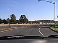
 A northbound view of I-95/New Jersey Turnpike at Exit 8A in Monroe Township
 -
 A New Jersey Turnpike Toll Gate for Exit 8A in Monroe Township, NJ
 -
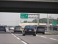
 Looking south just north of the bridge/overpss for Forsgate Drive in Monroe Township. Note that southbound traffic is congested due to traffic volume.
 -
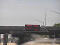
 Entering the Turnpike at Exit 8, traveling south in East Windsor Township. Note there are major delays northbound due to hazardous spill in southbound lanes, with northbound rubbernecking
 -
 Traveling south on Turnpike south of Int. 8 in East Windsor Township. Major delays northbound continue...
 -
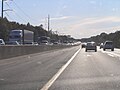
 A view of Turnpike northbound, north of Exit 7A in Washington Township. Major delays continue past Exit 7A...


See also
References
- Gillespie, Angus Kress and Rockland, Michael Aaron. Looking for America on the New Jersey Turnpike. Rutgers University Press, 1989. ISBN 0-8135-1466-5.
- John Shadely, Acoustical analysis of the New Jersey Turnpike widening project between Raritan and East Brunswick, Bolt, Beranek and Newman, 1973
- nycroads.com New Jersey Turnpike Historic Overview
Notes
- ^ Mileage taken from straight line diagrams listed below.
- ^ [1]
- ^ a b "New Jersey Turnpike (I-95) (Steve Anderson)"
- ^ New Jersey Set to Expand Turnpike, The New York Times, December 1, 2004
- ^ Turnpike authory to hold public information centers regarding widening project, November 20, 2006
- ^ Pike plan raises concern, The Trenton Times, January 1, 2007
External links
- New Jersey Turnpike Authority & Garden State Parkway Official Website
- NJ Route 78 Straight Line Diagram
- NJ Route 95 Straight Line Diagram
- NJ Route 95W Straight Line Diagram
- NJ Route 700 Straight Line Diagram
- An expanded view of road jurisdiction near the confluence of US 46, I-95 / NJTurnpike, I 280, NJ 7 and CR 508 in Kearny
- Traffic Conditions by Telephone: 1-800-33NJTPK (1-800-336-5875).
- New Jersey Turnpike at Exitlists.com