
Office of Barth
| coat of arms | Germany map | |
|---|---|---|

|
Coordinates: 54 ° 19 ′ N , 12 ° 40 ′ E |
|
| Basic data | ||
| State : | Mecklenburg-Western Pomerania | |
| County : | Western Pomerania-Ruegen | |
| Area : | 243.7 km 2 | |
| Residents: | 15,025 (Dec. 31, 2019) | |
| Population density : | 62 inhabitants per km 2 | |
| License plate : | VR, GMN, NVP, RDG, RÜG | |
| Office key : | 13 0 73 5352 | |
| Office structure: | 10 municipalities | |
| Office administration address : |
Tar passage 2 18356 Barth |
|
| Website : | ||
| Head of Office : | Christian hatred | |
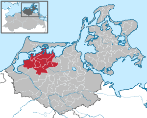
| Location of the Barth office in the Vorpommern-Rügen district | ||
  |
||

The Barth office is located in the district of Vorpommern-Rügen in Mecklenburg-Vorpommern (Germany). In the Barth office , the ten communities of Bartelshagen II b. Barth, Divitz-Spoldershagen, Fuhlendorf, Karnin, Kenz-Küstrow, Löbnitz, Lüdershagen, Pruchten, Saal and Trinwillershagen as well as the city of Barth have come together to handle their administrative business. The administrative headquarters are in the city of Barth . On January 1, 2005, the merger of the Barth-Land office and the city of Barth, as well as the municipality of Trinwillershagen, created the new Barth office.
The official area extends south of the Barther Bodden in the hinterland of the Zingst , Darß and Fischland peninsula . The north and west of the office borders on the Barther Bodden and Saaler Bodden , the east borders on the office of Niepar and the south borders on the offices of Franzburg-Richtenberg and Ribnitz-Damgarten . There are no larger lakes in the municipality, but large parts of the office are located on the Bodden waters. The river Barthe flows through the municipality and flows into the Barther Bodden near Barth. The northern part of the office with the lagoon coast is part of the Vorpommersche Boddenlandschaft National Park . There are no noteworthy surveys in the office, as the office is almost exclusively in the lowlands of the Barthetal and Bodden hinterland. Only at Lüdershagen do some hills reach the 20 meter mark.
Economically, only agriculture and fishing play a certain role and tourism is also important. There is also a shipyard in Barth. The region is hoping for further upswing through the federal motorway 20 . The B 105 ( Rostock - Stralsund ) runs through the south of the Barth district . Barth Airport is also located near the Barth headquarters .
On January 1, 2014, the formerly independent municipality of Bartelshagen II b. Barth incorporated into the community of Saal .
The municipalities with their districts
- City of Barth with Glöwitz, Planitz and Tannenheim
- Divitz-Spoldershagen with Divitz, Frauendorf, Gäthkenhagen, Martenshagen, Spoldershagen and Wobbelkow
- Fuhlendorf with Bodstedt, Gut Glück and Michaelsdorf
- Karnin with Friedrichshof
- Kenz-Küstrow with Dabitz, Kenz, Küstrow, Rubitz and Zipke
- Löbnitz with Buchenhorst, Kindshagen, Redebas and Saatel
- Lüdershagen with Heidberg, Kronsberg and Lüdershagen Heide
- Pruchten with Bresewitz
- Hall with Bartelshagen II b. Barth , Hermannshagen-Dorf, Hermannshagen Heide, Hermannshof, Hessenburg, Kückenshagen, Neuendorf, Neuendorf-Heide and Neuhof
- Trinwillershagen with Langenhanshagen, Mittelhof, Neuenlübke, Neuhof and Wiepkenhagen
politics
Coat of arms, flag, official seal
The office does not have an officially approved national emblem, neither a coat of arms nor a flag . The official seal is the small state seal with the coat of arms of the region of Western Pomerania . It shows an upright griffin with a raised tail and the inscription "AMT BARTH * LANDKREIS VORPOMMERN-RÜGEN".
supporting documents
- ↑ Statistisches Amt MV - population status of the districts, offices and municipalities 2019 (XLS file) (official population figures in the update of the 2011 census) ( help ).
- ↑ Main Statute, Section 1, Paragraph 4 (PDF).