|
Municipality of Amulung
|
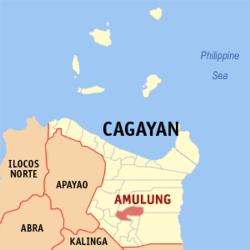
| Location of Amulung in the province of Cagayan
|
|
| Basic data
|
|
Region :
|
Cagayan Valley
|
|
Province :
|
Cagayan
|
|
Barangays :
|
47
|
|
PSGC :
|
021504000
|
|
Income class :
|
4. Income bracket
|
|
Households :
|
7874 May 1, 2000 census
|
|
Population :
|
47,860 August 1, 2015 census
|
| Coordinates : |
17 ° 48 ′ N , 121 ° 40 ′ E Coordinates: 17 ° 48 ′ N , 121 ° 40 ′ E17.79577 121.67358
|
| Geographical location in the Philippines
|
|
|
Amulung is a Filipino municipality in the province of Cagayan . The municipality, which was founded in 1734 , had a population of 47,860 on August 1, 2015. The largest peoples of the place are the Ilokano and Itawes .
Amulung is in the following 47 barangays divided:
- Abolo
- Agguirit
- Alitungtung
- Annabuculan
- Annafatan
- Anquiray
- Babayuan
- Baccuit
- Bacring
- Baculud
- Balauini
- Bauan
- Bayabat
- Calamagui
- Calintaan
- Caratacat
|
- Casingsingan Norte
- Casingsingan Sur
- Catarauan
- Centro
- Concepcion
- Cordova
- Dadda
- Dafunganay
- Dugayung
- Estefania
- Gabut
- Gangauan
- Goran
- Jurisdiction
- La Suerte
- Logging
|
- Magogod
- Manalo
- Marobbob
- Masical
- Monte Alegre
- Nabbialan
- Nagsabaran
- Nangalasauan
- Nanuccauan
- Pacac-Grande
- Pacac-Pequeño
- Palacu
- Palayag
- Tana
- Unag
|


