Baggao
| Municipality of Baggao | ||
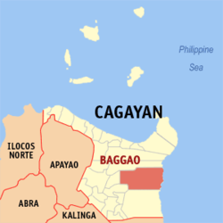
| Location of Baggao in the Cagayan Province | ||
|---|---|---|

|
||
| Basic data | ||
| Region : | Cagayan Valley | |
| Province : | Cagayan | |
| Barangays : | 48 | |
| District: | 1. District of Cagayan | |
| PSGC : | 021506000 | |
| Income class : | 1st income bracket | |
| Households : | 13,039 May 1, 2000 census
|
|
| Population : | 82,782 August 1, 2015 census
|
|
| Population density : | 83.6 inhabitants per km² | |
| Area : | 990 km² | |
| Coordinates : | 17 ° 58 ′ N , 121 ° 57 ′ E | |
| Postal code : | 3506 | |
| Geographical location in the Philippines | ||
|
|
||
Baggao is a municipality in the Philippine province of Cagayan . The municipality is located in the east of the province. In 2015 the 990 km² area counted 82,782 people, resulting in a population density of 84 inhabitants per km².
Baggao is divided into the following 48 barangays :
|
|
|
