
On the Untertrave


On the Untertrave is a street in Lübeck's old town .
location
The approximately 960 meter long street An der Untertrave is located in the northwest of the old town island. It runs as a promenade along the Trave .
The street begins at the northernmost point of the old town at the lift bridge over the Elbe-Lübeck Canal , which flows into the Trave at this point, and the confluence of Kanalstrasse , which opens up the northeastern edge of the old town island. There is also a footpath with stairs up to the castle gate, the Marstallweg .
In an arch that results from the course of the banks of the Trave, the street initially leads southwest, with Kleine Altefähre , Große Altefähre , Petersilienstraße , Alsheide , Engelsgrube , Fischergrube , Clemensstraße and Beckergrube coming one after the other from the inside of the old town . Then the Untertrave describes a bend, after which it continues southwards and follows as further old town streets , Mengstraße , Alfstraße , Fischstraße and Braunstraße . The Untertrave finally ends at the intersection with Holstenstraße and the Holstenbrücke leading to the Holsten Gate . Its continuation along the banks of the Trave is An der Obertrave .
history
Today's street An der Untertrave has only been seen as a continuous street since the late 19th century. Previously, only individual sections had their own names:
- The area at the confluence of the Fischstrasse was called Eisenmarkt , as the bar iron imported from Sweden was landed and stored in this part of the port . The oldest traditional form of the name is known from 1700 and was Osemundsmarkt
- The stretch of road between Alsheide and Alfstrasse has been called Petri-Sanddamm since the 16th century , as a sand house belonging to the Petrikirche stood here
- At the small old ferry , the street name was 1319 Apud arborem inferiorem ( Latin for the lower tree ) and 1459 To dem Torne , since a floating barrier made of tree trunks blocked the port entrance
- The section between Alfstraße and Mengstraße was known as the wine state in 1841 because ships loaded with imported wines moored here
- The section between Beckergrube and Fischergrube was called Heringsmarkt since 1483 at the latest
- After the pier between the Große Altefähre and Burgtor had been expanded in 1834 into a port reserved for steam ships only, the street that ran here was given the name Am Dampfschiffshafen
In 1884 the entire street was merged and received its name, which is still valid today.
The now very wide Untertrave was originally a narrow, narrow street that ran between the long row of granary houses on the eastern side and the medieval city wall on the western side. The harbor was outside the wall and was accessible from the street through gate openings. Remnants of the city wall existed along the entire Untertrave until the middle of the 19th century, when they were demolished in the course of the port expansion. On the east side of the Untertrave, modern warehouses have been built since 1853 and railway tracks have been laid for freight traffic. The port railway, which still lined the entire Untertrave down to the Holstenbrücke at the beginning of the 1950s , ultimately only ran as far as the swing bridge opposite the Engelsgrube , on which it crossed the Trave.
After the Second World War , the road was widened considerably in the 1950s and 1960s and expanded to include multiple lanes in order to be able to divert the rapidly growing car traffic around the old town. The footpath on the edge of the quay was named separately as Wenditzufer . In the course of the construction of the European Hanseatic Museum , some sections were dismantled from four to two lanes in 2013.
The museum harbor is located in the area between the swing bridge and the music and congress hall .
Height regulation of the road
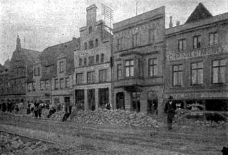
The need to build new quay walls from the swing bridge ( Engelsgrube ) to the mouth of the canal due to the flood damage in the previous decades in 1906 offered the opportunity to change the height of the quays at the same time. The streets behind it had to experience a corresponding increase.
This was sometimes a meter or more. While other road regulations were able to choose a center line first, this was not possible here, since otherwise the road would have turned into an inclined plane. The following pictures show the changes made on the route mentioned.
- Height regulation of the street on the Untertrave
Paving work and height adjustment

Changes in altitude


Conflict over winter linden trees

There was a conflict with the citizens and the city administration in 2016 when it became known that 48 winter linden trees on the banks of the Trave were to be felled. The trees in the section between Holstenstrasse and the swing bridge should give way to the new planting of Japanese pagoda trees for the redesign of the roadway and travepromenade, which has been planned since 2003 . Members of an action alliance ("Let Lübeck's Linden trees live") collected more than 10,500 signatures for a referendum in a referendum within four weeks to prevent the linden trees from being felled. In the referendum on December 18, 2016, 50.3 percent of the citizens who took part voted for the preservation of the winter linden trees.
Buildings
- Storage shed 6 , built in 1906 with a single-nave brick-built warehouse
- Storage shed 9 , built in 1906 with a two-aisled brick-built warehouse
- European Hanseatic Museum , An der Untertrave 1
- Petit-Haus , An der Untertrave 3
- At Untertrave 21 , a Renaissance house built between 1600 and 1649 with a classical facade from 1808
- At Untertrave 27 , a historicist facade erected in 1899 in front of a new building from 1981
- At Untertrave 34, Die Eiche , granary built in 1873 in the style of historicism, built for Thomas Johann Heinrich Mann
- On Untertrave 39 , a Renaissance gabled house built between 1600 and 1624
- At Untertrave 42 , a Renaissance gabled house built between 1550 and 1624 with a classical facade from 1797 and 1857
- At the Untertrave 52-53 , a Renaissance semi-detached house built between 1525 and 1599
- At Untertrave 60 , late baroque house from the 18th century
- At Untertrave 61 , a Renaissance gabled house built in the 16th century
- At Untertrave 62 , a Renaissance gabled house built in the 16th century
- Corner house built in 1749 at Untertrave 70 with a plastered facade
- At Untertrave 86 , Renaissance town hall
- At Untertrave 96 , three-story Renaissance half-timbered house built in 1569, originally planned and built as a tenement house
- At Untertrave 97 , neo-Gothic brick warehouse from 1871
- At Untertrave 98 , neo-Gothic brick granary from 1870
- The adjoining corner house at Alfstrasse 38 shows an impressive Renaissance stepped gable facing the Untertrave.
Corridors and courtyards
From the street An der Untertrave walk or walked off the following Lübeck corridors and courtyards (according to house numbers):
- 19: Dark green corridor
- 26: Light green corridor
- 29: Voss' gang (missing)
- 34: Harder's gang (missing)
- old house number 14: Grammans Hof (missing)
See also
literature
- W. Brehmer : The street names in the city of Lübeck and its suburbs. HG Rathgens, Lübeck 1889.
- W. Brehmer: Lübeck house names along with contributions to the history of individual houses. HG Rathgens, Lübeck 1890.
- Klaus J. Groth : World Heritage Lübeck - Listed Houses. Over 1000 portraits of the listed buildings in the old town. Listed alphabetically by streets. Verlag Schmidt-Römhild, Lübeck 1999, ISBN 3-7950-1231-7 .
- Max Hoffmann: The streets of the city of Lübeck. In: Journal of the Association for Lübeck History and Archeology. Jg. 11, 1909, ISSN 0083-5609 , pp. 215-292 (also special print: 1909).
Web links
Individual evidence
- ↑ Kai Dordowsky: Healthy or not to be saved? Expert dispute over the linden trees . Lübecker Nachrichten, August 27, 2016, p. 9.
- ↑ Let the action alliance Lübeck Linden live
- ↑ Kai Dordowsky: The linden trees are safe for now . Lübecker Nachrichten online from September 16, 2016 (beginning of article freely available).
- ↑ JVZ / DOR: Voting thriller Linden decision: What happens now with the Untertrave? , ln-online.de, December 18, 2016, accessed December 20, 2016
Coordinates: 53 ° 52 ′ 10.2 " N , 10 ° 40 ′ 48" E