Aureille
| Aureille | ||
|---|---|---|

|
|
|
| region | Provence-Alpes-Cote d'Azur | |
| Department | Bouches-du-Rhône | |
| Arrondissement | Arles | |
| Canton | Salon-de-Provence-1 | |
| Community association | Vallée des Baux-Alpilles | |
| Coordinates | 43 ° 42 ' N , 4 ° 57' E | |
| height | 55-410 m | |
| surface | 21.74 km 2 | |
| Residents | 1,522 (January 1, 2017) | |
| Population density | 70 inhabitants / km 2 | |
| Post Code | 13930 | |
| INSEE code | 13006 | |
| Website | www.aureille.fr | |
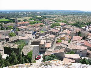
 View from the castle |
||
Aureille is a municipality with 1522 inhabitants (as of January 1, 2017) in the south of France in the Bouches-du-Rhône (13) department of the Provence-Alpes-Côte d'Azur region . The name of the place is derived from the location Aureilles on the Roman road Via Aurelia .
geography
The place is between Mouriès in the west and Eyguières in the east on the Alpilles mountain range . The municipality is part of the Alpilles Regional Nature Park .
Population development
| year | 1962 | 1968 | 1975 | 1982 | 1990 | 1999 | 2007 | 2017 |
| Residents | 465 | 518 | 573 | 835 | 1220 | 1357 | 1463 | 1522 |
| Sources: Cassini and INSEE | ||||||||
coat of arms
Description of the coat of arms : Split in red and gold, in front a bricked golden tin tower with closed golden gate and behind a red, upright, seated lion .
Web links
Commons : Aureille - collection of images, videos and audio files
