
Bolbritz
|
Bolbritz
Bolborcy City of Bautzen
Coordinates: 51 ° 12 ′ 4 ″ N , 14 ° 20 ′ 27 ″ E
|
|
|---|---|
| Height : | 211 m above sea level NN |
| Area : | 1.65 km² |
| Residents : | 132 (Dec. 31, 2019) |
| Population density : | 80 inhabitants / km² |
| Incorporation : | 1st July 1969 |
| Incorporated into: | Salzenforst-Bolbritz |
| Postal code : | 02625 |
| Area code : | 03591 |
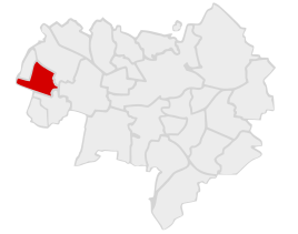  Location of Bolbritz in Bautzen
|
|

Bolbritz , Upper Sorbian , is a place in the East Saxon district of Bautzen and has been part of the large district town of Bautzen since 1999 . Since 2007 it has officially counted as a district. It is located in Upper Lusatia and is in the Sorbian settlement area .
geography
Bolbritz is located about six kilometers northwest of Bautzen city center.
Bolbritz is the settlement complex after a loose square village with an estate, which is located in the northwestern part of the place. A brook flows through the village, which later flows into the Milkwitzer Wasser and thus the Schwarzwasser . The elevation on the northern outskirts is known as Perleberg .
The neighboring towns are Oberuhna in the northwest, Salzenforst in the east, Bloaschütz in the southeast and Löschau in the west.
history
Even before the place was mentioned for the first time, the nationally important Hohe Straße on its way from Bautzen to the Schwarzwasser ford in Dreikretscham ran north past the current location. In addition, graves from the early Iron Age were found on the southern slope of Perleberg , which presumably belonged to a nearby settlement. In the 11th / 12th In the 19th century there was already a moated castle in the village , the remains of which are still preserved in the center and are now used as sheds.
The place itself was first mentioned in 1283 as the mansion of the brothers Gerhard and Johannes de Bolberitz , who served the Bishop of Meissen as feudal knights. The current form of the name is used for the first time in 1548. The relatively large manor Bolbritz survived until the 19th century and owned land in surrounding and more distant villages (e.g. Großgehchen ).
From 1756 there was the first school in the village. In 1886 the place received a new school building, which was expanded again in 1923. In 1959 the schools in Bolbritz and Storcha were merged.
Until 1969 Bolbritz was an independent rural community with the districts Bloaschütz , Neu-Bloaschütz , Döberkitz and Jannowitz . Then the communities of Bolbritz and Salzenforst were merged to form Salzenforst-Bolbritz . Jannowitz and Neu-Bloaschütz were annexed to the community of Göda . In 1994 Bolbritz came to the Kleinwelka community , with which it was incorporated into Bautzen in 1999.
population
In 1834 Bolbritz had 98 inhabitants. Arnošt Muka already had 145 residents in the 1880s, 136 of them Sorbs (94%). At that time Bolbritz was in the middle of the core settlement area. The proportion of Sorbian speakers in town has fallen sharply since then. In 1956 Ernst Tschernik counted a Sorbian-speaking population of only 26.5% in the municipality of Bolbritz with districts.
The population of the Bolbritz community rose slowly in the first half of the 20th century from 360 (1910) to 406 (1939). Immediately after the Second World War , the number in 1946 was 494 inhabitants, which suggests that one fifth of the population was repatriated. This development also influenced the decline of the Sorbian language in the village.
Since the Reformation, the inhabitants have been predominantly Evangelical-Lutheran and parish to Göda .
Infrastructure
Bolbritz is located immediately north of the federal motorway 4 and its service area Oberlausitz . The Salzenforst junction is only 2.5 kilometers away. The Salzenforst industrial and commercial area , where numerous companies have settled, is also located directly southeast of the village .
See also
literature
- Cornelius Gurlitt : Bolbritz. In: Descriptive representation of the older architectural and art monuments of the Kingdom of Saxony. 31. Booklet: Bautzen Official Authority (Part I) . CC Meinhold, Dresden 1908, p. 42.
swell
- Bolbritz in the Digital Historical Directory of Saxony
- ^ Olaf Bastian, Henriette Joseph, Haik Thomas Porada: Oberlausitzer Heide- und Teichlandschaft - a regional study , Böhlau Verlag, Cologne / Weimar 2005, p. 251
- ↑ Ernst Tschernik: The development of the Sorbian population . Akademie-Verlag, Berlin 1954.
- ^ Ludwig Elle: Language policy in the Lausitz . Domowina-Verlag, Bautzen 1995, p. 244 .
Web links

Auritz (Wuricy) | Bloaschütz (Błohašecy) | Bolbritz (Bolborcy) | Burk (Bórk) | Döberkitz (Debrikecy) | Well of Health (Strowotna Studnja) | Großwelka (Wulki Wjelkow) | Downtown (Nutřkowne město) | Kleinseidau (Zajdow) | Kleinwelka (Mały Wjelkow) | Löschau (Lešawa) | Lubachau (Lubachow) | Nadelwitz (Nadźanecy) | Niederkaina (Delnja Kina) | Northeast Ring (Sewjerowuchodny wobkruh) | Oberkaina (Hornja Kina) | Oberuhna (Horni Wunjow) | Ostvorstadt (Wuchodne předměsto) | Salt forest (Słona Boršć) | Schmochtitz (Smochćicy) | Stiebitz (Sćijecy) | Südvorstadt (Južne předměsto) | Teichnitz (Ćichońca) | Temritz (Ćemjercy) | West suburb (Zapadne předměsto)