Bugalagrande
| Bugalagrande | ||
|---|---|---|
|
Coordinates: 4 ° 12 ′ N , 76 ° 9 ′ W Bugalagrande on the map of Colombia
|
||
|
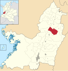
Location of the municipality of Bugalagrande in Valle del Cauca
|
||
| Basic data | ||
| Country | Colombia | |
| Department | Valle del Cauca | |
| City foundation | 1886 | |
| Residents | 20,970 (2019) | |
| City insignia | ||
| Detailed data | ||
| surface | 374 km 2 | |
| Population density | 56 people / km 2 | |
| height | 950 m | |
| Waters | Río Cauca , Río Bugalagrande | |
| Time zone | UTC -5 | |
| City Presidency | Jorge Eliécer Rojas (2016-2019) | |
| Website | ||
| San Bernabé Church | ||
| old trainstation | ||
Bugalagrande is a commune ( municipality ) in the department of Valle del Cauca in Colombia .
geography
Bugalagrande is located in the Centro sub-region in Valle del Cauca between the Río Cauca and the Central Cordillera of the Colombian Andes . The urban part (cabecera municipal) of the municipality is located at 950 meters 115 km from Cali and has an average annual temperature of 25 ° C. The municipality is bordered by Zarzal and Seville in the north, Tuluá in the east, Andalucía in the south and Riofrío and Bolívar in the west .
population
The municipality of Bugalagrande has 20,970 inhabitants, of which 11,917 live in the urban part (cabecera municipal) of the municipality (as of 2019).
history
During the colonial period, Bugalagrande was part of the Buga and Tuluá area . Bugalagrande was founded as a community in 1886 by Diego Rengifo Salazar.
economy
In Bugalagrande, sugar cane , soy , corn , coffee , bananas and fruit are grown in particular .
Web links
- Alcaldía Municipal de Bugalagrande. Alcaldía de Bugalagrande - Valle del Cauca, accessed on May 3, 2019 (Spanish, website of the municipality of Bugalagrande).
Individual evidence
- ↑ a b c Nuestro municipio. Alcaldía de Bugalagrande - Valle del Cauca, accessed on May 3, 2019 (Spanish, information on the municipality).
- ↑ ESTIMACIONES DE POBLACIÓN 1985 - 2005 Y PROYECCIONES DE POBLACIÓN 2005 - 2020 TOTAL DEPARTAMENTAL POR ÁREA. (Excel; 1.72 MB) DANE, May 11, 2011, accessed on May 3, 2019 (Spanish, extrapolation of the population of Colombia).


