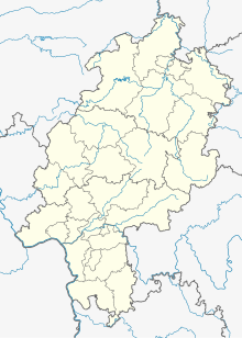
Detmarckusen
Coordinates: 51 ° 19 ′ 54 ″ N , 8 ° 41 ′ 2 ″ E
Detmarckusen or Detmarckhusen is a deserted area in the district of Ottlar in the north Hessian municipality of Diemelsee . The place was already desolate in 1537 and was last mentioned in a document in 1541.
Geographical location
The place was about 600 meters above sea level about 2.5 kilometers west of Ottlar and about 300 meters east of Dommelhof am Dommel . A field name known to the place is "Auf dem Menzighausen".
history
Historically, the place is rarely mentioned. In 1537 “Detmarckhusen” was obviously already deserted, because its field marrow was cultivated from Giebringhausen and Sudeck . In 1541 "Detmarckußen" was mentioned for the last time in a document. The place belonged to the Counts of Waldeck and was pledged by Wolrad II to his chancellor Wendelin Colbecker.
literature
- Gottfried Ganßauge, Walter Kramm, Wolfgang Medding: The architectural and art monuments in the Kassel administrative region, New Series, Volume 3, District of the Eisenberg , Bärenreiter-Verlag, Kassel, 1939, page 245. (digitized online)
- Heinrich Höhle: The submerged localities or the desert areas in Waldeck . Bing, Korbach, 1931, pp. 186–187, No. 9
Individual evidence
- ↑ a b Detmarckusen (Ottlar district), Waldeck-Frankenberg district. Historical local dictionary for Hessen. (As of October 16, 2018). In: Landesgeschichtliches Informationssystem Hessen (LAGIS).
- ^ Johann Adolph Theodor Ludwig Varnhagen : Basis of the Waldeckische Landes- und Regentengeschichte , Volume 1, Vandenhoeck & Ruprecht, Göttingen, 1825. ( p. 39, digitized online )
- ↑ Ganßauge: The architectural and artistic monuments in Kassel , S. 245th

