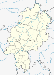
Ittlar
Coordinates: 51 ° 19 ′ 40 " N , 8 ° 45 ′ 20" E
Ittlar is a deserted area in the district of Sudeck in the North Hessian community of Diemelsee . The place was first mentioned in a document in 952.
Geographical location
The place was about 500 meters above sea level, almost 2 kilometers south of Sudeck and about 2 kilometers north of Schweinsbühl .
history
In the course of history the place name was spelled differently:
- Ittirlarun (952) [MGH Diplomata Kings 1, Konrad I, Heinrich I, Otto I .: Sickel, pp. 239–240, no. 158]
- Itterlare (1342) [Bredelar monastery documents, p. 161, no. 269]
- Itelar (1537) [HStAM inventory 127 No. 3]
In 952 the abbess Wicburga donated a hoof to her women's monastery in Geseke in Ittlar. The monastery still had a farm here in 1380. 1342 of the Knights of Stephan sold Horhusen the monastery Bredelar two pensions from his farm ( "curia") and a good ( "bonum") in Ittlar. In 1440 the von Horhusen brothers sold the monastery a pension from their farm in Ittlar. In 1537 the Counts of Waldeck received income from the farm in Ittlar. There was a chapel in Ittlar and in 1537 three courtyards are known in Ittlar.
literature
- Gottfried Ganßauge, Walter Kramm, Wolfgang Medding: The architectural and art monuments in the Kassel administrative region, New Series, Volume 3, District of the Eisenberg , Bärenreiter-Verlag, Kassel, 1939, page 249. (digitized online)
- Cave, localities in Waldeck, pp. 204–205, no. 30
- Müller, Cistercian Abbey Bredelar, p. 260
- Johann Adolph Theodor Ludwig Varnhagen : Basis of the Waldeckische Landes- und Regentengeschichte , Volume 1, Verlag Vandenhoeck & Ruprecht, Göttingen, 1825. ( Pages 51-52, digitized online )
See also
Individual evidence
- ↑ a b Ittlar (district Sudeck), Waldeck-Frankenberg district. Historical local dictionary for Hessen. (As of October 16, 2018). In: Landesgeschichtliches Informationssystem Hessen (LAGIS).

